
Lujiaowan Tian Shan Pasture: The Best-Kept Grassland Secret in Northern Xinjiang

Lujuiaowan Tian Shan Pasture: The Alps of Xinjiang You Haven’t Heard Of
If your mental map of Xinjiang attractions stops at Kanas Lake and Sayram Lake, you’re missing the most surprising grassland on the northern route. Tucked into the Tianshan foothills ~80 km from Shawan city, Lujuiaowan Tian Shan Pasture (鹿角湾) is where Tianshan spruce meets endless alpine meadow, where Tianshan wapiti (red deer) still shed their antlers each spring, and where the summer temperature hovers at a perfect 20°C (68°F).
This is one of the best things to do in Xinjiang if you want an off-the-beaten-path grassland experience without the ticketed-park crowding of Nalati. The name “Lujuiaowan” literally means “Deer Antler Bay”—the mountain creeks here accumulate shed antlers each year, a phenomenon that gave this place its poetic name centuries ago.
Where Is Lujuiaowan (and Why the Drive Is Half the Fun)
Lujuiaowan sits in Shawan City, Tacheng Prefecture, on the northern slope of the Tianshan Mountains, ~260 km from Urumqi (4-hour drive via G30 expressway + S101 Provincial Highway). But the real magic is the approach: you arrive via the legendary S101 National Defense Highway—a scenic mountain road that hugs the Tianshan geological corridor, delivering exposure after exposure of multicolored sandstone, spruce forests, and rolling pasture.
Getting there:
- From Urumqi: G30 expressway west → Shawan exit → S101 Provincial Highway south into Tianshan foothills. Total ~260 km / 4 hrs.
- From Shawan town: Tourism shuttle at 10:00 & 14:00 daily (¥25/person, ~2 hrs).
- Vehicle: SUV recommended; sedans can manage in summer but drive carefully on S101 curves.
 Nalati style Tianshan grassland rolling hills” style=”width:100%;border-radius:8px;margin-bottom:18px;”>
Why Lujuiaowan Belongs on Your Itinerary
Most visitors to Xinjiang flock to Nalati Grassland or Bayanbulak Grassland—both spectacular but heavily ticketed and managed. Lujuiaowan offers a different proposition: a wilder, less-commercialized valley where Kazakh nomad families still move with their herds, where you can walk a creek-side trail without dodging tour groups, and where the night sky is genuinely dark.
The pasture covers ~1,900 km² of valley and hillside, with the core visiting area ~500 km². Elevation ranges from ~1,800 m to ~3,500 m (glacier viewpoint). The forest coverage reaches 35%—dominated by Tianshan spruce—and the air carries >1,500 negative oxygen ions/cm³. It’s effectively a natural air filter.
Core Highlights (What to See & Do)
1. Lujuiaowan Grassland — The Main Event
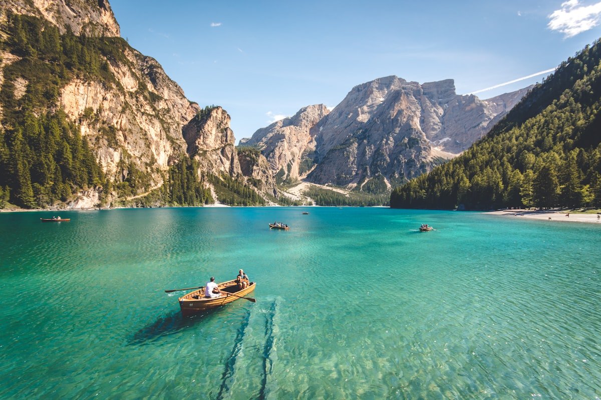
The central meadow stretches wide and level, ringed by spruce-covered ridges. In June–August the grass is knee-high and dotted with 20+ species of wildflowers—golden lotus, wild poppy, and alpine aster. This is also where Kazakh families set up their ailana (felt yurts) in summer. You can arrange a yurt stay (~¥200 for a standard yurt sleeping 4–6) and eat with the family—fresh milk tea, Kumiss, hand-pulled noodles, and lamb stew.
2. Dongdatang Glacier — Ice at 3,500 m
A ~1-hour hike (or horseback ride) from the valley floor takes you to the Dongdatang Glacier viewpoint at ~3,500 m. The glacier tongue is >100 m thick, and the vertical climate zones are on full display: meadow → spruce forest → alpine scree → ice. Bring a windbreaker even in July; the temperature drops ~10°C from the valley.
3. Bayingou River Trail — Creekside Walk
The Bayingou River flows the length of the scenic area, its water a transparent jade from glacial melt. A well-defined trail follows the river for ~5 km through spruce forest and open meadow. It’s an easy walk (flat, ~2 hours round-trip) and excellent for birdwatching—golden eagles and Himalayan griffons patrol the ridgelines.
4. Xia’ergan Valley Rock Art — 1,000-Year-Old Nomad Graffiti
Scattered across the hillsides in the Xia’ergan Valley are ~50 surviving rock engraving panels, estimated at 1,000–1,500 years old. The images depict deer, hunters on horseback, solar symbols, and tessellated patterns—a visual record of the ancient nomadic cultures that moved through Tianshan long before the Silk Road was a named thing. The site is a designated autonomous-region-level heritage protection unit; don’t touch the panels.
5. Natural Sulfur Spring — 52°C Mountain Spa
Just outside the core scenic zone, a natural sulfur spring emerges at a constant 52°C. The water is rich in strontium and fluoride—locals swear by it for joint pain and skin conditions. A few basic open-air pools operate in summer (¥30–50 entry); bring your own towel and flip-flops.
 Sayram Lake area alpine scenery representative” style=”width:100%;border-radius:8px;margin-bottom:18px;”>
When to Go (and What the Seasons Actually Feel Like)
| Season | What You Get | Temperature (day) |
|---|---|---|
| May | Grass greening, wildflowers starting, few people | 10–20°C |
| June–August | Peak green, nomad yurts, festivals, warmest | 18–25°C (valley) |
| September | Golden grass, crisp air, excellent photography | 5–18°C |
| Oct–April | Snow-closed; mountain roads dangerous | Below freezing |
Prime window: Mid-June through early September. If you want photographs without crowds, target late May or early September—the light is still excellent and the valley is quiet.
Tickets & Costs (2025–2026 Reference)
- Scenic area entrance: ~¥30 / person
- Horseback riding: ~¥80 / hour (negotiate via your yurt host)
- Yurt stay: ~¥200 / yurt (sleeps 4–6, shared facilities)
- Sulfur spring pool: ~¥30–50 entry
Prices are subject to annual adjustment by local authorities; verify at the gate.
S101 Highway: The Scenic Approach You Shouldn’t Rush
Even if Lujuiaowan were ordinary, the S101 Provincial Highway would make the trip worthwhile. This ~300 km mountain road between Urumqi and Kuytun/Bortala traverses the Tianshan Geological Corridor—a continuous exposure of multicolored Mesozoic sandstone, basalt cliffs, and hidden meadows. Locals call it the “Tianshan Hundred-Li Gallery.” Key photo stops en route to Lujuiaowan:
- Qiaotou Plateau (桥头高原): Wide alpine meadow at ~2,200 m, excellent for sunrise shots.
- Colorful Danxia viewpoints: Red-yellow sandstone ribs that glow at golden hour.
- Kuytun Reservoir side road: Turquoise water backed by snow peaks.
Allow at least 5–6 hours for the full Urumqi → Lujuiaowan drive if you’re stopping for photos. Don’t attempt S101 at night—the road is narrow, unlit, and has no guardrails in some sections.
Where to Stay (and Why a Yurt Night Is Worth It)
Accommodation at Lujuiaowan is deliberately low-key—this isn’t a luxury resort destination, and that’s the point.
- Yurt stay (recommended): ~¥200–350 / yurt. You’ll sleep on raised platforms with thick felt mattresses. Toilets are basic outhouses. The payoff: stepping out at 06:00 to a valley full of mist and the smell of damp spruce.
- Shawan town (budget–mid): ~¥150–400 / night. More comfortable beds and reliable hot water, but you’ll drive 1.5 hrs each way to the pasture.
Pro tip: Bring a lightweight sleeping bag liner if you’re particular about bedding. Yurt hosts provide thick quilts, but the liner adds comfort and hygiene peace-of-mind.
What to Pack (the Practical Stuff That Matters)
- Layers: Even in July, the valley drops to ~10°C at night. Pack a fleece or light down jacket.
- Sun protection: SPF 50+, sunglasses, wide-brim hat. The UV at ~2,000 m is no joke.
- Sturdy shoes: The creek trails are uneven; ankle-supporting hiking shoes are better than sneakers.
- Cash: No ATMs at the pasture. Bring ¥300–500 in small bills for yurt meals, horse riding, and spring entry.
- Offline maps: Mobile signal is spotty in the valley. Download offline maps before leaving Shawan.
- Insect repellent: Mosquitoes appear in July–August evenings. DEET 30%+ recommended.
Cultural Etiquette (Respecting the Nomad Families)
The Kazakh families who host visitors in their yurts are sharing their home, not operating a hotel. A few simple courtesies go a long way:
- Ask before photographing people, especially children. A smile and a gesture toward your camera is universally understood.
- Remove your shoes before entering a yurt (slippers are usually provided).
- Don’t walk in front of someone praying or eating.
- Accept offered food or tea with your right hand (or both hands). Declining repeatedly is fine if you’re full—just do it gently.
- Leave no trash on the pasture. Pack out everything; the valley has no formal waste collection in the upper zones.
How to Fit Lujuiaowan Into Your Xinjiang Itinerary
Lujuiaowan works best as a natural stop on a northern Xinjiang loop that also includes Urumqi, Sayram Lake, and the Duku Highway. Here are two practical routing options:
Option A: Urumqi round-trip (2 days)
Day 1: Urumqi → G30 → Shawan → S101 scenic drive → arrive Lujuiaowan afternoon, yurt stay.
Day 2: Sunrise grassland walk → Bayingou River trail → Dongdatang Glacier viewpoint → return to Urumqi evening.
Option B: One-way north route (1 day en route to Sayram / Yining)
Drive Urumqi → S101 → Lujuiaowan (2–3 hr visit) → continue west via G30 toward Sayram Lake / Yining. This works if you’re self-driving and want a grassland break without adding an overnight.
The Verdict: Is Lujuiaowan Worth the Detour?
If you’re the kind of traveler who measures a destination by its authenticity rather than its ticket-office scale, yes. Lujuiaowan delivers the core Xinjiang travel guide promise—dramatic mountain scenery, genuine nomadic culture, and the kind of quiet that’s increasingly rare in China’s marquee scenic zones. It’s not as famous as Sayram Lake, and that’s precisely why it’s worth your time.
Updated: June 2026. Practical details subject to seasonal adjustment—verify tickets and road status locally before departure.