
Qinghe County Self-Drive: Chinggil’s Stone Men and Empty Steppe
Ninety kilometres out of Fuyun the road went straight for so long that I started checking the odometer to prove I was still moving. No trucks. No fences for stretches at a time. A hawk on a power pole, then eleven more power poles, then another hawk. When I finally saw a shape standing alone on the grass off the left shoulder, I braked hard enough to slide gravel, because it was a stone man, and nobody had told me the first one would just be out there in the open with a horse cropping grass twenty metres behind it.
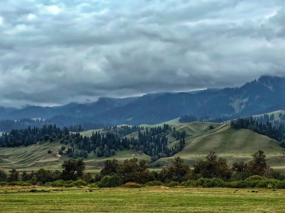
Qinghe County, also spelled Chinggil, is the far-eastern corner of Altay Prefecture, pressed up against the Mongolian frontier. It is the least driven piece of Altay by a wide margin. There are no turquoise lakes on the poster here, no October larch crowds, no shuttle buses. What there is instead: enormous open steppe, Kazakh and Mongol herding country, Turkic-period grave markers standing where they were set up more than a thousand years ago, and a very convincing end-of-the-road feeling once the tarmac stops caring about you.
The drive east from Fuyun and Koktokay
Most people arrive from the west, and that means Fuyun. Reckon on roughly 200 km from Fuyun town east to Qinghe town, three hours if the surface behaves, four if it does not. The road is signed for Qinghe and forms part of the border-following corridor that maps now label G331. Long empty straights, a few low passes, gravel shoulders that will bite a tyre if you drift while looking at the view. I averaged 75 km/h and that felt about right, mostly because I kept stopping.
Fuel discipline is the one rule I will not soften. Fill completely in Fuyun. There are stations along the way and in Qinghe town, but on a Sunday afternoon I found one pumping only diesel and the attendant simply pointed east when I asked about 92 octane. Range anxiety out here is not a joke, it is arithmetic. I now carry a 10-litre can on this leg and I have used it once.
Coming up from further south, the fastest approach is the S21 desert expressway shortcut up from Urumqi, then cutting east through Fuyun rather than continuing north toward Kanas. If you have any spare days, do not skip the granite on the way. Standing under the granite domes of Koktokay National Geopark and then driving out onto flat grassland the next morning is one of the better geological whiplashes in Xinjiang.
Arriving in Chinggil town
The town sits at roughly 1,200 to 1,300 m and reads like a working county seat, not a destination. Wide streets, a square, a few government buildings, small shops selling saddle blankets and phone chargers side by side. Mongol script appears on signage alongside Uyghur and Chinese, which tells you something about who lives here. It took me eight minutes to drive the whole place twice.
I liked it more than that description makes it sound. In late June the evening light lasts until nearly 22:00 local rhythm, families were out on the square, and somebody had parked a motorbike with a lamb sitting calmly in the sidecar. Nobody paid me any attention at all, which after Kanas felt like a holiday in itself.
The stone men, up close
The Turkic-period stele are the reason to come. Locally they belong to the wider balbal tradition of the eastern steppe: upright slabs of coarse granite or schist, carved with a face and often a hand holding a cup at chest height. Some are barely more than a shaped post with two eyes and a nose scratched into it. Others have a moustache, a collar, a belt line, and a distinctly annoyed expression.
What you actually see
Scale caught me off guard. I had pictured something monumental. The ones I stood next to came up to my chest or shoulder, maybe 1.2 to 1.6 m of visible stone, weathered to a soft grey with orange lichen filling the carved lines. The faces are cruder than photographs suggest and far more moving in person. Wind noise, the smell of crushed grass, a marker of somebody’s grave that has outlived every building for a hundred kilometres in any direction.
Many stand at the eastern edge of stone enclosures or circles: rings and rectangles of set slabs, sometimes with a low mound inside, sometimes with a line of smaller stones running east from them. The alignments matter to archaeologists. That is exactly why you should keep your boots off the stonework and out of the rings.
How they are protected, and how to behave
Protection is patchy and improving. Some sites now have a fence, an information board and a shallow gravel apron. Others sit on open pasture with nothing but a low post. A few of the best pieces have been lifted and moved into the county museum for safekeeping, which is a reasonable trade even if it drains something from them.
The rules I follow, none of them complicated. Do not climb on a circle or shift a slab for a better photo angle. Do not chalk, wet or rub a carved face to raise contrast. Park on the track, not on the grass, because tyre scars on this steppe stay visible for years. If a herder walks over, greet him and show him what you are photographing. Twice that turned into directions to another site I would never have found.
Sanhaizi, Huahaizi, and being honest about access
The famous concentration is the Sanhaizi and Huahaizi complex, a big archaeological landscape of circles, mounds and stele in the highlands of the county. It is not a roadside stop. The ground climbs steeply above the town, the surface degrades into rutted pasture track, and the whole area lies close enough to the frontier that access depends on the season, the weather and whoever is managing the route that year.
I did not reach the core of it. That is the truthful version. I got a long way up on a June afternoon, hit a section of washboard and mud that my two-wheel-drive rental had no business attempting, and turned around when I met a shepherd who told me by hand signals that it got worse. What I did see was a scatter of enclosures on lower ground and three stele in accessible spots. If the deep complex is your goal, plan a 4×4, a local driver and a full day, and ask in town about permission before you commit to the climb.
The Qinghe meteorite, and where it went
The county’s other claim is iron from the sky. A huge iron meteorite was found here, known locally by a nickname that translates roughly as the silver camel, and it is one of the largest ever recovered anywhere, in the region of 28 tonnes. The original is no longer in Qinghe. It sits in Urumqi in a museum collection, which is the usual fate of anything this important.
What the county keeps is the story and a stand-in. Ask locally and you will be pointed to a display piece and a marker in town. Do not drive here expecting to lay hands on the real thing. The interest is in the fact that a lump of nickel-iron that size lay on open grassland out here for who knows how long, in a landscape where you can genuinely believe nobody happened to walk past for a century.
Cold, altitude and the only window that works
Qinghe town is one of the coldest inhabited places in Xinjiang. Deep winter regularly runs below minus 30C and can drop past minus 40C, and that is not a statistic to be brave about in a rental car with all-season tyres. Water freezes in the door. Diesel gels. Nothing about the archaeology is visible under snow anyway.
June to September is the working season. Late June and July give you green grass, wildflowers on the slopes, herders up at summer pasture and long light. August is fine and hotter. September is my favourite for colour, but frost arrives early up high, and by late September I was scraping the windscreen at 07:00 in town. Altitude is modest where you sleep, around 1,200 to 1,300 m, but the plateau ground where the circles sit is far higher and the temperature difference between the two is startling. I drove up in a t-shirt and came back down in a fleece and a hard shell.
Border-zone awareness
You are near the Mongolian frontier. There is a land port in the county at Takeshiken, and roads run toward it that make perfect sense on a map and much less sense in practice for a foreign driver. Take this seriously and the whole trip stays easy.
Keep your passport with you and not in a bag in the boot. Expect registration at your hotel and at least one document check on the approach roads. Do not photograph checkpoints, port infrastructure or military vehicles. If a track heads toward the border and you are unsure, the honest answer is to ask in town rather than drive it and find out, because certain zones require a permit that visitors cannot arrange at a barrier at 17:00. My own checks here were courteous and quick, roughly five to fifteen minutes each, and the officers were more curious about the car than about me.
Sleeping and eating in an end-of-the-road county
Accommodation is thin and functional. A handful of small county hotels and guesthouses, rooms in the ¥130 to ¥280 range depending on season, heating that is superb in October and irrelevant in July, and hot water that occasionally requires patience. Book nothing fancy because nothing fancy exists. Check whether the place takes foreign passports when you arrive, since not every small hotel is set up for it, and that single question has saved me an hour of driving around.
Food is Kazakh and Mongol first, Han Chinese second. You will be offered boiled lamb with hand-pulled dough, milk tea with salt in it, fried baursak dough, dried curd balls that are far sourer than they look, and horse sausage if the household makes it. Say yes to the milk tea even if the first sip confuses you. My best meal in three days out here cost ¥45 and arrived on one enormous shared plate. My worst was a plate of stir-fried noodles at a highway stop that tasted mostly of the fryer.
How Chinggil fits into a bigger Altay loop
Nobody comes to Altay only for this. Treat Qinghe as the eastern hook on a loop that starts with the mainstream sights and then keeps going once the crowds stop. Fuyun and its geology first, then a slow day east, two nights in Chinggil, then back west.
On the return I stopped at the mineral pit at Koktokay No.3 Mine, which is an odd, terraced hole in the ground with a serious story attached, and then dropped south to the inland sea of Ulungur Lake for one night of fish and flat horizons. Travellers heading on to Kanas usually stage through Burqin, the gateway town for Kanas, which is where the tour buses reappear and the price of a room doubles.
Prices, gate hours and access to the highland sites all change, so treat everything above as a snapshot from my last drive rather than a promise. The steppe does not change much. That is the point of going.