

The Yili Grassland Circuit: Driving Nalati, Kalajun and the June Flower Seas
The first time I drove the Yili Valley, I treated Nalati as a single stop on a longer Xinjiang loop. That was a mistake. Two summers later I went back and did the opposite: I ignored everything east of the Tianshan and spent four days doing nothing but the grasslands west of them. That slower drive, roughly a 540-kilometre loop out of Yining, is the single best stretch of green road I have driven in China. Nobody calls it by one name, so I will: the Yili grassland circuit.
It links two of Xinjiang’s most famous alpine pastures, Nalati and Kalajun, with the smaller valleys and flower fields in between. Done right, it is a three- or four-day trip with short driving days, long picnics, and a bloom that turns the hills blue, yellow and red for about three weeks in early summer. Here is exactly how I drove it, what it cost, and the one road closure that quietly ruins people’s plans.
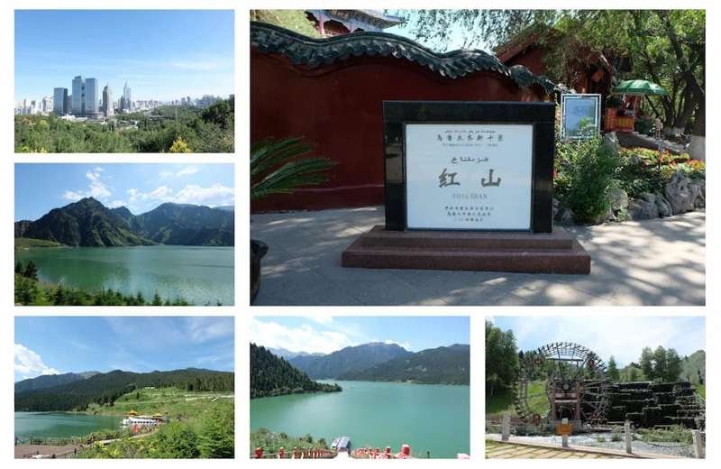
Why the Yili grasslands deserve their own loop
Most foreigners land in Urumqi, point the car at the Duku Highway, and blow through Yili as a transit corridor on the way to somewhere louder. That is a shame, because the Ili River basin catches moisture the rest of Xinjiang never sees. The result is pasture land that looks more like Switzerland than the Taklamakan. In late May the snow line pulls back up the mountains; by mid June the mid-slopes are a solid carpet of wildflowers.
Nalati and Kalajun sit about 150 kilometres apart as the crow flies, but the drive between them is a proper mountain crossing rather than a highway hop. Stringing them together means you see the settled fruit orchards around Yining, the big open meadows of Nalati, and the dramatic ridgelines of Kalajun without ever repeating a view. For the full picture of the region before you set off, the Yili Valley overview guide lays out the geography better than any map app will.
The shape of the circuit on a map
Start in Yining (also called Ghulja), the regional capital and the only place on the loop with a real airport and a train station. From there the loop runs clockwise:
- Day 1: Yining to Nalati, about 260 km, 3.5 to 4 hours on the G218 and G217.
- Day 2: A full day inside Nalati with no driving, or a short hop to nearby Xinyuan.
- Day 3: Nalati to Tekes, then up to Kalajun, roughly 160 km and a half day of driving broken by photo stops.
- Day 4: Kalajun back to Yining, about 120 km via the G577, easy and fast.
That is 540 km total, almost none of it on a toll highway. The roads are paved and in good shape, but they twist through river gorges, so your daily average speed stays low. Budget four nights if you want to actually walk the trails; three is enough if you only photograph from the road.
Day 1: Yining to Nalati
I left Yining at 8 a.m. after buying a thermos of milk tea and a bag of dried apricots from a street cart near the mosque. The first hour is flat orchard country, then the road climbs into pine forest. By early afternoon I was standing on the Nalati sky meadow, a rolling sea of grass backed by snow peaks that still had a dusting in early June.
Nalati charges for entry plus a mandatory shuttle bus into the core area. When I went, entry was around 95 yuan with another 40 yuan for the shuttle, and the cable car to the high meadow was extra. Prices shift between peak and shoulder season, so treat those as ballpark and confirm at the gate. The shuttle is not optional; private cars cannot drive the inner loops, so park at the lot and ride.
Day 2: Nalati’s valleys
The mistake most day-trippers make is seeing the sky meadow and leaving. Nalati is actually several valleys: the developed sky meadow, the quieter air grassland (kongzhong caoyuan) loop, and the river-valley route along the Nalati River. I spent the second day on the river route, where Kazakh herders still move yurts between pastures and you can buy fresh horse milk from a roadside family for a few yuan.
If you want the classic postcard, go to the sky meadow at 7 a.m. before the first shuttle arrives. I had the whole ridge to myself for twenty minutes, and the light on the dew was worth the early alarm.
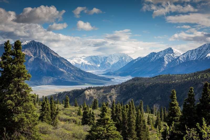
Day 3: Over the pass to Kalajun
This is the day that makes or breaks the circuit. From Nalati you retrace toward Xinyuan, then head southwest to Tekes, the famous eight-pointed-star county town laid out on a bagua (trigrams) plan. From Tekes the road climbs to the Kalajun scenic area. Kalajun is wilder and less groomed than Nalati: instead of one big meadow it is a series of narrow green ridges with thousand-metre drops into the Koksu River canyon.
Kalajun’s signature sight is the human-body grassland, a hillside whose curves look sculpted, best seen from the eastern platform late in the day. Entry ran me about 140 yuan with the cable car included when I visited, again seasonal. The Kalajun grassland guide has the current trail breakdown if you want to plan which ridge to walk.
Day 4: Kalajun back to Yining
The return is the easy leg. The G577 from Tekes to Yining is a modern tunnel-and-bridge road that cuts the old three-hour mountain drive to well under two. I stopped once at a roadside stand selling wild strawberries the size of my thumbnail, then rolled into Yining for a proper laghman noodle dinner.
Timing the June flower seas
The bloom is the whole point, and it is short. In a normal year the big show starts in late May at lower elevations and peaks across the mid-slopes from about June 10 to June 30. Go in early July and you will still find flowers, but the grass is already turning from green to gold and the tourist buses are at full volume. I caught the tail of peak around June 22 and it was near perfect: enough blossoms for the photos, few enough people to hear the wind.
Different flowers own different weeks. Purple echinops and red tulips open first near the valley floors; the famous blue forget-me-not carpets and yellow buttercup fields follow as you climb. If your dates are fixed, aim for the middle two weeks of June and you will hit something blooming no matter what.
Roads, fuel, and the one closure that wrecks plans
Two practical warnings. First, fuel: there are petrol stations in Yining, Xinyuan, Tekes and at the Nalati town entrance, but the stretch between Tekes and the Kalajun gate has nothing, so arrive with at least half a tank. Foreigners still need to show a passport at some remote stations, and a few only take mobile payment, so sort your Alipay or WeChat Pay before you leave the city.
Second, and more important: the Duku Highway, which many people use to enter Yili from the north, is closed from roughly early October to early June because of snow. If you are building this circuit as part of a bigger Xinjiang trip, do not book the Duku as your arrival road in spring. I met a couple in Yining who had planned to drive the Duku down from Urumqi in late May and had to rebook a flight because the pass was still shut. The circuit itself stays open year round, but the mountain crossings get slow under snow.
For the prettiest approach road inside the valley itself, the G218 Yili Valley road trip covers the orchard-and-river stretch between Yining and Xinyuan in far more detail than I can here.
Where to sleep and what it costs
You have three base options. Yining has the cheapest and most varied rooms, from 200-yuan budget hotels to 600-yuan international chains; it is where I started and finished. Nalati town, just outside the scenic gate, has yurt stays and mid-range hotels from about 300 to 500 yuan in season, and sleeping there lets you reach the meadow before the crowds. Tekes, below Kalajun, is the quietest base and the cheapest, with decent rooms around 250 yuan.
Add the park entries and shuttles and a solo driver should budget roughly 800 to 1,200 yuan for the circuit excluding fuel and the rental car, or about 1,500 to 2,000 yuan all in for four days if you rent a compact SUV at summer rates. Kalajun in particular has limited beds, so book the Tekes or Kalajun stay two or three days ahead in June.
What to pack for the grasslands
Bring a real windproof layer even in June. The meadows sit at 1,600 to 2,200 metres and a sunny noon can flip to a cold drizzle by dinner. I wore a t-shirt at lunch and a down jacket at the Kalajun sunset. Good shoes matter more than fancy gear: the ridges are sheep-track muddy after rain. Sunscreen, a refillable bottle, and a downloaded offline map are non-negotiable, because phone signal fades on the Tekes to Kalajun climb.
Eating on the loop: apples, lavender and horse milk
The Ili Valley grows some of the best fruit in China, and the circuit runs straight through it, so eat as you go. Yining’s morning bazaar sells apples and pears so fragrant they perfume the whole street; the surrounding orchards are the reason Xinjiang’s apple reputation exists at all. South of the city toward Huocheng, late June brings lavender fields that are worth a pull-over even if flowers are not your thing, because the roadside stalls sell lavender honey that I still think about.
Out on the grasslands the food gets simpler and better. I ate the same three things on repeat: laghman noodles tossed with tomato and green pepper in a Nalati town canteen for about 25 yuan, fresh naan still warm from a roadside tandoor, and salty fermented horse milk from a herder’s yurt that tasted like nothing I expected and grew on me by the third sip. Carry small cash for the yurt families; the card reader rarely works past the last town. If you want one proper sit-down meal, save it for Yining on the last night, where the Uyghur restaurants do a mutton polo and a cold yoghurt soup that resets you after four days of driving.
A few mistakes I made so you don’t have to
I under-packed for cold, over-packed for everything else, and on my first attempt tried to do Nalati and Kalajun in a single day from Urumqi. That last one is the big one. The circuit only works because the driving days are short and the stops are long. If you rush it, you trade the best grasslands in northwest China for a weary blur of car windows.
Give it three full days at minimum, four if you like to walk. Hit Nalati early, cross to Kalajun for the ridgelines, and time the whole thing for mid June. Do that, and the Yili grassland circuit will be the part of Xinjiang you tell people about first.
For a deeper look at the region’s headline pasture, the Nalati grassland travel guide covers trails, gates and the best viewpoints in detail.