
Karamay: The Oil City and the Ghost City
This Karamay travel guide covers the oil city of the Dzungaria basin and its doorstep to the World Devil City, a wind-carved yardang desert that looks like a ruined city built by giants. Karamay is industrial, flat, and unexpectedly good as a base for one of Xinjiang’s strangest landscapes, and it sits on the northern end of the Duku Highway.
Why Stop in Karamay
Karamay means black oil in Uyghur, named for the seepages that drew the first modern wells in the 1950s and turned a desert stop into a wealthy energy city. The core attraction is not the town but the Wuerhe Yadan Geopark, the Devil City, about 100 km away, where wind and time have sculpted the clay into castles, beasts, and towers. Add the Black Oil Mountain, the original oil spring, and Karamay makes a compact, fascinating overnight.
The Oil Story
Karamay’s rise is the story of modern Xinjiang in one place: a remote seep became a planned city of wide roads, green belts, and museums explaining the industry. The Karamay Oilfield Exhibition and the open-air rigs show how the black gold is pulled from deep Permian rock. Even travelers uninterested in engineering find the contrast between the bleak surroundings and the neat city striking.
The Devil City Landscape
The Devil City is a yardang field, steep-sided ridges of erodible rock aligned by the prevailing wind into shapes that read as forts, ships, and animals. The name comes from the whistle the wind makes through the formations at night. By day it is a photographer’s playground of shadow and rust color; at sunset the whole field glows. A shuttle loop takes you to the main viewpoints, and a short walk between stops is allowed.
How to Get to Karamay
By Air, Rail, and Road
Karamay Airport (KRY) flies to Urumqi in about 50 minutes and to a few other cities seasonally. The railway reaches Urumqi in roughly 4 to 5 hours. By road the city is about 310 km from Urumqi via the G217 and the expressway, a 3 to 3.5 hour drive that is fast and flat. Karamay is also the northern terminus region of the Duku Highway, whose southern end is Kuqa, so many road-trippers pass through twice.
Top Things to Do Around Karamay
Wuerhe Yadan Geopark (Devil City)
The geopark lies about 100 km southwest of Karamay, a 90 minute drive toward Wuerhe. A ticket plus shuttle covers the loop road and the signed formations, including the famous Great Hall and the Camel Rock. Go late afternoon for light and stay for sunset if you can; the wind picks up in the evening, so bring a windbreaker even in summer. Photography from the marked platforms is easy and spectacular.
Black Oil Mountain (Heiyou Shan)
North of the city center, Black Oil Mountain is the natural oil seep that started it all, a low hill still oozing dark crude from vents protected by a small park. A short boardwalk and a纪念碑 mark the site, and the smell of sulfur and oil is part of the experience. It is free or nominal and takes under an hour.
Karamay Oilfield Museum
The city museum tells the drilling history with models, old rigs, and a clear timeline from seep to superfield. It is air-conditioned, which makes it a smart midday stop in July and August, and the exhibits explain why the neat streets outside exist at all. Allow 60 to 90 minutes.
Artificial Lake and City Parks
Karamay built a chain of lakes and green belts to fight the dry wind, and the evening crowds there are genuine local life. The lakeside near the center is where families walk, and the fountains run on summer nights. It is an easy, free way to end a day before an early start to the Devil City.
Day Trips from Karamay
North to the Duku and the Tianshan
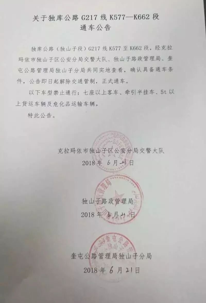
From Karamay the Duku Highway runs south across the Tianshan to Kuqa, a full day of changing landscape from desert to alpine meadow. The Xinjiang self-drive crowd loves this route, and Karamay is the natural fuel and sleep stop before the climb. Check the seasonal opening, because the pass closes in snow.
West to the China-Kazakhstan Border Zone
The road northwest reaches the border country around Tacheng and the trade towns, a different, greener face of northern Xinjiang. These are long day drives best done with a local who knows the checkpoints, but they show how varied the north is compared with the desert south.
Where to Eat in Karamay
Oil-Town Comfort Food
Karamay eats like a northern Han working city with strong Uyghur and Kazakh input: hand-pulled noodles, big-plate chicken, and mutton polo sit beside Russian-style bread and dairy from the north. A plate of noodles or polo runs 18 to 30 yuan, and the night food street by the lakeside is the liveliest option.
Kazakh Dairy and Meat
The nearby pastoral belt brings kumiss, thick yogurt, and roasted lamb leg to the city’s tables. Try a bowl of milk tea with fried dough for breakfast; it suits the windy climate. The best time to visit Xinjiang page notes that northern nights cool fast, so warm food matters from September.
Karamay at a Glance
| Detail | Information |
|---|---|
| Best Season | May to October; Devil City windy year-round, best at sunset |
| How to Get There | Flight from Urumqi 50 min; rail 4-5 h; G217 drive 3-3.5 h (310 km) |
| Ticket Price & Hours | Devil City 62 yuan + 20 yuan shuttle, 09:00-20:00; Black Oil Mtn nominal |
| Distance & Drive Time | Devil City 100 km / 90 min; Karamay-Urumqi 310 km / 3-3.5 h |
Practical Tips
Use Karamay as a one- or two-night base for the Devil City rather than a day trip from Urumqi, because the round drive is long and the sunset is the best light. The best time to visit Xinjiang for the north is May to October, but pack a windbreaker even in July, because the yardang field funnels gusts. If you drive, the best time to visit Xinjiang note for the north still applies: afternoons are windiest from spring, so autumn gives calmer light.
Karamay as a Loop Base
Many self-drivers run Urumqi to Karamay, south on the Duku to Kuqa, then west to Kashgar before returning north, or the reverse. Karamay’s airports and hotels make it a sensible place to drop or collect a rental and to restock before the long desert stages. The Xinjiang self-drive guide maps this loop with fuel and permit detail, and Karamay is one of its anchor cities.
When to Make Karamay a Priority
Karamay is not for everyone; if your trip is scenery-oXinjiang self-drivend for travelers curious about how modern Xinjiang was built, it earns its night. Treat it as the practical hinge between the north and the south, and the strange beauty of the geopark becomes the bonus rather than the burden. The Duku Highway plan makes the most of that position.
Updated July 2026. By Karl Huang.
Duku Highway