
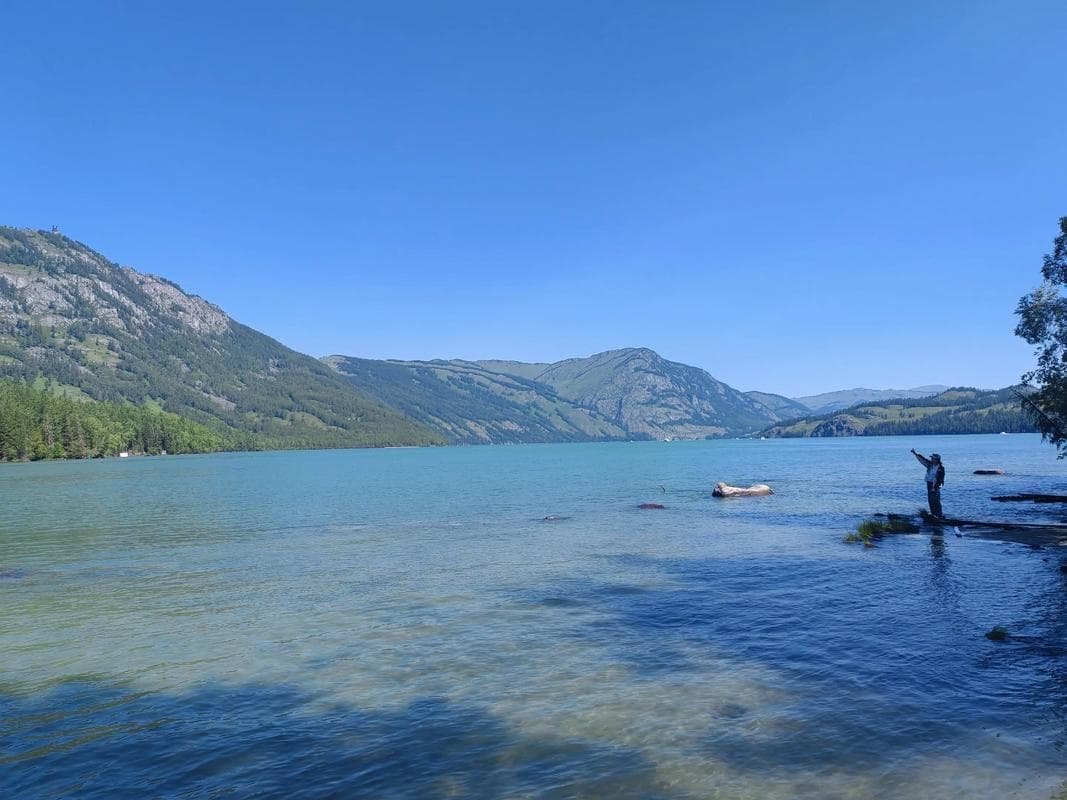
Northern Xinjiang Loop Road Trip 2026 — Ürümqi → Kanas → Yining → Ürümqi
The Kanas Lake circuit is the route most overseas drivers picture when they dream about Xinjiang, and the Northern Xinjiang Loop Road Trip 2026 turns that dream into a drivable plan. The loop leaves Ürümqi, runs north to the Altai mountains, curves west into the Ili Valley past Sayram Lake, and returns south over the Duku Highway back to the capital. For the wider context, our Xinjiang travel guide covers permits, seasons, and car rental, but this article is about the road itself — the distances, the surfaces, the fuel stops, and the rhythm of a week behind the wheel in China’s northwest.
What makes this loop worth the fuel is range. In a single week you move from desert-ringed oil towns to glacier-fed lakes, from Tuvan villages to lavender fields, then over a 3,400 m mountain pass where the climate changes every hour. The total driving distance is roughly 2,100 km, almost all on paved national highways in good condition, and the scenery never settles long enough to get boring. Most drivers complete it in eight days, which keeps daily legs between 140 km and 650 km — a sane pace when you want to stop for photos, melons, and the occasional roadside nomad camp.
Why Drive the North Instead of Joining a Tour
Northern Xinjiang’s highlights are spaced 200–400 km apart, which is exactly the distance a self-drive day should cover. Buses connect the big towns but leave you stranded at the trailheads — Kanas, Hemu, and the Sayram lakeshore all sit well away from any station, and the last few kilometers to a guesthouse are rarely served. With your own car you control the clock: stop at a roadside melon stand near Shawan, pull over for the Yining night market at 11 pm, or sleep in when morning fog hides the peaks. Tours rush these places; a car lets you wait for the weather to clear, which in the mountains is the difference between a gray snapshot and a postcard.
The Classic 8-Day Outline
Most independent drivers stretch the loop to eight days so the long hauls stay relaxed. The table below uses realistic drive times measured at a tourist pace, including fuel and photo stops, and assumes you pick up the car in Ürümqi on the morning of day one.
| Day | Route | Distance | Drive time | Overnight |
|---|---|---|---|---|
| 1 | Ürümqi → Karamay (G3014) | 310 km | 3.5 h | Karamay |
| 2 | Karamay → Burqin (G217) | 330 km | 4 h | Burqin |
| 3 | Burqin → Kanas Scenic Area | 140 km | 2.5 h | Kanas / Hemu |
| 4 | Kanas → Hemu → back to Burqin | 180 km | 4 h | Burqin |
| 5 | Burqin → Ürümqi (via Fuhai/Koktokay) | 650 km | 8 h | Ürümqi |
| 6 | Ürümqi → Sayram Lake (G30) | 550 km | 6.5 h | Sayram lakeside |
| 7 | Sayram → Yining → Nalati (G30/G218) | 400 km | 5.5 h | Nalati |
| 8 | Nalati → Dushanzi (Duku) → Ürümqi | 450 km | 7 h | Ürümqi |
Day-by-Day Notes
Day 1 is a gentle warm-up on the G3014, a smooth toll road across the Dzungaria basin. Karamay is a clean, modern oil city; fuel and hotels are easy. Day 2 follows the G217 north through flat grassland and the strange beauty of the Ulho Desert outcrops. Burqin is the gateway town — its riverside night market is the best place in the north to eat grilled fish from the Irtysh. Day 3 climbs into the Altai; the Kanas entrance is 140 km from Burqin and the final 30 km wind through spruce forest. Day 4 is for Hemu Village, a Tuvan settlement of log cabins an hour beyond Kanas, best at sunrise when woodsmoke lies in the valley.
Day 5 is the longest haul — 650 km back to Ürümqi, often broken with a stop at Koktokay (Fuyun), a granite-canyon geopark worth two hours. Day 6 runs the G30 west to Sayram, Xinjiang’s largest alpine lake at 2,070 m, ringed by snow peaks; sleep in a lakeside yurt or the new tourist lodges. Day 7 drops to Yining, the green heart of the Ili Valley, then climbs toward Nalati, one of the most famous grasslands in the region. Day 8 is the payoff: the Duku Highway south to Dushanzi and the fast run back to Ürümqi.
Road Conditions You Should Expect
Every road on this loop is sealed asphalt and is plowed and maintained year-round except where noted. The G217 Karamay–Burqin section is fast and flat, crossing the Junggar Basin with long straightaways and strong crosswinds that can push a high-roof van around — grip the wheel and don’t overestimate your speed. The Burqin–Kanas road climbs into the Altai and has tighter curves but is fully paved and well signed in Chinese and, increasingly, in pinyin. The G30 west of Ürümqi is a world-class expressway with rest areas every 40–60 km.
The Duku Highway Is Seasonal
The Duku Highway is the emotional peak of the trip but it is closed from roughly late October to early June because of snow at the 3,400 m Tianshan pass. Even in summer, snow can fall at the top and morning ice is common in June. Check the opening date before you build day 8 around it; if it is shut, return from Nalati to Ürümqi via the G218–G30 loop through Korla, adding about 200 km but keeping you on open road. The Duku itself is 561 km end to end; the Nalati–Dushanzi slice you’ll drive is around 200 km of switchbacks, tunnels, and突然 open valley views.
Fuel, Tolls, and Costs
Petrol (92 and 95 octane) is available in every county town on the route; the only stretch where you should top up early is the Burqin–Kanas–Hemu arm, where the last reliable station is in Burqin and the scenic-area pumps are pricey and queue-prone in October. Tolls on the G30 and G3014 are modest — budget around 300–400 RMB for the whole loop. A rented SUV runs about 8–10 L/100 km; at roughly 7.5 RMB/L that is around 1,300–1,600 RMB in fuel for the full circuit. Add 600–1,000 RMB for Kanas and Hemu entrance tickets and shuttle buses, which are separate from driving costs.
Where to Sleep Along the Way
Karamay and Ürümqi have international-standard hotels. Burqin ranges from hostels to comfortable inns; book early in October. Inside Kanas and Hemu, accommodation is mostly guesthouses and cabins — basic but heated, and the only way to catch sunrise without a 6 am drive. Sayram has yurts and new lodges; Nalati has grassland resorts. None take walk-ins reliably in peak season, so reserve through your car-rental contact or a Chinese booking app before you lose signal.
Food on the Northern Loop
The north eats well. Burqin’s night market grills local river fish with cumin; Ürümqi and Yining are overloaded with Yining noodle and kebab houses; the Ili Valley is famous for its creamy dairy and the sweetest apples in China. Carry snacks and water for the Kanas and Duku legs, where options thin out above the tree line.
Best Time to Run the Loop
Late September to early October is the standout window: Kanas turns gold, the summer crowds are gone, and the Duku is still open. June to August is green and floral but busy and prone to rain in the mountains. Winter closes the Duku and freezes Kanas access roads, so treat the loop as a May–October route. Spring (May) is quiet and cheap but the high passes can still be icy.
Scenic Detours Worth the Extra Hours
Two stops justify bending the schedule. Koktokay (Fuyun), on day 5’s return, is a granite-canyon geopark with cold blue rivers and few crowds; budget two hours and arrive before the 7 pm gate. Colorful Beach, just north of Burqin where the Irtysh meets the desert, glows at sunset and is a 20-minute detour on day 2 or 4 — go late, when the tour buses have gone. Hemu’s sunrise platform above the village is the single most-photographed view in the north; the walk up takes 30 minutes from the cabin area and the light is best in the first 20 minutes after the sun clears the ridge.
Driving Rules and Etiquette in China
Drive on the right, overtake on the left, and treat the expressway speed limit (usually 100–120 km/h) as real — cameras are common and fines attach to the rental. Don’t drink and drive at all; the limit is effectively zero and checkpoints run breath tests. At roundabouts and merges, local drivers assert position rather than yielding, so make your intentions early with indicators and avoid hovering in blind spots. Headlights are required in the tunnels that punctuate the Duku, and you should slow to the posted limit inside them because the temperature and surface change abruptly. Fuel stations are full-service; hand over the key fob or just say the pump number and let the attendant do it.
Altitude and Health on the Loop
The highest sustained point is the Duku pass at 3,400 m, with Sayram Lake at 2,070 m and Kanas around 1,300 m. Most drivers feel only mild breathlessness at the Duku top, but if you are coming straight from sea level, spend day 1–2 low in Karamay and Burqin to acclimatize before the pass. Drink more water than feels necessary — the northern air is dry and altitude hides dehydration. Pack ibuprofen for a headache and skip the heavy night-market meal the evening before day 8’s climb.
Practical Tips
- Carry your passport at all times — there are police checkpoints on the Ürümqi–Karamay and Burqin approaches, and hotels scan it at check-in.
- Download offline maps before leaving Ürümqi; the Kanas and Duku corridors lose signal for long stretches.
- Book Kanas and Hemu accommodation a week ahead in October — guesthouses fill during peak color.
- Keep a mental note on fuel: top up whenever the tank drops below half in the Altai and on day 5’s long return.
- Start day 8 early so you clear the Duku before afternoon fog on the pass, and pack a warm layer even in July.
- Tell a friend your daily overnight town; signal returns in each city so a quick WeChat ping keeps everyone calm.
Updated July 2026. By Karl Huang.