
Xiata Ancient Road & Zhaosu: Hiking a Thousand-Year Trade Route to the Muzart Glacier
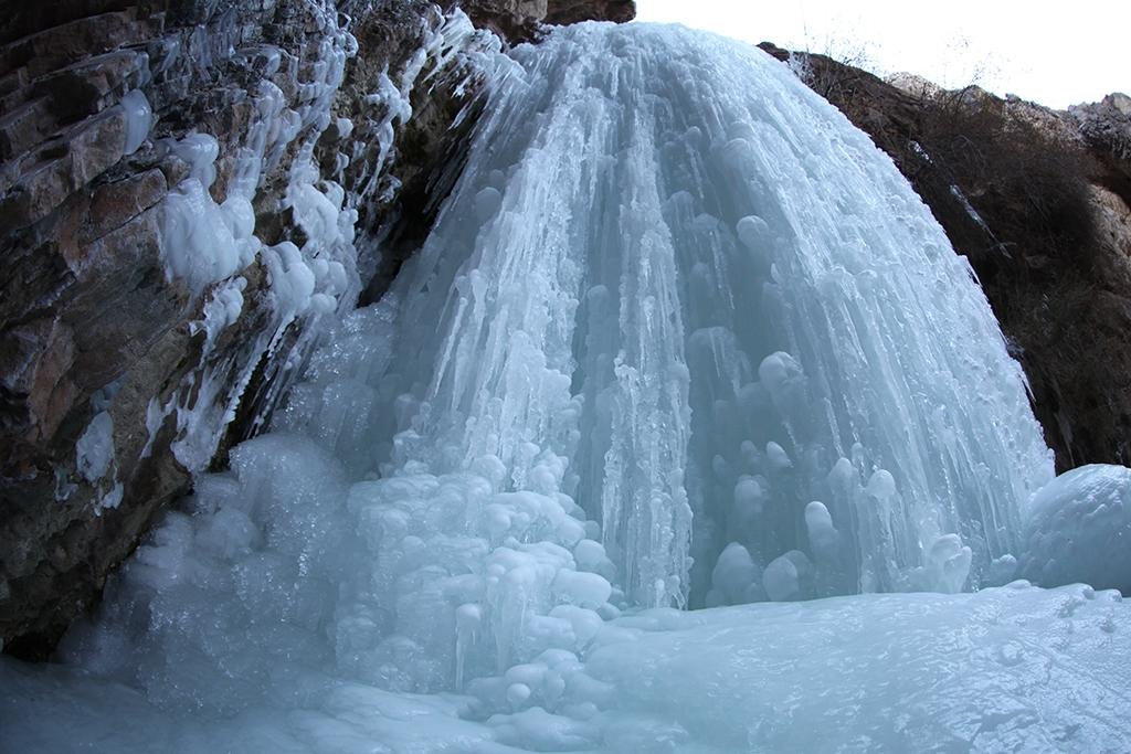
I drove four hours west from Yining on a single-track impulse: everyone told me the Xiata Ancient Road was just a soggy trail to a glacier you could barely see. They were wrong about the “barely.” On a clear morning in early July the Muzart Glacier fills the entire valley head like a frozen waterfall, and the only sound is the river you have to keep one eye on the whole way up. This is a first-hand account of driving into Zhaosu County and hiking the Xiata (Xiate) Ancient Road, written for foreigners who actually want to do it rather than just read about it.
Why the Xiata Ancient Road is worth the detour
The Xiata Ancient Road is one of the last intact sections of the ancient Tianshan corridor that linked the Ili Valley to the Tarim Basin. For a thousand years horses and pilgrims climbed out of Zhaosu over the Muzart (Ice) Pass before the modern G217 made the crossing irrelevant. What’s left is a day-hikeable river valley where the pavement ends and the mountains begin. It is not a comfortable attraction. It is the most “expedition-feeling” walk most self-drivers will do in Xinjiang, and that is exactly why it sticks.
Getting to Xiata from Yining or Zhaosu
Most people base themselves in Yili (Ili) Valley and make Xiata a long day trip or an overnight. From Yining it is roughly 220 km and 4 hours of driving; from Zhaosu town the scenic-area gate is about 70 km south on the S237, the last 30 km of which are a slow, potholed mountain road. A normal sedan can crawl it in dry summer, but after rain the locals run 4WD shuttles because the creek crossings get real. I drove a rented SUV and still paid for a local transfer for the final stretch.
There is a ticket gate, an ID check, and a hard rule: you cannot drive your own car past the visitor center. A shuttle or a hired local 4WD takes you the remaining 10 km to the actual trailhead at the trail village. Budget 40 to 60 minutes of transfer time on top of your hiking.
The hike itself: river, bridge, and the glacier wall
The walk to the glacier viewpoint is about 15 km round trip on a wide riverbank path, mostly flat for the first 7 km and then a gentle grind as the valley narrows. Allow 5 to 7 hours round trip at a relaxed pace. The path runs alongside the Muzart River the entire way, and this is the one part people underestimate. The river is glacial, fast, and cold enough to drop your heart rate. There are log bridges at the obvious crossings; do not improvise a ford when the water is high in July and August.
About 2 km before the glacier a rope-assisted section climbs the moraine. It is not technical, but the loose rock and the altitude (the trailhead sits near 2,400 m and the viewpoint pushes past 2,800 m) will have your lungs working. When the glacier finally swings into view it is bigger than any photo suggests, a 10 km-wide sweep of ice pinned between two ridgelines.
Permits, gates, and the rules nobody tells you
Xiata sits close to the Kazakh border, so expect a tourist-area ticket (around 60 yuan in 2026) and a routine passport/ID check at the gate. The “ancient road” beyond the standard viewpoint sometimes requires an additional permit or a registered guide, and the rule changes year to year depending on snowfall and border sensitivity. Ask at the visitor center the morning you go; do not assume the trail is open just because a blog from 2019 says so. If you are planning a longer Xinjiang loop, fold this stop into a broader independent-travel plan for 2026 so the permit questions are answered before you are standing at the gate.
When to go, and when the road closes
June through September is the window. July and August are lush and busy, with the highest river. Early September is my pick: golden grassland, fewer trucks of tourists, and cold-clear nights. The access road and the upper trail close with the first serious snow, usually late October, and stay closed through winter. One genuine bonus most guides skip: the summer-night sky here is absurd. With no valley light for 30 km, the Milky Way is a bright smear by 11 pm.
What it costs in 2026
Real numbers from my trip: scenic-area ticket about 60 yuan, local 4WD transfer round trip roughly 100 to 150 yuan per person, a basic Zhaosu guesthouse 150 to 250 yuan a night, and fuel from Yining around 160 yuan round trip in a small SUV. Horse hire from the trail village, if your legs object, runs 150 to 200 yuan one way. A solo day at Xiata lands near 400 yuan all in; a couple sharing a room and a car splits closer to 250 yuan each.
Gear and fitness reality check
You do not need mountaineering skills, but you do need the right kit. Waterproof boots with ankle support, trekking poles, a rain shell (afternoon storms are routine), and two litres of water per person. The Xinjiang packing list I wrote for mixed seasons covers the rest. Altitude is modest but the distance is not, so train-legs beat training-peak. If you are travelling alone, the solo-travel notes on checkpoints and phone signal apply here doubly, because the valley drops to patchy signal past the trail village.
Xiata, Qiongkushitai, or Kalajun?
Three famous Yili valley walks get confused by first-timers. Xiata is the wild glacier-hike option. Qiongkushitai is the softer, horse-trek-friendly alpine village with wooden cabins. Kalajun and nearby Kuerdening are the groomed grassland-scenic areas with boardwalks and cable cars. If you want a workout and a glacier, pick Xiata. If you want a photo plateau with a coffee stand, pick the other two. They are 2 to 3 hours apart by car, so you can sample two in a long weekend.
Stringing Xiata into a Yili loop
Xiata pairs naturally with the rest of the Nalati grassland circuit. A sensible 4-day self-drive runs Yining to Nalati (day 1), Nalati to Zhaosu via the southern Yili backroads (day 2), Xiata as a full day (day 3), then Zhaosu to Yining or on toward Kuerdening (day 4). The S237 south of Zhaosu is the scenic spine of the whole valley and the part most foreigners skip. Do not skip it.
Where to sleep and eat in Zhaosu
Zhaosu town has the practical hotels; the trail village has a handful of basic guesthouses and yurts that fill by mid-morning in peak season, so book the night before. Food is standard Yili: lamb skewers, hand-pulled laghman, and the local horse-milk kumis if you are feeling brave. The Zhaosu night market after a Xiata day is the right kind of reward, cheap and loud and full of people who also limp a little.
Mistakes I made so you don’t have to
I left at 10 am and spent the glacier hour fighting the midday glare instead of the morning alpenglow; start by 8. I wore trail runners and spent the last crossing with wet socks; boots next time. And I assumed the transfer was included in the ticket; it is not, so carry cash because the shuttle operators do not always take mobile pay this far out. None of it ruined the day, but all of it was avoidable.
Xiata is not the easiest stop in Xinjiang, and that is the point. Drive in with the right shoes and the right morning, and you get a glacier, a borderland valley, and a silence most travellers drive right past.