
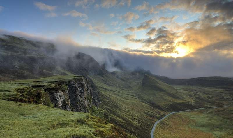
Driving the Yizhao Highway: Xinjiang’s Wild Mountain Road from Yining to Zhaosu
Last July I left Yining at 7:10 in the morning with a full tank and a thermos of milk tea, aiming for Zhaosu before the afternoon haze rolled over the pass. The road I chose was the Yizhao Highway, locally called Yizhao Gonglu, the provincial route S237 that stitches the Ili Valley floor to the Zhaosu basin by climbing straight over the Tianshan. Most foreign travelers have heard of the Duku Highway. Almost none have heard of this one. After driving both, I think the Yizhao is the more startling of the two, and the easier to get wrong.
Where the Yizhao Highway Actually Is
The road runs roughly 120 km from Yining (Ghulja), the main city of the Ili region in far northwest Xinjiang, south to Zhaosu county, the high grassland basin famous for horses and summer rapeseed. It is not a new highway built for speed. It is a rebuilt mountain provincial road, and for long stretches it is a single lane each way with a painted edge and nothing between your left wheels and a drop of several hundred meters.
What makes it special is the vertical. Yining sits at about 660 m. The pass tops out near 3,000 m at the Baishifeng (White Rock Peak) area, a wall of pale limestone that gives the road its nervous reputation. In 120 km you gain and lose more altitude than many travelers see in a week. The spruce forests of the Tianshan, the alpine meadow, the scree slopes, and then suddenly the open wheat-and-horse country of Zhaosu all arrive in a single morning.
Before you commit, read up on the wider region in our Yili (Ili) Valley overview and the Yining city guide, because the Yizhao only makes sense as one leg of an Ili loop, not a standalone trip.
When It Opens (and When It Doesn’t)
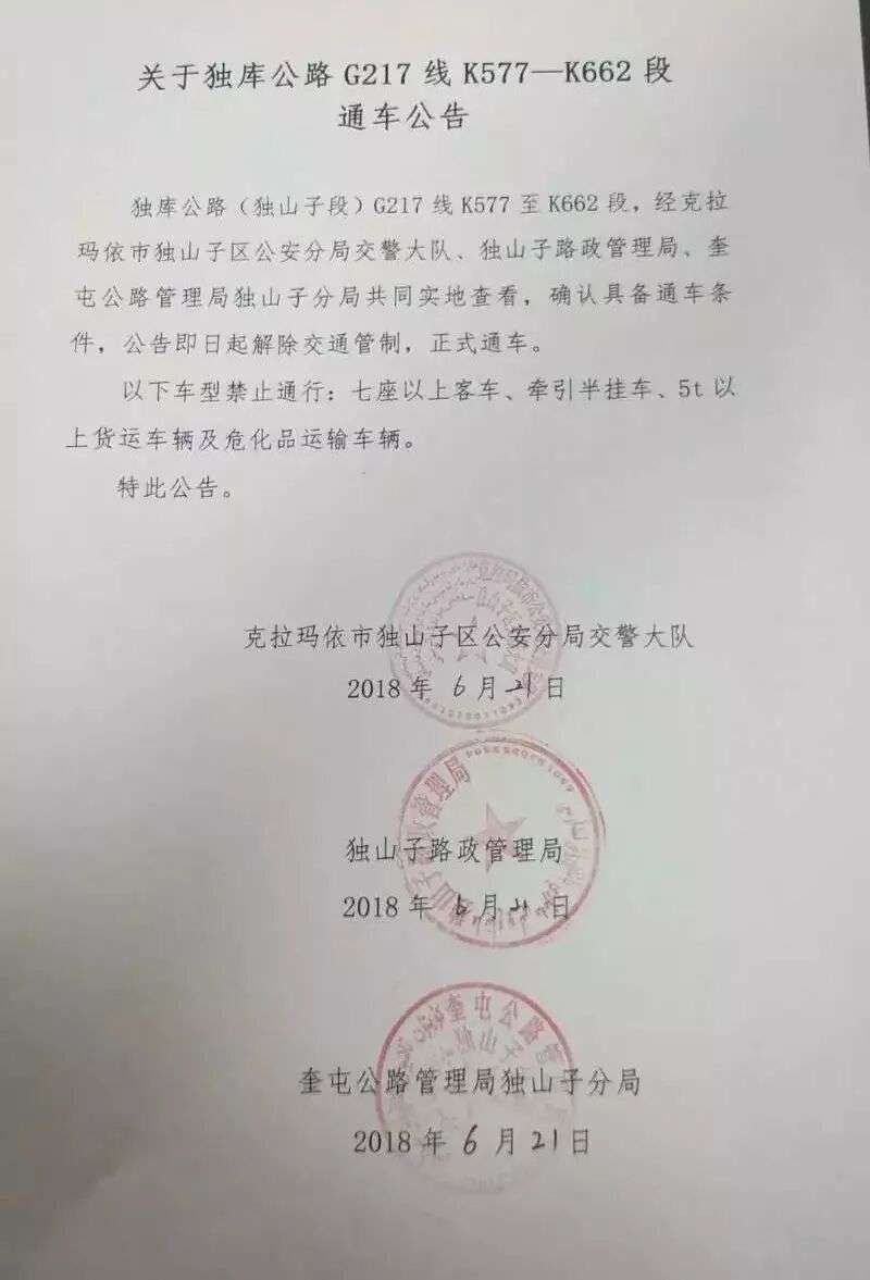
This is the single fact that ruins itineraries. The Yizhao Highway is seasonal. In a normal year it opens around June 1 and closes in late September or early October, sometimes as early as mid-September if the first snow hits the pass. The exact dates float with the weather, and the local traffic police close the whole road on short notice whenever there is snow, ice, or a landslide after heavy rain.
Unlike the Duku, which is long enough that crews keep most of it clear, the Yizhao is short and high, so a single night of frost shuts it. I checked the night before on the Xinjiang traffic police feed and again at the Yining gas station at 6:40 a.m. Both said open. Two hours later, at the lower checkpoint near the forest edge, a police officer waved me through but told the bus behind me to turn back. Buses and large vehicles are routinely refused.
Two practical rules I now follow. First, never book a non-refundable Zhaosu hotel for a day you plan to cross on the Yizhao in May, September, or October. Second, have the Guozigou Bridge route as your backup, because that highway over to Zhaosu via the G30 and the果子沟 gorge stays open year-round and only adds about 90 minutes.
The Drive Itself: Yining to Zhaosu
I broke the morning into three sections, and so should you, because each one asks something different of the driver.
The Valley Run (Yining to the Mountain Foot)
The first 35 km out of Yining are flat, fast, and dull: irrigated fields, poplar lines, the occasional herd crossing. Speed limit here is 80 km/h and it is enforced by section radar. This is the place to fuel, use a toilet, and buy water, because the next 60 km have almost nothing.
The Climb (Forest Edge to the Pass)
Then the road turns upward and stops being gentle. The surface is good asphalt, but the corners come in tight sequences, many at 180 degrees, with a guardrail on the inside and open air on the outside. I was in a rented 1.5-liter sedan, and on the steeper pitches in second gear it held 30 km/h comfortably; a heavier SUV would want third. There are no passing lanes. When a local pickup appears behind you, pull to the wide spots and let it by. Locals drive this road daily and do not slow for tourists.
About two-thirds up there is a pull-off with a view back down the valley. I stopped there at 9:15. The light was flat, the spruce below looked like a green carpet, and the Baishifeng wall caught the sun. There is no ticket office, no vendor, just a gravel strip and a drop. Park fully off the lane; the road is too narrow for a stalled car to be ignored.
The Descent into Zhaosu
The top is marked more by a change in air than a sign. Past the pass the road unwinds down the north face of the Zhaosu basin. The temperature rose about 9 degrees Celsius between the summit and the county edge. I reached Zhaosu town at 10:50, roughly three hours and forty minutes after leaving Yining with one photo stop, average moving speed around 45 km/h including the slow climb.
Yizhao vs Duku: Which One Should You Drive?
People always ask me which is better. They are different animals, and the choice depends on your trip, not your bravery.
The Duku Highway is the famous one: 561 km from Dushanzi to Kuqa, crossing the whole Tianshan north to south, open roughly early June to early October, a multi-day epic through canyons, tundra, and red rock. It is wider, better guarded, and built for through-traffic. You can do a piece of it in a day, but its real value is the long traverse.
The Yizhao is short, intense, and local. It does not cross the range; it hops one ridge and drops into a neighboring valley. What it gives you is a concentrated dose of mountain driving in about four hours round-trip, plus direct access to Zhaosu’s horse ranch and July lavender. If you are based in Yining for three or four days, the Yizhao is the one morning drive worth clearing your schedule for. If you are doing a grand north-south traverse, the Duku is the headline and the Yizhao is the optional side quest.
My honest take: drive the Yizhao first if you are new to Xinjiang mountain roads. It teaches you the rhythm of tight switchbacks and altitude without committing you to a 200 km stretch of nowhere. Then, when the Duku opens, you will already know how your car behaves on a cliff edge.
Rules, Restrictions, and What Your Car Must Handle
The restrictions are real and they are enforced at the Yining-end checkpoint:
Vehicles with more than 7 seats are turned back. That means no coaches, no big vans, no rented 9-seat people-carriers. A standard 5-seat sedan or SUV is fine. Dangerous-goods trucks are banned. The road is closed to all traffic during snow, ice, or high wind on the pass, and closures can last a full day.
Your car needs decent brakes and a low enough gear range to hold a descent without riding them. My little sedan managed, but I would not take a worn tire up there; the descent is long and the asphalt gets slick after rain. Fuel: fill in Yining. The only fuel between the valley and Zhaosu is a single small station near the forest boundary, and it ran out of 92-octane on the day I passed.

Practical Stops: Fuel, Food, Toilets
Do not expect services. The mountain section has one toilet at the midway pull-off, a squat style with no paper, and that is it. Food is a thermos and the naan you bought in Yining. I paid ¥6 for two warm naan and ¥4 for a boiled egg at a roadside stall on the valley run, and that was the last hot food until Zhaosu.
In Zhaosu itself, the county town has proper restaurants. A plate of laghman noodles cost me ¥22, and a bowl of horse-meat naan stew (a Zhaosu specialty) was ¥38. Fuel in Zhaosu is easy and cheap, 92-octane was ¥7.4 per liter that week.
A Sample Timing Plan
If you want the clean version of my morning:
06:40 – Fuel and buy food in Yining. Check the traffic-police feed for the road status.
07:10 – Depart. Valley run, 35 km, ~30 minutes.
07:45 – Begin the climb. Tight switchbacks, 60 km, ~2 hours with a photo stop.
09:50 – Summit and short break at the pull-off.
10:50 – Arrive Zhaosu, 120 km total in about 3 hours 40 minutes moving.
Return the same day if you like; the light coming back over the pass around 18:00 is even better than the morning. I stayed in Zhaosu and drove the Zhaosu grasslands the next morning instead, which I recommend far more than rushing back.
What to Do in Zhaosu After the Pass
Zhaosu is the reason the Yizhao is worth the nerves. In July the county turns purple with lavender and yellow with rapeseed at the same time, a striped quilt you can see from the road. The Tian Ma (Heavenly Horse) ranch runs equestrian shows through summer; the ticket was ¥80 when I went. The grassland around the county is free to drive and full of herders who will sell you fresh milk for ¥10 a liter if you slow down and wave.
If the Yizhao is closed when you arrive, do not force it. The Guozigou Bridge route and the longer Duku are both open far more reliably, and Zhaosu is reachable by the G218 regardless. The mountain will still be there next morning, and in Xinjiang the weather changes faster than any plan.