
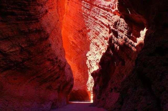
Maigaiti: The Desert Oasis and Golden Poplars at the Edge of the Taklamakan
I reached Maigaiti late one October afternoon, the poplars already turned a colour I had last seen only on postcards. The bus from Kashgar had rolled south out of the old city and then east along a flat road that kept going until the horizon seemed to forget where it was meant to end. Maigaiti sits on the western skin of the Taklamakan, that ocean of sand people here call the death desert, and the town itself stays green only because the Yarkand River agrees to spare a little water on its way past. Everything about the place feels like a quiet bet against the land. The county is a thin ribbon of fields and trees pressed against a wall of dunes, and the families who live there have spent generations negotiating with both. I came for the golden Populus euphratica forests, the desert poplars that set the riverbanks on fire for a few weeks each autumn, and I stayed because the slow rhythm of oasis life was the opposite of every frantic itinerary I had built before.
Getting to Maigaiti from Kashgar
The easiest way in is Kashgar, the old Silk Road hub in far western Xinjiang and the natural base for anywhere in this corner of the Tarim basin. From the Kashgar long distance bus station a regular coach runs east to the Maigaiti county town, a distance of roughly 180 kilometres. The fare in 2025 was about 50 yuan and the ride took three and a half to four hours, depending on how many roadside stops the driver favoured. The road is paved and dull for long stretches, running through a flat agricultural plain where every town looks like the last one until the green thins out.
If you would rather move on your own clock, hiring a car with a driver in Kashgar costs around 400 to 500 yuan one way, and it lets you stop at the poplar patches and village markets that the bus blows past. I did the trip both ways and preferred the hired car on the way out, simply because the light over the fields at dawn was worth pulling over for. A shared taxi from the Kashgar transport hub is cheaper if you can fill the seats, usually 80 to 100 yuan per person, but you leave when the car is full rather than when you are ready.
The road from Hotan
Coming from Hotan is a different kind of day. Hotan sits south of the desert, and to reach Maigaiti you have to go north across the Taklamakan and then west, a distance of around 600 kilometres that eats most of a daylight window. Most travellers do this as part of a longer loop rather than as a point to point dash, because the drive itself crosses the heart of the sand sea on the desert highways. If you are starting from Hotan, plan an overnight somewhere in between, or accept a very long day behind the wheel with fuel and water stowed for the crossing.
Yecheng and the southern gateway
Another neighbouring anchor is Yecheng, known in older maps as Karghilik, about 130 kilometres southeast of Maigaiti within the same Kashgar prefecture. Yecheng matters to travellers because it is where the G219 highway begins its climb south toward the Tibetan plateau, the famous road that leaves the farmland behind for good. I mention it because a lot of people pair a Maigaiti stop with the start of that route, and you can read more about the southern gateway in our guide to the G219 highway out of Yecheng before you commit to the altitude.
The Yarkand River and the Poplar Belt
Maigaiti owes its existence to the Yarkand River, the long watercourse that drains the northern face of the Karakoram and feeds a chain of oases before it loses itself in the desert. The river does not run wide or loud here. It moves slow and brown between low banks, and the desert poplars crowd its edges the way people crowd a single tap in a drought. Populus euphratica is the survivor of this landscape. Its roots drive down toward deep groundwater, and its leaves turn from green to gold to a copper red as the cold arrives, holding on the branches long enough to be photographed and then letting go all at once in a wind.
What surprised me was that Maigaiti is not one tidy forest you pay at a gate to enter. The poplars grow in scattered patches along the river and around the fields, threaded by dirt tracks and irrigation ditches, and the best stands are the ones you find by asking a local which direction the water went this year. If you want a managed park with boardwalks and a ticket office, the better known golden poplar forest at Zepu is the cleaner experience, about a half day west. Maigaiti gives you the wilder, more broken version, and I came to prefer it precisely because nothing was arranged for me.
Where the trees actually grow
The reliable belts sit north and east of the county town, where the land still catches river water before the sand claims it. A local driver took me to a stretch where the poplars stood so dense the ground underneath stayed cool at noon, and a narrow canal ran between them carrying meltwater from the mountains hundreds of kilometres away. Stand there long enough and you understand the logic of the oasis: everything green is a loan, and the desert is the bank that always collects.
The Autumn Season: Late October Gold
If you remember one thing, make it the timing. The poplars in this part of Xinjiang turn in late October, and the window is short. A warm autumn can hold the colour into early November, but a cold snap will strip the branches in a matter of days, and I met a photographer who had driven twelve hours only to find the ground already carpeted in fallen gold. Late October is the safe bet, with the last week of the month usually the peak. The trees do not wait for your schedule.
The light is the other half of the equation. Mornings here are clear and cold, the sort of light that makes the leaves glow without washing them out, and the hour before sunset does the same from the opposite angle. I shot most of my good frames between seven and eight in the morning, when the village smoke was still thin and the canals lay flat and mirror still. Midday is harsh and flat, fine for walking but poor for pictures.
What the weather does to you
October days in Maigaiti run mild, often 15 to 22 degrees in the afternoon, but the nights drop close to zero and a wind off the dunes cuts straight through a light jacket. Pack in layers even if Kashgar felt warm when you left. The early October national holiday brings Chinese domestic crowds to the famous sites, so late October has the double advantage of better colour and thinner crowds. I had whole stands of poplars to myself on a weekday, which is rare anywhere worth photographing.
Oasis Villages and Uyghur Daily Life
The county is a patchwork of Uyghur oasis villages, low mud brick courtyards shaded by apricot and walnut trees, with grape trellises thrown across the lanes and narrow canals carrying water from field to field. Life here runs on the canal clock. Women wash at the water channels in the early cool, men tend the poplar lined fields, and the call to prayer drifts over mud walls at the times it has always drifted. It is a working landscape, not a museum, and the hospitality hits you before the scenery does.
I was invited into a courtyard within an hour of wandering past the first village, handed a bowl of tea and a piece of warm nan pulled fresh from the tandir oven. Nobody expected payment and nobody performed the welcome. That is the ordinary etiquette of the Tarim oasis, and the right move is to accept the tea, take your shoes off at the threshold, and ask before you lift a camera to anyone’s face. A smile and a few words go further than any permit.
The weekly market
Each town keeps a bazaar day, and the Maigaiti market is worth timing your visit around. Stalls stack piles of melons, grapes, and walnuts, and the food corner turns out polo, laghman, and skewers of mutton cooked over open coals. Prices are local, not tourist: a full plate of polo ran me about 15 yuan, and a skewer of lamb was two or three. If you want to see how deep the oasis tradition runs, read about the last desert village along the Keriya River, a place where the same river culture holds on hundreds of kilometres east of here.
The Desert Edge and the Death Desert Road
North of the county town the fields simply stop. One moment you are among poplars and wheat, the next you are looking at a line of dunes with nothing negotiated in between. This is the edge of the death desert, and it pulls at you the way any untouched edge does. You can drive a dirt track toward the sand and walk out onto the first ridges, but the desert here is not a playground. It is dry, disorienting, and quietly lethal to anyone who treats it as one.
The basics of staying alive on the sand are not complicated, just non negotiable. Carry more water than you think you need, tell someone in the town exactly where you are going and when you will be back, and never drive off the established tracks without a second vehicle and a sat phone or offline maps. Fuel up in the county town, because the next pump may be a hundred kilometres away. A hot October wind can push the temperature from pleasant to punishing in an hour, and the horizon offers no landmarks once you are past the last poplar.

Building a safe desert day
I treated the desert edge as a half day outing, not an expedition. I left the town with a full bottle, a charged phone loaded with offline maps, and a promised return time with my guesthouse owner. I walked the first dune line, watched the light fail over the sand, and turned back well before dark. That restraint is what lets you come back. If you want to see the whole system of roads and highways that ring this sand sea, our guide to looping both Taklamakan desert highways lays out the longer routes that connect Maigaiti to the north and south rims.
Where to Sleep and What to Eat
The county town has a working set of guesthouses and small hotels, the kind that cost 120 to 200 yuan a night and are clean without being memorable. I stayed in a family run place off the main road, where the owner locked the gate at ten and unlocked it when I tapped at six for the dawn. Book ahead only if you are travelling during a holiday; on a random October weekday I walked in and took a room. The heating mattered more than the decor, because the nights were already cold.
Eating is the easy part. Every few hundred metres there is a nan oven, a polo pot, or a charcoal grill, and the fruit in late October is the quiet star of the region. Maigaiti and its neighbours grow melons and grapes that taste like the water they were loaned, and a kilo of grapes cost me less than five yuan at the market. Sit at a roadside stall, order a plate of laghman for twelve yuan, and watch the poplar leaves come down in the wind. It is a cheap, slow meal and exactly the point of coming here.
A Note on the Wider Tarim Loop
Maigaiti works best as one stop on a longer southern Tarim circuit rather than a destination in isolation. From here you can run east through the oasis towns toward the Keriya and Niya ruins, or swing west to the managed poplar parks and the Kashgar hub that got you here. The desert highways to the north and south let you close the loop without backtracking, and the oasis lakes of the region, written up in our Bosten Lake oasis guide, show the same river culture with a lot more water. Pair Maigaiti with a couple of those stops and the death desert stops feeling like a wall and starts feeling like a shoreline you can read.
Practical Basics Before You Go
A few things I wish someone had handed me at the Kashgar station. Bring cash in small bills, because the village stalls and the cheaper guesthouses do not always take a card or a foreign phone payment. Pack layers and a windproof shell no matter the forecast. Download offline maps before you leave the city, because the signal thins the moment you are past the last tower. Learn three or four polite phrases and a genuine smile, since the language gap is real but the welcome is not. And give the poplars the time they deserve: a single afternoon at the river will teach you more about this edge of Xinjiang than a week of rushing between ticketed sights.
Maigaiti is not the easiest name on the map and it is not the most famous stop in the south. That is exactly why it stayed with me. A green ribbon fighting a sand sea, a river that decides who eats, and a few weeks of gold that the desert will take back without apology. I left the way I came, east on a quiet road, already planning the late October return.