
Top 10 Hiking Trails in Xinjiang 2026 — From Grasslands to Glaciers
Xinjiang is a hiker’s continent compressed into one province. Within a single Xinjiang travel guide you can move from alpine lakes ringed by snow peaks to 4,000-year-old juniper forests, from emerald river valleys to the terminal moraines of active glaciers. The distances between trailheads are huge, but the trails themselves are remarkably walkable, and most are free of the crowds you’d meet on famous routes elsewhere in China. This list covers ten day hikes and overnighters that span the region’s full altitude range, with honest notes on distance, gain, and what to carry so you can plan a realistic week or two on foot.
What makes hiking here special is the silence. Outside the busiest boardwalks at Kanas and Nalati you may walk an hour without seeing another person, yet you are never far from a herder’s yurt where a pot of milk tea appears the moment you pause. The landscapes change fast: start in spruce forest, climb past flower meadows, and finish on a ridge with a glacier filling the horizon. Few places on earth pack that much variety into a single morning’s walk.
How Xinjiang Trails Are Different
Most Xinjiang hiking happens between 1,300 m and 3,200 m. At the upper end, expect thinner air and strong UV even on cool days. Trails are rarely signposted in English, and cell coverage disappears behind the first ridge, so download offline maps (Gaode or Maps.me) before you leave the city and share your route with your guesthouse. Herding dogs and livestock are common on grassland routes—carry a stick and keep a calm distance; a raised voice and steady pace sends most dogs back. The reward is solitude: on a weekday you may have an entire mountainside to yourself.
Best Seasons for Each Zone
Northern Xinjiang (Kanas, Hemu, Nalati) is best from mid-June to late September. High grasslands green up after snowmelt, and July brings a riot of wildflowers—yellow batschia, blue delphinium, and red poppies along the forest edge. Southern Xinjiang and the Pamir (Muztagh Ata, Karakul) are walkable from May through October, with the clearest glacier views in September after the summer haze clears. Avoid November to April unless you are on a dedicated snow route with proper gear.
The Ten Trails
1. Kanas Three Bays: Shenxian Bay to Guanyu Bay
The classic Kanas walk follows a wooden boardwalk along the Kanas River, linking three famous bends—Shenxian (Fairy) Bay, Moon Bay, and Guanyu Bay. It is about 9 km one-way and almost entirely flat on well-laid boardwalk, which makes it the most accessible hike in the region and a favorite for sunrise photography. Start at Shenxian Bay before 7 a.m. to catch valley mist drifting between the pines. Entry to the Kanas Lake scenic area covers the boardwalk; a shuttle bus returns you to the village, so you only carry a day pack.
2. Hemu Village to the Gukepulin Viewpoint
From the wooden houses of Hemu, a forest track climbs to the Gukepulin platform overlooking the village and the Friendship Peak (Youyi Feng) massif. Budget 14 km round-trip and 600 m of climb on a mix of dirt road and single track. In October the birch belt turns gold and the smoke from chimneys makes for the iconic winter-card photo. Stay overnight in Hemu Village to hike at first light when the light is soft and the tour buses have not arrived. Locals rent horses (120–150 RMB) if you would rather ride the climb.
3. Heavenly Lake (Tianchi) Bogda Foothills Loop
Above Urumqi, Heavenly Lake sits at 1,910 m under the 5,445 m Bogda Peak. A half-day loop of roughly 12 km circles the western shore and climbs to a hanging valley viewpoint, gaining 400 m. The stone path is solid but exposed—bring a wind layer even in summer, as gusts off the glacier drop the temperature 10 degrees in minutes. The Tianchi cable car saves the initial climb if you want more time at altitude, and paddle boats on the lake make an easy family add-on.
4. Nalati Grassland Ridgeline
In the Ili Valley, Nalati’s aerial grassland rolls in green waves to the horizon. A ridgeline path from the tourist platform runs about 8 km with gentle ups and downs (300 m gain) and endless photo stops among Kazakh yurts where you can try kumiss, the fermented mare’s milk. Horses are available if legs tire. Visit Nalati Grassland in June for flower fields and again in September for autumn tones when the grass turns copper.
5. Kuerdening Pine Forest Trails
A UNESCO World Heritage component of the Tianshan, Kuerdening protects old-growth spruce and open glades threaded by clear streams. Multiple signed loops total about 18 km; the highlight is the ridge above the valley with views toward the snow-striped Khan Tengri region on a clear day. The Kuerdening Nature Reserve is quieter than nearby Nalati and excellent for birding—look for the Himalayan snowcock and the lammergeier riding thermals above the ridge.
6. Bayanbulak Nine-Bend River Boardwalk
At 2,500 m, Bayanbulak is China’s most accessible alpine wetland. A flat 6 km boardwalk traces the Kaidu River’s bends—famous for the “nine suns” optical effect at sunset when light splits across the water. Easy walking, but the plateau wind is brutal; pack a fleece even in July. Swans nest in the reed beds in spring, and the vastness of the basin makes a fine contrast to the tight mountain gorges elsewhere on this list.
7. Muztagh Ata Glacier Base Camp Trek
On the Pamir Plateau, the “Father of Ice Mountains” rises to 7,509 m. The trail from Karakul Lake (3,600 m) to the glacier base camp is ~14 km round-trip with 700 m of gain on rocky, vehicle-wide track. Acclimatize at least two nights above 3,000 m before attempting it, and turn back if you feel light-headed. The views of the icefall are worth every step, and yaks graze the moraine slopes like slow white stones.
8. Karakul Lake Circuit
A gentle 8 km loop around the lake shore, mostly level at 3,600 m, with the Muztagh Ata massif as a constant backdrop. Kirghiz herders may invite you into a yurt for milk tea, and the lakeside reflects the peak so perfectly that the windless dawn hours feel like floating. Good as an acclimatization walk before the base-camp push, or as a recovery stroll after it.
9. Tianshan Grand Canyon (Kizil Canyon)
Near Kuqa in the south, this red-rock gorge cuts 5 km into the mountain. The marked path is ~10 km out-and-back on sandy and rocky ground (250 m gain) with towering canyon walls that glow orange at midday and deepen to crimson at dusk. It is hot and dry—carry 3 L of water May through September—but the geology is spectacular, with wind-carved turrets that locals call the “thousand Buddha cliffs.”
10. Sayram Lake Lakeside Trail
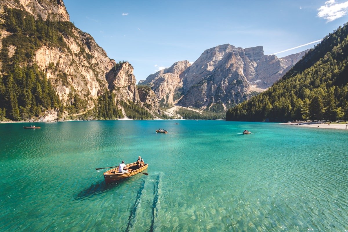
Xinjiang’s largest alpine lake (2,073 m) has a paved ring road, but the best walk is the unpaved western shore from the wetland boardwalk, roughly 10–20 km depending on turnaround, flat and windy with constant mountain reflections. Wildflowers carpet the shore in late June, and the cold, clear water hosts migratory swans. Expect strong afternoon wind; hike the shore in the calm morning and save the drive for later.
Trail Comparison Table
| Trail | Region | Distance (round-trip) | Difficulty | Best months |
|---|---|---|---|---|
| Kanas Three Bays | North (Altay) | 9 km (one-way) | Easy | Jun–Sep |
| Hemu to Gukepulin | North (Altay) | 14 km | Moderate | Jun–Oct |
| Heavenly Lake Loop | Central (Tianshan) | 12 km | Moderate | May–Oct |
| Nalati Ridgeline | North (Ili) | 8 km | Easy–Moderate | Jun–Sep |
| Kuerdening Loops | North (Ili) | 18 km | Moderate | Jun–Sep |
| Bayanbulak Boardwalk | Central (Tianshan) | 6 km | Easy | Jun–Sep |
| Muztagh Ata Base Camp | South (Pamir) | 14 km | Strenuous | Jun–Sep |
| Karakul Lake Circuit | South (Pamir) | 8 km | Easy | May–Oct |
| Tianshan Grand Canyon | South (Kuqa) | 10 km | Moderate | Apr–Oct |
| Sayram Lakeside | North (Bortala) | 10–20 km | Easy | Jun–Sep |
Practical Tips
Training and Fitness
You do not need to be an athlete, but the altitude multiplies effort. If your home is near sea level, add two or three weekly hill sessions for a month before departure, and arrive a day early in Urumqi to adjust. On the strenuous Pamir routes, build in a rest day at 3,000 m+ before the push. Most fit travelers handle the moderate trails (Nalati, Tianchi, Kuerdening) without special training beyond regular walking.
What to Pack
Layers beat bulk: a wicking base, a fleece, and a windproof shell cover most conditions above 2,000 m. Sunscreen (SPF 50+), a brimmed hat, and glacier glasses are non-negotiable—snow reflection burns fast. Carry at least 2 L of water per 10 km; on the dry southern trails carry 3 L. A basic first-aid kit, a whistle, and a power bank round out the day pack, plus trekking poles for the steeper descents.
Permits and Safety
Border-zone trails near the Pamir and the Kanas–Baihaba area require a permit obtainable in Kashgar or Burqin with your passport. Tell your guesthouse your route and return time. Afternoon thunderstorms build quickly in July and August—start before 8 a.m. and be off exposed ridgelines by early afternoon. If you feel a pounding head above 3,000 m, descend; altitude sickness resolves with loss of height, not with more climbing.
Getting There Independently
Scenic-area shuttles reach Kanas, Nalati, Tianchi, and Bayanbulak trailheads directly. For Kuerdening, Sayram, and the Pamir trails you’ll want a rented car or driver, as public buses leave you far from the start. Guesthouses in Hemu, Karakul, and Bayanbulak can arrange local guides for 200–400 RMB per half day, worthwhile on the glacier routes where weather turns fast.
Where to Sleep Near the Trails
Kanas and Hemu have wooden lodges and homestays (200–500 RMB in season); book ahead for July and October. Nalati and Bayanbulak offer yurt stays (150–300 RMB) that put you on the grassland at dawn. On the Pamir, the Karakul Lakeside Lodge sits steps from the shore. Carry a sleep liner; heating varies, and a cold night saps altitude tolerance.
Updated July 2026. By Karl Huang.