
Xinjiang Self-Drive Travel: The Ultimate Guide to Driving, Car Rental & Road Trips in 2026
There are few places on Earth where getting there is half the adventure — and Xinjiang is every one of them. Stretching across 1.66 million square kilometers (640,000 sq mi), China’s largest province-sized region is not a destination you day-trip. It’s a landscape you traverse. And the single best way to do that — the way that turns a sightseeing list into a real journey — is to get behind the wheel yourself.
This guide is written for independent travelers who want to drive Xinjiang on their own terms: the routes that actually deliver, the paperwork you’ll need before you turn the ignition, what rental cars cost in 2026, and the real-world road conditions you won’t read on a brochure.
Why Self-Drive in Xinjiang Changes Everything
Xinjiang isn’t designed for point-to-point tourism. Its greatest places — the high pastures of Bayanbulak, the birch groves of Hemu, the granite canyon at Koktokay, the Pamir horizon beyond Tashkurgan — sit 100 to 500 kilometers apart, connected by roads that cross mountain passes, desert pavement, and sheep-grazed valleys. A rented car transforms those distances from transit boredom into a moving feast of scenery.
Self-drive also means agency. You stop when a herd of horses crosses the asphalt. You linger at a Karakul Lake viewpoint until the wind dies down and the reflection locks in. You reroute when a local at a teahouse mentions a blooming meadow the guidebooks haven’t found yet. That’s the difference between seeing Xinjiang and moving through it.
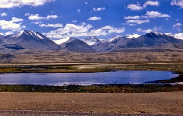 Karakoram Highway – a classic Xinjiang self-drive destination” style=”width:100%;max-width:700px;display:block;margin:20px auto;”>
Car Rental in Xinjiang: What You Need to Know (2026 Update)
Can Foreigners rent a car in Xinjiang?
Yes — but with context. In Urumqi, Kashgar, and Yining, major agencies (Hertz partner outlets, local Chinese rental companies, and some Avis-affiliated desks) will rent to holders of a valid passport and an International Driving Permit (IDP) or, more practically, a notarized translation of your home license accompanied by a Chinese temporary driving permit for visitors.
The practical reality: Most independent foreign travelers in Xinjiang choose a private charter with driver rather than a pure self-drive rental. The reasons are logistical, not legal: checkpoints, signage in Chinese only, and the occasional road closure for weather or security are easier to navigate with a local driver who speaks the language and knows the detours. That said, if you have China driving experience and decent Mandarin reading skills, self-drive rental is absolutely doable.
Rental Costs (2026 Estimates)
| Vehicle Type | Daily Rate (CNY) | Best For |
|---|---|---|
| Economy sedan (VW Lavida, etc.) | ¥250–400 | City-to-city on expressways |
| SUV / 4WD (Toyota RAV4, Great Wall Haval) | ¥450–800 | Mountain routes, Duku Highway |
| Van / 7-seater (Buick GL8) | ¥600–1,000 | Groups, gear-heavy trips |
| Private charter (with driver) | ¥800–1,800 | Most foreign independent travelers |
Insurance note: Basic rental insurance in China typically carries a deductible of ¥1,500–3,000. Consider the full-coverage upgrade if you’re driving mountain routes. One hailstorm on the Duku Highway can dent a roof in seconds.
The Four Legendary Driving Routes
1. The Duku Highway (G217) — China’s Most Scenic Road
If Xinjiang has a signature drive, this is it. The Duku Highway runs 561 km from Dushanzi (north) to Kuqa (south), crossing the Tianshan range at an elevation of 3,400+ meters. In a single day you’ll pass red-rock canyons, alpine meadows, snow-fenced passes, and a spruce forest that smells like Christmas.
Season: Typically open June 1 – October 10 (weather-dependent). Snow can close the pass any time outside those windows.
Drive time: 10–12 hours without stops — but you should stop. Plan it as a two-day traverse with a night in Bayanbulak or Nalati.
Vehicle: SUV / 4WD recommended. Sedans can manage in dry summer, but weather shifts fast at altitude.
Permits: None needed for the highway itself, but some side detours (Baihaba) require a border permit.
We cover this route in full detail in our Duku Highway complete guide.
2. The Taklamakan Desert Highway (G216 Luntai–Minfeng)
The Taklamakan is the world’s second-largest shifting-sand desert. Crossing it on the Desert Highway is 450 km of straight asphalt between nothing and nothing — an experience of scale that borders on the surreal. Telephone poles march alongside the road like soldiers. Occasional sandstorms turn the sky the color of raw umber. It’s not about dunes every minute; it’s about the feeling of being small in a very large place.
Season: April–May and September–October are the survivable windows. July–August midday temps hit 40°C+.
Fuel: Fill at Luntai and again at Tazhong (km 220) — Tazhong is a surreal oilfield outpost with basic noodles and a dormitory.
Water: 3L per person minimum. No shade. No mercy.
3. The Ili Ring Road — Grassland, Lake & Canyon
Starting and ending in Yining (Ili), this 600–800 km loop connects Sayram Lake, Guozi Gorge (the epic bridge/scenic corridor), Nalati or Kalajun Grassland, and the Bagua City of Tekes. It’s the most “European” drive in Xinjiang — rolling green, wildflower verges, and Kazakh yurt smoke on the horizon.
Season: June–September. September is the sweet spot: golden grasses, fewer tour buses, clean air.
Drive time: 2–3 days at a relaxed pace.
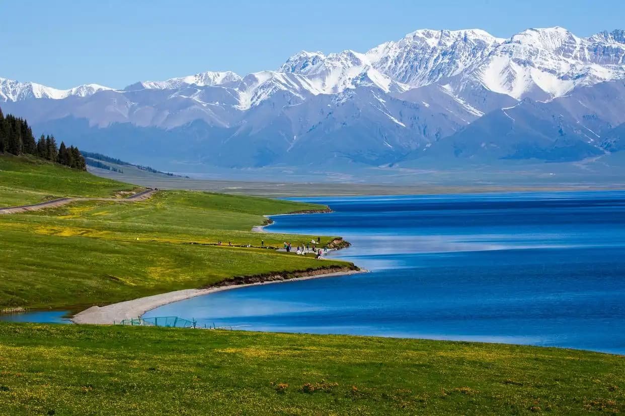
4. The Karakoram Highway (G314): Kashgar to the Pamir
Running southwest from Kashgar to the Pakistan border, the KKH climbs onto the Pamir Plateau and delivers some of the most dramatic road scenery on the planet. Karakul Lake at 3,600 m is the headline stop, but the entire run — White Sand Lake, Subash Pass, the approach to Tashkurgan — is cinema-grade.
Permits: You need a border-zone PSB permit (边防证) specifying Taxkorgan County. Arrange this in Kashgar.
Season: May–October. Winter closes passes.
Altitude: Sleep in Kashgar (1,280 m) before ascending to 3,600 m in one day. Acclimatize.
Border Permits: The Paperwork That decides Your Route
Several of Xinjiang’s most spectacular drives enter border zones where a standard ID card or passport isn’t enough. You’ll need a Public Security Bureau (PSB) Border Permit (边防证).
- Where to get it: Kashgar PSB office (most common), Urumqi PSB, or your home-country Chinese consulate (before travel).
- Cost: Free if you apply in person; agencies charge ¥50–100 for service.
- What to specify: List each border county you plan to enter: Taxkorgan, Baihaba/Habahe, etc.
- Validity: Typically 7–30 days, depending on issuance.
Without this permit, you will be turned back at the Kanas–Baihaba checkpoint or the Kashgar–Tashkurgan roadside stop. No exceptions, no negotiation.
Fuel, Checkpoints & Real-World Road Conditions
Fuel
Gas stations in Xinjiang require ID registration — passport for foreigners, ID card for locals. It’s a quick scan, not a hassle, but you can’t just swipe and pump. In remote areas (Taklamakan crossing, Pamir stretches), fill up whenever the tank drops below half. Stations can be 200+ km apart.
Payment: Alipay and WeChat Pay work at most stations. Cash is backup. Foreign credit cards rarely work at the pump.
Checkpoints
Xinjiang has security checkpoints on major intercity roads. They’re routine, not personal. You’ll hand over your passport (or have it scanned), maybe open your trunk, and drive on. Budget 10–20 minutes extra per checkpoint into your daily drive time during busy periods.
Road Conditions by Route Type
- Expressways (G30, G7): Excellent. 100–120 km/h. Tolls apply (¥0.4–0.6/km).
- National highways (G217, G218, G314): Generally good pavement, some construction delays in summer. Expect occasional herding crossings — sheep, cattle, camels.
- Mountain passes (Duku, Pamir): Paved but narrow. No guardrails on some sections. Falling rocks after rain. Drive daytime only.
- Desert Highway: Straight, flat, paved. Wind-blown sand can reduce visibility. Watch for camel crossings near oasis towns.
When to Drive: The Seasonal Window
| Month | What’s Open | Driving Conditions |
|---|---|---|
| April–May | South Xinjiang, Turpan, Ili (bloom) | Good; Duku still closed |
| June–August | Everything (Duku open, grasslands peak) | Warm; crowds; afternoon thunderstorms |
| September | Everything; golden grasslands | Best month; cool nights |
| October | South Xinjiang, some north routes | Duku closes ~Oct 10; chilly |
| November–March | Snow-limited; ski resorts only | Many passes closed; not recommended |
Safety & Etiquette on the Road
- Don’t drive at night in mountain areas. Livestock on the road, no streetlights, and narrow lanes with drop-offs are a bad combination after dark.
- Altitude awareness. If you’re driving above 3,000 m, take it slow. Headache and nausea mean descend — don’t push through.
- Respect checkpoints. Have your passport ready. Smile. It’s routine security, not a personal interrogation.
- No off-road without permission. Driving on living grassland (especially in protected areas) carries fines and ecological damage complaints. Stay on the asphalt.
- Cash buffer. Carry ¥500–1,000 in small bills. Card readers fail. Alipay needs a Chinese bank account. WeChat Pay same.
A Note on Private Charter (The Smarter Alternative for Many)
If reading this gives you second thoughts — the permits, the checkpoints, the Chinese-only signage — consider a private charter. For ¥1,200–1,800 per day you get a local driver, a vehicle, and someone who knows which checkpoint lane to use, where the best roadside noodle shop is, and how to reroute when the Duku gates close for weather. It’s not “self-drive,” but it’s independent travel on your own schedule. For many foreign visitors, it’s the right balance.
 Xinjiang self-drive adventure” style=”width:100%;max-width:700px;display:block;margin:20px auto;”>
Sample 7-Day Self-Drive Itinerary (Ili Loop)
This is the route most first-time Xinjiang drivers can handle confidently:
- Day 1: Arrive Yining (Ili) → pick up rental → explore Yining old town
- Day 2: Yining → Sayram Lake (ring road) → stay at lake or Guozi area
- Day 3: Sayram → Guozi Gorge → Tekes Bagua City → stay Tekes
- Day 4: Tekes → Kalajun Grassland → stay Tekes or Yining
- Day 5: Tekes → Nalati Grassland (Sky Prairie) → stay Nalati area
- Day 6: Nalati → Yining via G218 → Uyghur dinner in Yining
- Day 7: Return rental → depart
This loop keeps drive times under 4 hours per day, stays on paved roads, and hits three of Xinjiang’s most iconic landscapes.
The Bottom Line
Self-drive travel in Xinjiang is not the easiest way to see China — but it’s the most rewarding. The paperwork is real, the distances are long, and the altitude is no joke. But the first time you crest a Tianshan pass and see a valley unfold that no tour bus reaches until noon — you’ll know why you came.
Updated: June 2026. Drive safe, fuel often, and don’t skip the border permit office.