
Driving the S101: Xinjiang’s Tianshan Scenic Highway
The Road Most Drivers Skip
Most travelers treat the stretch between Urumqi and the northern Ili corridor as a blur on the G30 expressway. I did the same on my first trip, chasing the big names: Sayram Lake, the Duku Highway, the grasslands around Nalati. It was only on my third visit, in late September, that a Kazakh friend in Yining said, “You drove past the best road and never saw it.” He meant the S101, the old provincial highway that climbs out of the northern suburbs of Urumqi and threads the folded edge of the Tianshan for roughly 300 kilometers before it finally meets the G217 near Kuytun.
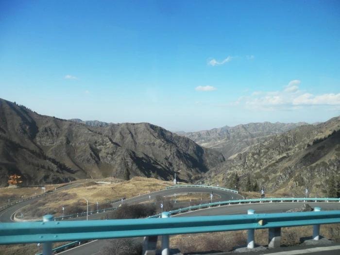
I drove it the next morning. By the time I reached the first switchbacks above the floodplain, I understood. The S101 is not a fast road. It is a slow road, a geological gallery where the mountains have been sliced open like a layered cake, and the layers are red, ochre, grey, and the pale gold of weathered sandstone. Locals call it the “Tianshan Geographic Gallery,” and the name is not marketing. The rock does the talking.
This guide is for self-drivers who want that quieter, stranger side of northern Xinjiang. I will cover the practical bits first: where the road actually starts, what kind of car you need, fuel and phone signal, and the stops worth slowing down for. Then I will walk through a realistic two-day version of the route that I have now driven twice.
Where the S101 Begins (and Why the Start Confuses People)
The western terminus is easy: near Kuytun, the S101 joins the G217, and from there it is a straight shot to either the Duku Highway or north to Karamay. The eastern end is the part that trips people up. The “official” start is signed about 20 kilometers southwest of central Urumqi, off the G216, but in practice the interesting terrain does not begin until you have climbed past the first range front, roughly 45 kilometers out. Do not judge the road by its first half hour of flat farmland and power lines. Push on.
I fueled up in Urumqi the night before, because the small towns along the early S101 do not always have a 24-hour station, and the ones that do can have slow pumps. As a rule on any Xinjiang back road, I never leave a city with less than half a tank. The distances between reliable fuel on the S101 are not huge, but the margin for error is small if you misjudge closing times.
What Kind of Car, and When
On a dry summer day, a normal sedan rental will manage most of the S101. The surface is paved but narrow, with crumbling shoulders in places and the occasional washboard section where a culvert has settled. After rain, or in early spring when the snowmelt runs down the gullies, the lower sections can turn to slick clay. That is when you want clearance and decent tires. I drove it once in a compact SUV and once in a low sedan; the SUV was the calmer experience, especially at the eastern river crossings.
Timing matters more than the car. Late September gave me two things the July crowds miss: empty pull-offs and a mountain flank that had turned from green to a burnt copper. May and June bring snow patches on the high bends and the first wildflowers in the meadows. July and August are warm but busier, though “busy” on the S101 still means you might pass a dozen cars in a whole morning. Winter closes the upper passes entirely, and the local traffic shifts to the main highways.
If you want the photographic sweet spot, aim for the last two weeks of September. The light is low, the poplars along the small streams have gone yellow, and the red rock glows instead of glaring.
Signal, Cash, and the Things That Quietly Matter
Phone coverage on the S101 is patchy. There are long stretches where your map app will keep working for navigation but messages will not send, then sudden dead zones in the canyons. I download the offline region before I leave Urumqi; the general advice for driving here is to treat the route as partly off-grid. Tell someone your plan. The road is not remote in a dangerous way, but a flat tire at a spot with no signal is an annoyance you can avoid preparing for.
Cash is worth carrying in small bills. The roadside stands, where an old woman sells you ten sun-dried apricots or a bag of walnuts, do not take cards, and the nearest town ATM can be an hour away. None of this is hard. It is just the difference between a relaxed day and a frustrated one.
The Stops I Actually Made
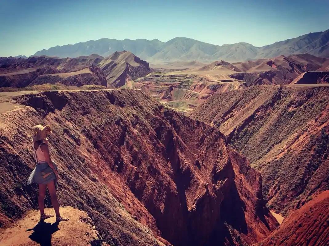
Rather than list every pull-off, here are the four that earned their stop on both my runs. First, the red rock canyon about 70 kilometers in, where the road narrows and the cliff face is close enough to touch from the shoulder. There is a rough lot on the uphill side; I ate lunch there watching swifts wheel over the gorge. Second, the small village at the river bend near the midpoint, where a teahouse with plastic chairs and a real stove served me milk tea and a wedge of naan for the equivalent of a couple of dollars. Third, the high meadow at roughly 2,100 meters, where the road crests and you can see the next three ranges stacked behind each other in the haze. Fourth, the descent toward the western end, where the rock gives way to cultivated terraces and the first poplars appear.
None of these are “attractions” with ticket booths. That is the point. The S101 rewards people who are willing to stop for no reason other than a good view and a quiet ten minutes.
A Realistic Two-Day Version
Day one: leave Urumqi after an early breakfast, fuel full, offline map loaded. Drive the eastern half slowly, stopping often. Sleep in one of the county towns along the western approach; I stayed in a basic but clean hotel for about 180 yuan and ate at a kebab joint that had been open since morning and would be open past midnight. Day two: finish the western half to the G217 junction, then decide. You can turn south toward the Duku Highway if it is open for the season, or north toward Karamay and the World Devil City yadan fields.
The drive pairs naturally with a longer northern loop. If you are building a route, the G216 and G217 northern Xinjiang loop picks up almost exactly where the S101 leaves you, and the two together make a satisfying week without backtracking.
Practical Cautions
A few honest warnings. The road has livestock. Sheep and cattle cross without looking, especially near the villages, and a startled herd on a blind bend is no joke at speed. Slow down in the settlements. The surface can hide a pothole under a thin film of dust after a dry spell. And the eastern end, near Urumqi, shares the valley with quarry traffic on some sections; a loaded truck will not move over for you, so give it room.
One more: the S101 is not the place to discover your rental’s spare tire is missing. Check it in Urumqi before you leave, along with coolant and wiper fluid, because the dust here eats wiper blades by the hour.
When to Go, and What to Pack in the Car
I would put the best window for this road at late May through early October, avoiding the deep winter closure of the high bends. In the car I keep two liters of water per person, a power bank, a paper map as backup, and more snacks than I think I need. The self-drive essentials list covers the rest, but on the S101 the single most useful item was a thermos. The teahouses are warm, but the road between them is long and cold even in September.
If you take one thing from this guide, take this: the S101 is not a road you conquer. It is a road you let slow you down. Drive it that way and northern Xinjiang will show you a face the expressway never does.
A Mistake I Made (So You Don’t)
On my first S101 run I trusted the map’s estimated time and left Urumqi at ten. Bad call. The road is slower than it looks, the pull-offs are irresistible, and I rolled into the western town after dark with a low tank and a hotel that had just given away its last room. I slept in the car’s back seat at a truck stop, which was safe but cold and silly. Now I leave by eight and treat the posted drive time as a floor, not a target.
The other mistake was skipping the spare check. The eastern quarry section had a staple-sized piece of steel in the shoulder that I felt through the wheel an hour later. The rental’s jack worked; the lug wrench was the wrong size. I limped to a village repair shop where a man with a bigger wrench fixed it for 20 yuan and a laugh. Check the tool kit in Urumqi. It is the difference between a story and a problem.
A Rough Time and Fuel Budget
For planning: the driveable S101 core is roughly 300 kilometers, but with stops you should allow a full day east-to-west, or two days if you want to linger. Fuel from Urumqi to the western junction cost me about 180 yuan in a compact SUV, plus another 60 in the towns. Food is cheap; figure 80 to 120 yuan per person per day eating local. A basic hotel at the western end ran 180 yuan. All in, two people in one car can do the S101 properly for well under 1,000 yuan, not counting the rental.
The rental itself is the big line item. A small SUV in Urumqi runs 300 to 500 yuan a day in season, less off-season. Split two or three ways it is reasonable, and for a road like this the clearance is worth the premium over a sedan.
What to Tell Your Rental Company
When you collect the car, say where you are going. Some agencies get nervous about unpaved or remote roads and will try to talk you onto the expressway. The S101 is paved and legal, but mentioning it lets them flag any known closures and confirm the spare and tools. If they push back hard, that is useful information about the car’s condition, not a reason to abandon the plan. Just make sure the agreement covers the route and carry the paperwork at checkpoints.
The Version I Recommend
If I had one day, I would drive the eastern half only and be back in Urumqi for dinner, because the eastern red-rock section is the most distinctive and the easiest to enjoy without an overnight. If I had two, I would do the full line and sleep west, then connect to the Duku or Karamay the next morning. Both versions beat the expressway blur. The S101 is proof that in Xinjiang the interesting road is rarely the fast one, and that the best view is usually fifty meters past the point where your map says you have arrived.