Qitai and Jiangbulake: Terraced Fields Where the Tianshan Meets the Desert
A County With Three Climates
Qitai County, in Changji prefecture, is the only place in Xinjiang where you can stand in a wheat field, look up at a snow peak, and know that 40 km north the same road runs into the Gobi Desert. Locals call it “one county, three zones” — mountain forest, oasis farmland, and desert — stacked north to south in a single day’s drive. I planned a two-hour photo stop here in 2023 and stayed the night. The pull is the Jiangbulake scenic area, where terraced fields step down the Tianshan like a green staircase.
Most drivers know Qitai only as the last fuel town before the desert roads east. That undersells it. The terraces alone are worth the detour, and the loop road over the mountain is one of the better drives nobody mentions.
The Road to the Terraces
Qitai town is 210 km northwest of Urumqi on the G7 Beijing–Urumqi expressway, about two and a half hours. From town the Jiangbulake road (the S303 spur, signed “Jiangbulake Scenic Area”) climbs 45 km into the range. The lower section is sealed and fast; the upper section is a winding mountain two-lane with a 40 km/h limit and a string of speed bumps the locals love. I counted eleven in the last 8 km. You will not speed, and you should not want to — the view opens at every bend.
The scenic area entry is ¥43 (2025 price), paid at a gate 10 km below the terraces, and from there a one-way loop road carries you up through pine forest, past the first fields, to the high meadow at 2,000 m. The loop is one-way by design; you cannot backtrack, so stop wherever the pull-off appears. I drove it twice — once in morning haze, once at golden hour — and the light was different at every corner.
The Terraced Fields
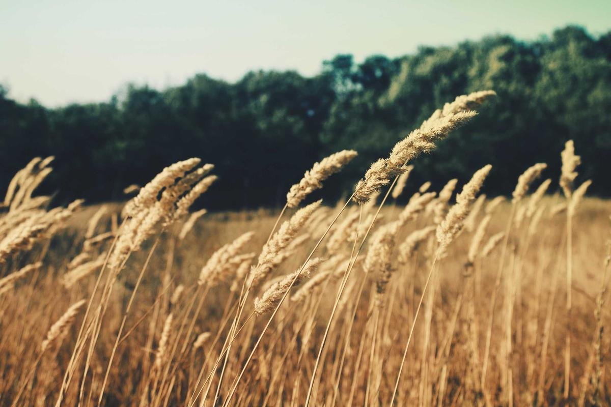
Jiangbulake means “the source of the holy water” in Kazakh, and the fields are the visible result: snowmelt channelled across terraces of winter wheat and barley so the water never runs to waste. In July the steps are solid green and the contrast with the dark forest behind is the shot everyone comes for. In late August the wheat ripens to gold and the whole stairway turns the colour of honey.
I walked the field-edge path for an hour. A farmer named Old Wang was cutting a strip by hand with a sickle and waved me over to taste the kernels — sweet, milky, nothing like shop bread. He said the terraces had been worked this way for nine generations. That is the kind of detail no overlook sign tells you. Stay on the paths; the terrace walls are earth and a wrong step collapses a season of someone’s crop.
The Wind Farm and the Ridge Road
Above the terraces the S303 continues over the Tianshan crest and down the north side toward Karamay and the Gurbantunggut Desert. The ridge is lined with hundreds of white turbines — one of the largest onshore wind farms in Asia — and on a clear day you can see the desert floor fall away to the north. I drove the crest in a hired 4WD and stopped at every turbine pull-off; the road is sealed but narrow, with no guard rail on the drop side, so keep right and let the coaches pass.
This ridge road is the hidden gem. Tour buses turn around at the terraces; almost nobody continues over the top. If you have a full day and a confident right hand, the full S303 crossing to the north is a 160 km drive through three climate zones in three hours. Fuel it in Qitai — there is nothing between the terraces and the far side.
Food in the Oasis
Qitai town eats like a proper farming county. The morning market off Guangchang Road sells just-pulled laghman noodles at ¥15 a bowl, mantou steamed buns at ¥1 each, and the local qitai pingguo — a small sour apple that travels badly and tastes best within ten km of the tree, ¥6 a kilo in autumn. For dinner, the grill row on Wenhua Street does mutton ribs at ¥48 a half-rack and the flat nang baked to order in 90 seconds.
In the scenic area itself, the lone restaurant at the high meadow sells niurou mian (beef noodle soup) at ¥28 and instant coffee at ¥15 — overpriced but welcome at altitude. I ate there once and packed a lunch the second time. Bring your own water; the meadow café ran out by 3 p.m. both days I visited.
Where to Sleep
Qitai town has the usual mid-range set: a Home Inn and a Jinjiang Inn at around ¥250 a night, both with parking and both bookable the same day outside holiday peaks. Up at the terraces, the Jiangbulake resort has cabins from ¥420 in season and a few yurts at ¥200; the cabins have heating and the yurts do not, so pick by temperature. I took a cabin in August and woke to cloud at the window — worth the premium over the town.
For a northern-loop plan, Qitai slots between Urumqi and Shihezi as a scenic break, or as the southern anchor of the S303 crossing. The Changji region around it shares the farming character, so pair the two for a low-key, food-forward few days.
When to Come
The terraces are green from June to mid-August and gold from late August to early October. July is lush but busy with domestic tours; the first two weeks of September are my choice — gold fields, cool air, thin crowds. May and October are cold and quiet; November to April the road is closed by snow above 1,800 m. The month-by-month climate guide on this site puts Qitai’s comfortable window in the same band as the Ili valley, a day’s drive west.
Practical Notes
No border permit. Checkpoints on the G7 are routine; have passport and rental papers ready. The scenic-area gate takes cards and Alipay but the field-path vendors take cash only. Mobile signal is full in town, patchy on the ridge, gone on the north descent — download offline maps before you leave Qitai. The terrace loop road closes in high wind (the turbines speak for themselves); if it is blowing hard at the gate, the upper road may be shut, and you should not argue with a 70 km/h gust on a blind bend.
Qitai is the Xinjiang that farms for a living and lets you watch. Drive the terraces slow, climb the ridge if you dare, and you leave understanding the mountains and the desert as one system rather than two postcards.
The Qitai Yardang: A Northern Devil City
Most travellers know the Karamay Devil City far to the west, but Qitai has its own yardang field on the desert side of the ridge, 70 km north of town, where the Gobi wind has carved a red-earth “city” locals call the Qitai Ghost Town (Qitai Devil City). I drove out one afternoon on the desert road and found towers and gates of bare silt standing in the flat, the same process as Wubu and Karamay but quieter and free. The track is graded hardpack; a 2WD at 40 km/h is fine, but carry water and tell someone in Qitai your direction — the field has no signal and no gate.
The light there is best at dusk, when the red earth glows. I climbed a low tower (careful — the silt crumbles) and looked back at the ridge, green on one side and red desert on the other, and understood the “three zones” the county boasts. It is a half-day add-on to the Jiangbulake stop and needs no ticket, no tour, no plan beyond a full bottle and a charged phone.
The Desert Descent
North of Qitai the land falls from the oasis into the Gobi in about 40 km, and the S303 desert spur shows you the transition in one drive: wheat fields, then scrub, then nothing but gravel and the occasional populus windbreak the farmers planted against the sand. I drove the desert spur to its end at a relay station and turned back; there is no through road, only the sense of the oasis defending itself against the empty. The Gurbantunggut Desert begins properly north of here, and the Qitai desert is its soft edge.
This is also where the wind farm’s access road runs, and where you see the turbines up close — bigger than they look from the terraces, and louder. The access road is gated and signed private; respect it. The public desert spur is enough.
Festivals and the Local Calendar
Qitai keeps two events worth timing a visit to. The Wheat Harvest Festival in late July brings the terraces alive with cutting, threshing demos, and a noodle competition in the town square — I ate three bowls of laghman entered by three villages and judged none a loser. The Autumn Poplar Watch in early October is quieter, a few signs and a photography meet at the meadow, but the gold is the draw. Either way, book the town hotel a week ahead; the festival crowds fill the 250 rooms fast and I once settled for a ¥160 guesthouse with a rooster and no regrets.
The county also runs a small silk-road museum off Guangchang Road with Tang-era pottery from the local towers and a map of the old post road. It is free, takes 40 minutes, and explains why Qitai was a garrison town long before it was a farm. Pair it with the beacon-tower drive and the whole “one county, three zones” idea clicks into place.
Walking Qitai Town
The county seat rewards an hour on foot. The old granary quarter off Guangchang Road keeps a row of 1950s brick warehouses now turned into a small crafts street — a knife grinder, a nang oven, a woman who repairs the felt chápán bags the north favours. I bought a shouzhua (hand-grabbed) sesame cake hot from a cart at ¥3 and ate it watching a man sharpen a hoe with a rhythm that was its own kind of music. The river park on the south side is where the town cools off in summer, with a lit walk and a fountain the kids chase; it is the ordinary China the guidebooks skip, and the better for it.
The Beacon-Tower Drive
East of Qitai, along the old post road, stand three Tang beacon towers the county has signed but not fenced. The track is graded hardpack for 20 km; a 2WD at 40 km/h is fine, but tell the town you are going — no signal, no gate, no drama if you stay on the track. I drove it one evening and climbed the middle tower (rebuilt, safe) for a view back over the oasis and the first wind turbines on the ridge. The towers mark the northern silk road’s relay line, and standing on one you see the logic: each within sight of the next, a chain of news across the plain. The Changji guide sets Qitai in the wider farming-prefecture context; the towers are the history under the farms.