

Xinjiang Self-Drive Navigation: Offline Maps, Dead Zones & Convoy Comms (2026)
The first time Xinjiang truly blindsided me was July 2023. Driving from Bayinbuluk toward Dushanzi, just past the Tielimaiti pass my signal fell from full bars to one, then nothing. Amap’s blue route line turned grey: “Weak signal, switched to offline navigation.” I had half a tank, a road under construction beside me, and grassland that gave no clue which way was which. That stretch had been rerouted in 2022, but my offline package was the old one. If a Kazakh herder hadn’t waved me the right way, I’d likely have spent the night in the car.
Since then I’ve driven Xinjiang four more times, about 18,000 km, from Hemu in the north to Moyu in the south, Hami in the east to Yining in the west. This article isn’t about scenery. It’s about one practical problem almost every guide rushes past: what you rely on to find your way, and where you suddenly go blind. I’m laying out the mistakes, the wasted yuan, and the system that finally let me relax.
Why Xinjiang eats your signal
Xinjiang covers about 1.66 million square km, larger than Henan, Shandong, Hebei, Beijing, Tianjin, Shanxi and Shaanxi combined, yet has under 26 million residents, fewer than Chengdu. Where people are sparse, towers are sparse. Along the desert highways skirting the Taklamakan, the nearest maintenance station might be 100 km away. No carrier rushes to lay 5G there.
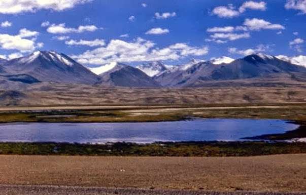
The Tianshan splits Xinjiang in two, and cross a high pass and the signal is blocked by the range behind you. The Altun and Kunlun ranges sit near the border, where base stations are limited by design. Inside the Taklamakan, coverage is “dot shaped”: signal at a fuel station, nothing between. The pattern holds: the prettier the view, the worse the signal. You can stream at Sayram Lake, but at the Duku summit passes you often can’t dial 110.
Most visitors miss this: many run SIM cards from their home province. Out where land is empty, the phone latches onto the weakest edge tower or the one carrier with coverage. I keep two cards, China Mobile and China Telecom, and use whichever shows bars. It has saved me more than once.
Then there’s heat. At noon in summer a Xinjiang car cabin passes 50°C. Leave a phone on the dashboard and it throttles; the GPS drifts as it warms. Near Turpan I left the phone under the windshield and ten minutes later it blacked out, and I’d missed a turn. Treat the phone as fragile: shade, cool, charge, all at once.
Which navigation app, and why you shouldn’t trust any single one
Don’t worship any one app. Amap and Baidu work inland because of live data and user reports. In Xinjiang, below county-road level, at detours, on seasonal highways, their offline data lags. My rule: cross-check two. Amap primary, Baidu backup. At a fork I glance at both; if they disagree, I stop. I never follow one app blind.
Amap’s edge in Xinjiang is the fullest road, speed-camera and service-area data, plus a mature head-unit version. Baidu’s city and county detail is sometimes newer, and its satellite imagery loads sharper on WiFi for scouting parking. Tencent Maps I use only for buses. Apple Maps is missing roads across large parts of Xinjiang; never make it main.
On unpaved roads, no-man’s-land, or the G219 Xinjiang-Tibet highway, use an offline-track tool from our pre-departure gear guide, such as OvitalMap or Locus Map. You import a GPX someone already drove and follow it, far more reliable than road-network nav. I keep OvitalMap with Tianditu and Google satellite sources, so offline I still see a cached base map.
My setup: Amap daily, OvitalMap in the mountains, Baidu spare. The mount must lock down with wireless charging. The sun is brutal; after half an hour the phone dims, and a weak mount flings it on the first washboard road. I went through three mounts before a four-claw lock with cooling clip, about ¥120.

Download offline maps before you reach the desert
This is where most people trip. You think you have data, then hit no-man’s-land and try to download. No network, no download. The provincial pack plus your prefecture packs run several GB. The night before, on hotel WiFi, I download three things: the whole province, the prefectures I’ll cross (Aksu, Kashgar, Ili), and detailed county-town packs. County detail matters; inside town the provincial pack isn’t precise enough.
Download the night before you leave, not in a scenic parking lot where signal is worse than the road. Before my 2024 southern loop I spent an hour in a Urumqi hotel pulling 6.2 GB, and lived off it for two weeks. After downloading, switch on airplane mode and search a destination to confirm offline search works. Don’t assume it finished because the bar looked full.
OvitalMap’s cache is box-select; a province takes a dozen-plus GB. I extend the box 50 km each side of my route. On a 128 GB card, 20-some GB for offline maps is normal. For SIM and data-plan detail, see our guide on staying connected on the road; this article focuses on what to do once the network is gone.
The stretches that really go dark
Sections where I or fellow drivers lost signal for over 20 km. Numbers aren’t exact, but the “it dies” verdict is certain:
Duku Highway (G217 Dushanzi–Kuqa): around the Tielimaiti pass (roughly 30 km), the Yuximolegai tunnel, and near the Hashilegen pass, signal is patchy. This corridor opens only months a year and the summit is nearly network-free. Check the opening window before you plan. My 2023 blackout was here.
Yizhao Highway (S237 Yining–Zhaosu): the Baishifeng switchbacks cut in and out. Offline, you rely on notes like “right after the third bend past the checkpoint.” I drove it in June; the summit had no signal for 40 minutes.
Taklamakan Desert Highway (G217 Aral–Hotan, G216 Minfeng–Luntai): no signal except at fuel stations. The road is straight so you won’t get lost, but if the car breaks, no one answers. These are the toughest on vehicles among the five most scenic drives.
G219 Xinjiang-Tibet Highway (south of Sanshili Yingfang): high, empty, signal by luck, whole passes drop out. Beidou messaging is mandatory before driving it.
S101 Defense Road (Changji toward Bayingol): the “Tianshan Geography Gallery” mixes gravel and pavement with stunning Danxia, but most of it has no signal and many forks. Save a GPX. My first time I hesitated twenty minutes at a junction for lack of a track.
Altun and Lop Nur edge roads: not for ordinary drivers. Send your route to family, agree a daily check-in time, and never enter alone; run at least two vehicles.

Three backups for the dead zones
Backup one: the offline GPS track. Find a GPX for your route and import it. A track doesn’t depend on road data; you follow a line someone drove, so you arrive even if the map is stale. I save at least two tracks from different people. On a rerouted G217, Amap tried to send me into a closed zone; the old track routed around and saved a 60 km U-turn.
Backup two: Beidou short messaging. Beidou boxes and some outdoor phones send a short text where there’s no signal, a few dozen characters per message. On my Altun trip I texted my wife one word daily: “safe.” The box runs just over ¥1,000; a per-message annual plan is a few hundred yuan. Activate it before entering no-man’s-land.
Backup three: paper map plus a route card. In my glove box I keep a full Xinjiang map, the day’s route circled in red, key nodes marked with distance and turn. When nav goes black and the phone dies, that paper is the lifeline. In 2023 a ranger’s arrow on paper saved me. The map costs ¥20 at an Urumqi outdoor shop, tougher than any phone.
One cheap gadget: a ¥10 car compass on the dashboard. In the Gobi the sun gives no clue which way is east. Near the Five-Colored Beach I got turned around and used it to confirm northeast back to Burqin.

Convoy comms: don’t buy the wrong radio
WeChat voice in a dead zone just spins. A radio is the answer, but there’s a knack.
Handhelds run about 5 watts, 3 to 5 km in the open, under 1 km behind cover. A mobile radio (car-mounted, external antenna) reaches 25 watts or more. If you drive teams through mountains, fit at least the lead and tail cars with mobiles. A starter mobile plus antenna runs ¥700–800. The license-free 409 MHz toys are too weak. Serious folks use 430–440 MHz, which needs a license; in practice commercial 400 MHz is common. Ask local drivers what they use. Carry spare batteries; 10-plus hours a day is normal, so I keep two spares per car.
On the radio, report “milestone” or “km post,” not “by that red house.” There is no red house on the Gobi. Our rule: “XX km to service area Y.” Lead car scouts and calls obstacles; tail car counts heads; middle cars listen. Agree to check in on the group chat at the first town with signal. Once our tail car blew a tire and halted the lead by radio.

Mistakes I made, so you don’t have to
One: the nav sends you into a riverbed. Seasonal rivers leave the dry bed as a road, and nav treats it as real. A friend in 2022 was guided into the Hotan River bed and hit quicksand. An offline “road” isn’t always drivable. When terrain looks wrong, stop and check the track.
Two: drift in tunnels and canyons. Losing GPS in a tunnel is normal; for a km or two after, nav may jump and say “turn around.” Ignore it. On the Duku’s long tunnels, don’t panic on exit.
Three: charging. Nav with screen on drains fast. I keep a lighter fast charger and a long cable, plus a power bank for the spare phone, which runs only offline maps, no data. Once my main phone overheated at the Flaming Mountains; the spare carried the last 80 km.
Four: assuming “a road means signal.” Service areas and checkpoints have network, but between them is often dozens of km of blank. Past a checkpoint, first tell family you’re safe, then head into no-man’s-land.
Five: sun and cold. Signal-less stretches are the most sun-baked. Window-down nav sunburns your left cheek; I added side film and arm sleeves. At night the Gobi drops to single digits; keep a thick jacket. In no-man’s-land, even buying medicine is hard.
My 30-minute pre-departure checklist
Offline packs downloaded? Two GPX tracks imported? Beidou or spare phone charged? Radios on and matched? Paper map in the car? Both carrier cards seated? Compass stuck down? Power bank full? Tick them, then start the engine.
The most seductive thing about Xinjiang is that it’s so vast it makes you uneasy. Signal dies, nav goes blind, but build the backups and that “whole world is just you and this road” feeling is something no inland highway gives. Do these steps beforehand and relax into the loneliness. My old phone still holds four Xinjiang tracks; maybe you’ll drive one.
Two hidden traps in offline packs
Trap one: province borders don’t line up. Where Xinjiang meets Gansu, Qinghai and Tibet, datasets are cut by province, so the Gansu-to-Xinjiang transition is thin on both sides. Near Star Gorge on G30 my pack went blank; I still had signal then. Fix: download a bit of western Gansu and northwestern Qinghai too.
Trap two: storage and updates. Amap’s whole-Xinjiang pack is 2 to 3 GB; OvitalMap’s base is a dozen-plus GB; under 64 GB struggles. I keep a dedicated 128 GB nav phone, maps and tracks only, no WeChat. Each year I redownload the latest; don’t use last year’s. Xinjiang reroutes often; last year’s line may be a construction site.

Amap’s packs refresh monthly, but in Xinjiang the real update is slow. The offline pack is your floor; what saves you is a GPX someone just drove. A week before departure I ask driver groups for the freshest track. Whoever finished that line last month has data newer than any official source.
China Mobile or China Telecom, who’s stronger
In cities and scenic spots, both work. In mountains and desert, often only one has signal, not fixed which. Along the northern Tianshan, Telecom is often stronger; on southern desert highways Mobile covers slightly better. Dual-SIM isn’t fussy, it’s useful. My main is Telecom, spare Mobile; both low-monthly Xinjiang plans, together under ¥100 a month.
In border counties (Tashkurgan, Khunjerab) your phone may catch a neighbor’s carrier with scary roaming fees. Turn off auto network select and lock to domestic. A friend near a port auto-connected abroad; one text cost a few yuan, the bill came back ¥100-plus higher.
Small settings that quietly save you
Amap’s “navigate offline too” is off by default, so it freezes when the network drops. Turn it on, set voice to detailed, so offline it says “turn right in 2 km” and you don’t stare at the screen. Baidu has “offline priority”; turn both on. Before entering Xinjiang, search and save your hotels, fuel stations and checkpoints offline. I set the day’s hotel as “home” and the next town as “work”; “arriving at work” means a supply point is near. Turn on “always bright” and add a ¥10 silicone shade; poor visibility is the biggest hidden risk.
Charging: don’t wait for zero
A 30-watt lighter charger (¥40–50) feeds the main phone; a 20,000 mAh bank feeds the spare running only offline tracks, lasting a full day. Two power paths mean the spare carries you out even if the main dies. Don’t use junk cables; my ¥9.9 cable couldn’t keep up and the phone went red mid-desert. Use a shielded thick cable and carry a spare; dust fouls connectors. The mount I changed three times before the four-claw lock, steady on washboard roads; ¥120 well spent.
Wrong place name beats no signal
Xinjiang has too many duplicate names. “Dushanzi” and “Dushanzi District” return two results; “Kashgar” is city and prefecture; some corps farms share names. Once I searched “Bayinbuluk” and the top hit was a same-named dot hundreds of km away; my passenger caught it. Now I check the county and direction before hitting nav. Ten seconds beats a hundred km. Read “avoid toll” and “avoid highway” too; on county roads “avoid highway” gets you to the right place, but “avoid toll” may send you onto washboard.
Mount and placement
Xinjiang sun is fierce and the road rough; the wrong mount and you can’t see or hold the screen. A suction cup fell at the first bump; a vent clip blew hot air. I settled on a four-claw lock glued top-left of the dashboard with a cooling clip, steady even on the Duku. Place it where a small eye drop scans it. In the Gobi, two seconds looking down and the car is dozens of meters out. The spare phone I tuck under the AC vent showing only the track, borrowing cool air. If the main blacks out, the spare is still there.
Night driving and the signal illusion
Night feels easy with fewer cars, but in Xinjiang, driving into no-man’s-land after dark is the most dangerous move. No-signal odds rise, and foxes, wild donkeys, even the odd wolf cross the road; in the dark you see them 30 m out and can’t brake. My rule: reach a town before dark, or hole up at a lit service area. Nav can’t tell you in the dark whether there’s a herd on the road; only slow and steady can.