

Xinjiang Hiking Trails: The Best Multi-Day Treks and Day Walks
I Came to Xinjiang to Drive. The Hiking Kept Me
Most foreigners plan Xinjiang as a driving trip, and it is a great one. But some of the best mornings I have spent in the region were on foot, on trails that start where the asphalt ends. I am not a mountaineer; I am a steady walker who likes a full-day trek and a hot meal after. Over five trips I have hiked in the Altai, the Tianshan, and the Pamir edge, and these are the trails I would send a fit traveller to, with honest notes on difficulty and season.
Koktokay: Granite Canyons and a Quiet River
In the north, the Koktokay National Geopark is a string of granite canyons carved by the Irtysh River. The main walk follows the river for about 8 km on a flat, well-built path, taking three to four hours at a relaxed pace. I went in September and the birch along the water had turned, and the big rock formations (one looks like a finger, another like a gate) made the walk feel like a sculpture park. It is an easy trail: no scrambling, clear signage, and shuttle buses at both ends. Entry was about ¥90 including the shuttle. This is the one I send to people who want a taste of wilderness without the risk.
Xiata: The Ancient Road Through the Tianshan
Near Zhaosu in the Ili valley, the Xiata ancient road follows a route once used to cross the Tianshan to the Tarim side. The walkable section runs about 12 km one way along a river valley to the foot of the Muzart glacier, with the snow peak dead ahead the whole way. I did the first 8 km out and back in a day; the path is mostly flat riverbank with some boggy patches after rain, so waterproof boots matter. Permits and a vehicle transfer at the start are required, and the area closes in heavy snow. Late June to September is the window. It is moderate: long, but not technical. The Zhaosu guide has the gateway logistics.
Tomur: The Grand Canyon of the South
Down in Aksu prefecture, the Tomur Grand Canyon is red rock on a scale that makes you stop talking. The hiking here is less a single trail and more a network of rim walks and a canyon-floor route of about 6 km that you can do in two to three hours. I visited in May when it was warm but not brutal; by July the midday heat on the exposed rock would be dangerous without water and an early start. This is a dry, dramatic landscape, closer in feel to the American southwest than to the green north. Moderate, with little shade, so go at opening.
The Pamir Edge: Karakul and Beyond
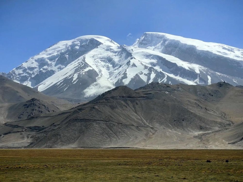
Up near Tashkurgan, the walk around Karakul Lake is a gentle 4 km loop on the lakeshore with Muztagh Ata, a 7,500-metre peak, filling the view. It is easy and high: the lake sits near 3,600 metres. I felt the altitude on the short climb to a viewpoint but the loop itself is flat. Combine it with the short stroll at the Karakul herder camps where you can meet Kyrgyz families. This is the most photogenic easy walk in the region and the best place to test how you handle elevation before going higher.
Difficulty, Season, and the Altitude Reality
The single thing that catches hikers here is elevation. Trails above 3,000 metres (the Pamir walks, parts of the Xiata approach) produce shortness of breath and a headache in people who are fine at home. I spend two nights in Kashgar (1,300 m) before any Pamir walk and drink heavily the day before. My notes on preventing altitude sickness are worth reading before you lace up. Below 2,000 metres, altitude is a non-issue and the only limits are heat and distance.
What I Carry on a Day Hike
My kit is boring and it has never let me down: 2 litres of water per person in the dry south (1.5 in the greener north), a salty snack, a real sun hat, SPF 50, a light rain shell, a basic first-aid strip, and offline maps downloaded the night before. Phone signal is fine near the park gates but gone within an hour on the Xiata and Tomur trails, so I tell someone my plan and turn back by early afternoon. Trekking poles help on the boggy Xiata sections and on the loose canyon descents.
Guides, Permits, and the Border Factor
Koktokay and Tomur need standard park entry; no special permit. Xiata and the Pamir walks sit near border zones, so you may need the county border permit that foreign travellers require for parts of Xinjiang. I sort that in Kashgar or the gateway town before driving up, and I keep the paper copy in the same zip pocket as my passport. The checks are routine but real, and a missing permit turns a hike into a U-turn. Allow a half day for the paperwork; it is cheaper than the disappointment of being turned back at a gate you drove three hours to reach.
Multi-Day Treks for the Fit
If a day walk is not enough, the established multi-day routes are the Xiata-to-Tarim crossing (guided, 3-4 days, serious) and the Kanas-to-Hemu backcountry paths (1-2 days, moderate, busy in autumn). I have only done the Kanas segment, a beautiful ridge-and-river walk I shared with a few horses and no people in June. For anything multi-day near a border, hire a local guide through a registered outfit in the gateway town; do not self-navigate the remote passes. The extra ¥300-¥500 for a guide is the best insurance you can buy.
The Mistakes I See
The worst is starting a south-canyon hike at 11:00 in July; people underestimate the heat and run out of water on exposed rock. The second is underestimating how quickly weather turns on the Pamir, where a clear morning can deliver hail by noon. The third is skipping the permit and assuming the gate will wave you through; it will not. None of these are hard to avoid with a little planning.
My Favourite Half-Day Walks
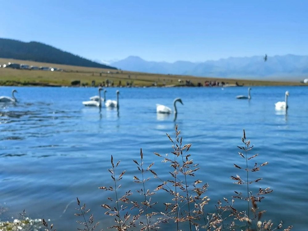
Not every good walk is a full-day expedition. Three short ones I return to: the Koktokay riverside loop (8 km, flat, three to four hours with photo stops), the Karakul lakeshore (4 km, flat, an hour if you dawdle), and the Sayram Lake eastern shore (a 5 km stretch I walked in the wind and rated as the best easy cardio in the region). The Sayram Lake guide marks the section with the fewest tour buses. These are the walks I send to people who want mountains without the commitment of a dawn start and a 12 km grind.
Trail Etiquette and Leaving No Trace
The busy trails (Koktokay, Karakul) have bins and toilets at the gates but nothing further in. I carry a small trash bag and pack out what I bring; the remote trails see few visitors and the last thing they need is our litter. Stay on the worn path in the fragile north grasslands, where a single off-trail step can kill a metre of alpine meadow that takes years to return. The herders appreciate it, and the next walker does too. Simple stuff, but it is the difference between a trail that survives and one that erodes into a scar.
What to Do If the Weather Turns
On the Pamir and the Tianshan, weather flips fast. My rule: if I see hail or a sudden whiteout, I turn back immediately, even if the goal is close. I once pushed on at Xiata through a sleet burst and spent an unpleasant hour shivering back to the trailhead; the glacier was still there the next day, but my confidence was not. Tell someone your route and expected return before you set off, carry the whistle from your first-aid strip, and remember that the mountain is not going anywhere. The safety update has a fuller weather-readiness section I reread before every high trail.
Hiking With Older Travellers or Kids
The flat walks (Koktokay river, Karakul shore, Sayram east) are fine for fit older travellers and children over about eight who can manage 5-8 km. I took my ten-year-old on the Koktokay loop and he finished bored rather than exhausted, which is the right side to be on. Skip Xiata and Tomur for anyone with knee or altitude issues; the distances and the elevation are unforgiving. For families, the family trip guide has pacing advice that applies to trails as much as to drives.
A Note on Guides and Horses
At several trailheads (Karakul, parts of Kanas, the Zhaosu approaches) local herders offer horse rides partway up. I have taken a horse up a short section near Karakul for about ¥80 and it was a genuine pleasure, but I treat it as a ride, not a safety plan; the animal knows the path better than I do, but I still walk the tricky bits. For any multi-day crossing, a registered human guide is non-negotiable, not a luxury. The cost, ¥300-¥500 a day, is the cheapest insurance against a wrong turn in a place with no signal.
Trail Markings, Maps, and Not Getting Lost
The established trails (Koktokay, Karakul, the Sayram shore) are marked and busy enough that getting lost is hard. The semi-wild ones (Xiata, Tomur) are not, and the river can shift the path year to year. I download the offline map, follow the obvious track, and turn back at the first point where I am genuinely unsure rather than pressing on hoping it improves. The herders are the best navigators; a wave and a pointed finger has corrected me more than once. I also note the time and light: the walk out is easy when you can see; the same path in fading light is a different, harder thing, and that is when people go wrong.
My Worst Hiking Day, and the Lesson
My hardest day was the Xiata approach in a sudden sleet, when the river crossing got slick and my boots soaked through. I pushed for the glacier view, got within a kilometre, and realised I was cold, late, and alone on a no-signal trail. I turned back, walked out wet and quiet, and learned the rule I now repeat to everyone: the mountain is not going anywhere, but your safety window closes with the light. The view I missed that day I caught two years later in better conditions and enjoyed more because I was warm. Ambition is fine; stubbornness on a remote trail is not. Plan the turn-around time before you start, not when you are already in trouble.
A Note on the Seasons for the Trails
The hiking season is shorter than the driving season. The north trails (Koktokay, Kanas, Xiata) are best from June to early October; May is muddy and October brings early snow. The south canyons (Tomur) are a spring-and-autumn affair, best in May and September, and brutal in July. The Pamir walks are solid from late May to early October but can close with the first snow any time in October. I plan hikes for the shoulder months when the crowds are thin and the temperature is kind, and I always check the local forecast the morning of, because a closed pass or a wet trail changes the day. The mountains here keep their own calendar, and the good hiker learns to read it.
Where I Would Send a First-Timer
If you hike once in Xinjiang, make it Koktokay for ease and beauty, or the Karakul lakeshore for the peak view with almost no effort. If you want a proper day out and you are fit, the Xiata ancient road is the most memorable walk I have done, with the glacier at the end making the sore legs worth it. Whatever you pick, go early, carry more water than feels necessary, and turn back with daylight to spare. The mountains here are generous with views and unforgiving of arrogance.