
G216 & G217 Northern Xinjiang: The Ultimate Self-Drive Guide 2026
Last updated: June 2026
There is a particular kind of traveller who looks at a map of China, spots the massive blank space in the northwest, and feels an almost physical pull to drive it. If that’s you, welcome. Northern Xinjiang — the vast region north of the Tianshan Mountains — is where China’s self-drive dreams either come true or fall apart, depending on how seriously you take the planning.
This guide focuses on the G216 / G217 Northern Xinjiang circuit — the ring route that takes you from Urumqi up through the Altai Mountains to Kanas, then loops back south through the Dzungarian Basin to Urumqi. It’s roughly 2,000 km of some of the most dramatic scenery on the planet, and it requires real preparation.
What “Northern Xinjiang” Actually Means
When locals say “North Xinjiang” (北疆), they mean the region north of the Tianshan range. This includes Urumqi, Altay Prefecture (Kanas, Hemu, Baihaba), Karamay, Burqin, and the Dzungarian Basin. It’s different from southern Xinjiang in almost every way: cooler summers, snowier winters, more grassland, more ethnic minority villages, and better roads.
The core self-drive circuit most foreigners attempt looks like this:
- Day 1–2: Urumqi → Burqin (via G216, ~650 km, 8–9 hours)
- Day 3–4: Burqin → Kanas Lake → Hemu Village (scenic zone, 2–3 days)
- Day 5: Kanas → Burqin → Karamay (via S232 + G217, ~450 km)
- Day 6: Karamay → Urumqi (via G3014/G30, ~350 km, 4 hours)
That’s the compressed version. If you have 10–14 days, you can extend north to the Kanas Lake area, loop through Sayram Lake, and even touch the Yili Valley if the season is right.
G216: The Urumqi–Altay Arterial
G216 is the main north–south highway connecting Urumqi to the Altai region. The Urumqi → Burqin leg is fully paved, well-signposted, and patrolled. The scenery transitions from suburban Urumqi through the Gurbantünggüt Desert fringe, then into ranch country as you approach Burqin.
Key facts about G216:
- Total distance Urumqi → Burqin: ~650 km
- Driving time: 8–9 hours (with stops)
- Surface: Fully paved, 2-lane in places, 4-lane highway near Urumqi
- Fuel: Multiple gas stations en route; fill up in Urumqi before departing
- Speed limit: 80–120 km/h depending on segment; mobile cameras are active
The stretch between Fukang and Burqin has decent mobile coverage, but don’t rely on data in the desert segments. Download offline maps (Gaode / Amap works in China; Google Maps is unreliable in Xinjiang).
G217 Northern Section: Burqin to Karamay (and the Duku Connection)
G217 is most famous as the Duku Highway (独库公路) — the epic north–south crossing of the Tianshan range. But the northern section of G217, from Burqin south to Karamay (via the S232 connector and the G217 proper), is a worthy drive in its own right.
The Burqin → Karamay leg takes you through the heart of northern Xinjiang’s oil country (Karamay is China’s first major oil field), then connects to the G3014 expressway for a fast run back to Urumqi.
Important: The Duku Highway (southern G217) is typically open June 1 – October 10 each year, weather permitting. The northern section (Burqin–Karamay) is open year-round, but winter driving requires snow tires and experience. Check the Xinjiang self-drive guide for current road conditions before setting out.
The Kanas–Hemu Detour: Why It Changes the Trip
You don’t drive all the way to northern Xinjiang just to tick a highway. The reason you come is Kanas Lake and Hemu Village — and both require entering a managed scenic zone where private cars are parked at the periphery.
Here’s how the logistics work:
- Drive to Jiadenyu (贾登峪) — the staging area for Kanas
- Park your rental car at the long-term lot (~¥50/day)
- Take the mandatory park shuttle bus into Kanas Village (~30 km, 45 minutes)
- For Hemu: drive or shuttle to the Hemu ticket gate, then shuttle up to the village
This means you cannot use your rental car inside the Kanas biosphere. Plan to stay 2–3 nights in the zone and use your feet or local transport. It’s not a bug — it’s how the place stays as spectacular as it is.
Car Rental in Northern Xinjiang: The Practical Reality
Renting a car in Urumqi is straightforward if you have a Chinese driver’s license. International Driving Permits (IDP) are not recognized in China. You need either:
- A valid Chinese driver’s license (translation not enough), OR
- A Chinese temporary driving permit (临时驾驶许可) — available in some cities but not guaranteed
For most foreign travellers, the practical solution is to hire a car with a driver. A private 4×4 with driver costs ¥800–1,500/day depending on season and vehicle quality. The driver handles fuel, parking, checkpoints, and navigation — and you get to actually look at the scenery.
If you do rent and drive yourself:
- Book in advance via Ctrip, Zoomcar, or local agencies
- SUV recommended (higher clearance for unpaved detours)
- Full insurance is non-negotiable — roads are good but distances are long
- Police checkpoints are frequent in northern Xinjiang; always carry passport and border permit
Border Permits: The One Thing You Cannot Skip
Northern Xinjiang has multiple border zones. If your route includes Baihaba Village (the northwestern extremity near the Kazakhstan border), you must have a border zone permit (边防证) issued by the Public Security Bureau.
For most foreign travellers, the simplest process is:
- Apply for the border permit in Urumqi or Burqin
- Bring your passport; processing takes 30–60 minutes
- Specify all counties you plan to visit (Habahe, Burqin, Qinghe, etc.)
- Cost: Free (or nominal service fee if processed through an agency)
Without this permit, you will be turned back at the Kanas–Baihaba checkpoint. No exceptions, no negotiation.
When to Go: Season by Season
Northern Xinjiang has a short but spectacular warm season, and a long, brutal winter. Here’s the breakdown:
| Season | What You Get | Road Reality |
|---|---|---|
| June–August | Green grasslands, wildflowers, warm days (15–25°C), all facilities open | Peak season; heavy domestic tourism; book accommodation 2–3 weeks ahead |
| September | Larch and birch turn gold; best photography window; fewer tour buses | Ideal driving conditions; nights near freezing; some guesthouses close end of month |
| October–May | Solitude, snow, ski access (Altai has world-class powder) | Snow tires mandatory; many passes closed; Kanas road sometimes limited to authorized vehicles |
The golden window is September 15 – October 5. The larch forests turn electric gold, the tour buses are gone, and the light is crystalline. If you can only take one window, make it this one.
Fuel, Food, and Accommodation on the Road
Fuel: Gas stations in Xinjiang require ID check (passport) for foreign travellers. This is normal — just hand over your passport at the gate. Fill up whenever the tank drops below half; desert stretches can be 150+ km between stations.
Food: Every county town has lamb-heavy Xinjiang cuisine. In Burqin, try the irene (iren = wild berry) ice cream and the grilled fish from the Burqin night market. In Karamay, the city has proper restaurants and even a few international options.
Accommodation: The range is wide:
- Urumqi / Karamay: 4–5 star international brands (IHG, Marriott, etc.)
- Burqin: Mid-range Chinese business hotels (¥200–500/night)
- Kanas / Hemu: Wooden guesthouses and yurts (¥150–800/night; book ahead for September/October)
Safety & Common-Sense Warnings (EEAT)
This is the section that makes the difference between a helpful article and a dangerous one:
- Altitude: Kanas sits at ~1,374 m — mild, but if you’re coming from sea level, take it easy on day one.
- Sun: At northern latitudes with thin air, UV burns fast. SPF 50+, hat, and sunglasses are mandatory.
- Checkpoints: Xinjiang has frequent police checkpoints. Stay calm, hand over your passport, and you’ll be waved through. Don’t argue, don’t joke, don’t take photos of checkpoints.
- Mobile coverage: China Mobile has the best coverage in remote Xinjiang. Unicom and Telecom are spotty. Consider a local SIM if you’re relying on maps.
- Weather: Conditions can change fast in the Altai Mountains. Carry a warm layer even in July — a t-shirt at 30°C in Burqin doesn’t mean it won’t be 8°C at the Kanas lakeshore that evening.
Extending the Route: Sayram Lake & the Ili Valley
If you have more than 7 days, the northern Xinjiang ring can be extended south to include Sayram Lake and the Ili Valley. The route becomes:
- Urumqi → Burqin → Kanas → Karamay → Sayram Lake → Yining (Ili) → Nalati Grassland → Tekes → Yining → Urumqi
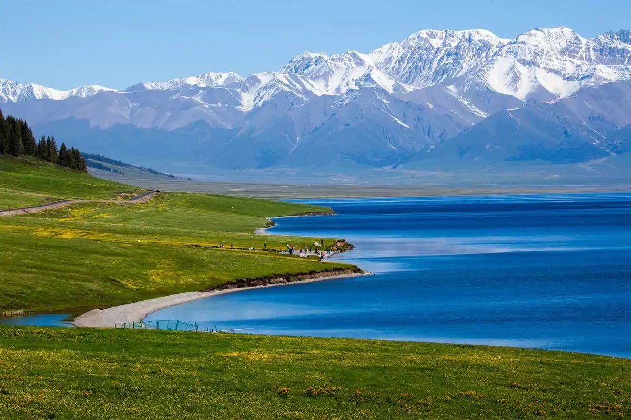
This is a 10–12 day loop and ranks among the best road trips in Asia. The Sayram Lake stop alone justifies the detour — an alpine lake at 2,073 m that cycles through jade, cobalt, and steel-blue depending on the cloud cover.
Sample 7-Day Northern Xinjiang self-drive Itinerary
This is the itinerary I recommend to first-time visitors who want the highlights without rushing:
Day 1: Arrive Urumqi, pick up car, overnight Urumqi (rest/acclimatize)
Day 2: Urumqi → Burqin (650 km, full day drive). Overnight Burqin.
Day 3: Burqin → Kanas Lake (enter scenic zone). Hike Three Bays. Overnight Kanas Village.
Day 4: Kanas → Hemu Village. Sunrise at Hemu viewing deck. Overnight Hemu.
Day 5: Hemu → Burqin → Karamay (450 km). Overnight Karamay.
Day 6: Karamay → Urumqi (350 km). Visit World Devil City en route. Overnight Urumqi.
Day 7: Urumqi buffer day / fly out.
If you have 10–12 days, add Sayram Lake and Nalati Grassland to the south leg. The additional driving is ~600 km but the scenery shift — from Altai taiga to Tianshan alpine meadow — is worth every kilometre.
The Bottom Line
Northern Xinjiang is not a place you casually add to a China trip. It requires planning, permits, seasonal timing, and either a Chinese license or a budget for a private driver. But if you do it right, the Kanas birch forests, the Altai taiga, the Kazakh yurt camps, and the empty highways under massive skies will be the travel memory that outlasts everything else from your time in China.
Drive carefully. Fill up often. And when the road crests a ridge and the taiga opens up in every direction — pull over. That’s the moment you came for.