Baisha Lake: The White-Sand Shore on the Karakoram Highway
The White Sand Between Kashgar and the Pamir
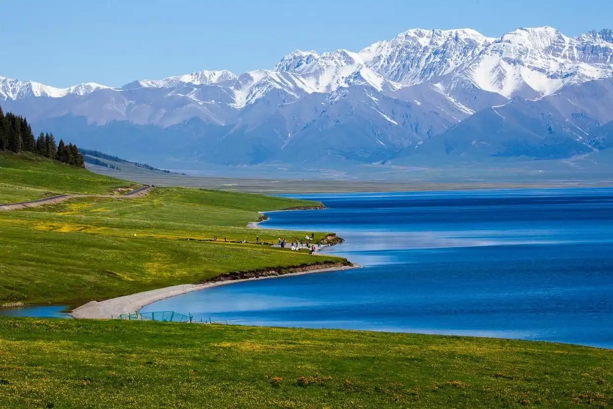
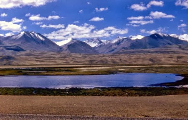
About 150 km southwest of Kashgar, as the G314 Karakoram Highway climbs toward the Pamir, the road runs along the north shore of a lake so pale it looks bleached. This is Baisha Lake — White Sand Lake — where a bank of fine white sand meets a long sheet of grey-green water, backed by a wall of bare grey mountains. It is the first “wow” of the Pamir drive, and almost nobody stops long enough. I drove past it twice before I pulled in, and the third time I stayed an hour and wished for three.
Baisha sits at about 3,200 m, the point where the Tarim basin’s last air gives way to the high plateau. It is not a town, not a ticketed park in the usual sense — just a lakeshore with a few pull-offs and a small viewing point. That is exactly why it works.
The Drive Up From Kashgar
The G314 from Kashgar to Baisha is sealed and good, a 2.5-hour run through the Gez River gorge and up onto the plateau. The first hour is oasis and orchard; then the road enters the gorge, where the river runs white and the cliffs close in, and you climb steadily. I stopped at the gorge’s narrowest point and listened to the water echo — a good warm-up for the stillness to come. Past the gorge the land opens and Baisha appears on the left, sudden as a held breath.
The lake has two shores. The G314 runs the north (sandy) side; a rougher track continues to the south shore for a different angle. I took the north pull-offs — easier, and the sand bank is right there. Fuel and food end at Kashgar; fill the tank and pack water and lunch before you leave. Above 3,000 m there is nothing until Tashkurgan, 110 km on.
Why the Sand Is White
The sand is not beach sand but fine glacial flour washed down from the surrounding mountains and trapped at the lake’s edge, bleached by the thin sun and the constant wind. On a still day it reads pure white; when the wind lifts, the lake vanishes in a pale haze. The grey mountains behind are the edge of the Pamir, their rock too poor to hold soil, so nothing grows and the contrast stays stark. It is a geology lesson you can see without a guide.
I reached Baisha at 4 p.m. after a cloudy morning; the cloud broke and the light went flat and silver, the best light for the white-on-grey palette. The Karakul Lake 60 km further on gets the famous Muztagh Ata reflection, but Baisha gets the minimalist shot, and I rate it higher for a calm frame.
Altitude and the Body
At 3,200 m the air is thin and the wind is cold even in July. I felt the first light breathlessness walking the sand bank and sat for ten minutes to let it pass — standard for the plateau, not a problem if you hydrate and go slow. The rule for the whole Pamir drive: ascend gradually, drink 3 litres of water a day, skip the alcohol the night before, and watch for a headache that worsens. The Pamir plateau guide covers the sickness signs in full; Baisha is where they first show for many drivers.
Children and older travellers do fine here with the same care. The family-travel notes on this site say to acclimatise a night in Kashgar (1,300 m) before the climb — good advice I ignored once and regretted.
Photography Without the Crowds
Baisha has a paid viewing platform (¥40, 2025) at the east end, but the free pull-offs along the north shore are better and emptier. Walk 200 m from the road and you have the lake to yourself. The light is best 5–7 p.m. in summer and 3–5 p.m. in autumn; mornings are often flat with cloud. A polarising filter cuts the glare on the water; a telephoto compresses the sand and the far peaks into one plane. I shot on a 70–200 mm and got the frame I wanted without another person in it.
The Kashgar-to-Pamir guide lists Baisha as stop one of five; treat it as the one to linger at, not the one to tick.
Food and the Long Plateau
There is no food at Baisha. The last real meal is in Kashgar or at the Kashgar outskirts; the only thing at the lake is a seasonal noodle tent at the platform in summer, ¥25 for a thin laghman. I ate in Kashgar at 11 a.m., carried nuts and two litres of water, and did not eat again until Tashkurgan at 7 p.m. That is the plateau routine — fuel the body in the city, not on the shore.
Where to Sleep
Baisha has no lodging. The plan is Kashgar the night before and Tashkurgan (110 km on, 3,100 m) the night after, with the lake as a day-stop between. Tashkurgan has the plateau’s only proper hotels and a border-permit office if you push on to the Khunjerab Pass. Do not attempt to sleep at the lake — it drops below freezing most nights even in August.
When to Go
May to October is the open season; the G314 can close on the plateau for snow from November to April. July to August is green and busy; September to early October is my pick — cold nights, clear days, and the autumn light on the sand. The Pamir guide puts the comfortable window in the same band.
Practical Notes
Baisha is inside the Pamir border zone: you need the border permit issued in Kashgar (or via your Tashkurgan hotel) before you pass the Gez checkpoint, about 60 km out of Kashgar. No permit, no past the gorge — the police turn you back. Carry the permit, passport, and car papers at every checkpoint; there are three between Kashgar and the lake. Wind on the shore hits hard; stand clear of the water edge where the white silt is knee-deep mud under the sand. Mobile signal is patchy from the gorge up; download offline maps in Kashgar.
Baisha is the Pamir’s first promise. Pull in, walk the white bank, let the grey wall silence you, and then drive on to the bigger peaks knowing the plateau had already shown its hand.
The Gez Gorge in Detail
The gorge between Kashgar and Baisha is the most dramatic 60 km of the whole Pamir drive, and most drivers rush it. The Gez River (Ghez, also written Gêz) cuts a slot through red-brown mountains, and the G314 clings to its north wall on a shelf blasted into the rock. There are three pull-offs where the road widens; I stopped at the second, where a footbridge crosses to a pebble beach, and listened to the river echo off the walls. The water is glacier-fed, grey with silt, and cold enough to numb a hand in seconds — do not wade.
The gorge is also where the permit check happens. The Gez checkpoint, about 60 km out of Kashgar, is the gate to the border zone; no permit, no pass, and the police are firm. Have the permit flat in the window, passport ready, and the car papers on the dash. The Kashgar-to-Pamir guide walks the full checkpoint sequence; the gorge checkpoint is the one that matters for Baisha.
Gear for the Shore
Baisha rewards a little kit. A polarising filter cuts the glare on the water and deepens the grey of the peaks; a telephoto (70–200 mm) compresses the white sand and the far wall into one plane; a wide takes the whole shore but flattens the contrast, so I shot wide only for the approach. A tripod helps at the still, silver 6 p.m. light when the exposure drops. I carried all three and used the tele the most — the minimalist frame is the one Baisha gives for free if you zoom.
Bring more than you think: the wind at 3,200 m is cold and lifts the white silt into the air, so a UV filter protects the front element and a lens cloth earns its place. The photography route guide ranks Baisha in the top five Pamir frames; the kit above is why.
The South Shore Track
If the gate is open (it is seasonal, roughly June–September), a rougher track continues from the north pull-offs across a shallow ford to the south shore, where the lake meets a different wall of mountain and the sand bank is wider. I took it in a hired 4WD one October and had the far shore alone for an hour. The ford is ankle-deep and firm in dry weather, thigh-deep after rain — ask at the gate before you cross; a high vehicle and a local who knows the line are the safe play. The south shore gives the reflection shot the north shore cannot, with Muztagh Ata distant on the skyline if the day is clear.
Do not camp at either shore. The temperature drops below freezing most nights and the wind does not stop; the Tashkurgan guide covers the only sensible lodging 110 km on. Baisha is a daylight stop, a long look, and a drive to a warm bed.
Altitude, Day by Day
The Pamir is a gentle climb if you let it be. Night one in Kashgar at 1,300 m is the baseline; night two at Baisha (3,200 m) is where the air thins; night three at Tashkurgan (3,100 m) confirms it. I drink 3 litres of water a day on the plateau, skip alcohol and heavy meals the first night, and walk the first hour at the lake slow enough to talk — if I cannot talk, I am too fast. A mild headache at Baisha is normal; a worsening one with nausea is not, and means descend. The Pamir guide lists the red-flag signs; the rule is simple — ascend slowly, descend if it worsens, and the plateau gives more than it takes.
What the Lake Tells You
Baisha is also a weather station. The white sand banks build and shift with the wind; a calm day means a still mirror, a windy day means a pale haze that swallows the far wall. I read the lake to time the rest of the Pamir drive — if Baisha is flat, Karakul will reflect Muztagh; if Baisha is hazed, the bigger lake will be too, and I save the photo for the return. Local drivers do the same; ask at the gate how the wind was up the road. The lake is the plateau’s mood made visible, and a patient driver uses it. The Karakul guide is the next read in the same weather book.