

Xinjiang Driving Distances: How Far It Really Is Between the Big Stops
The first thing every first-time driver underestimates about Xinjiang is the scale. This is not a place where you hop between cities in an afternoon. The straight-line map lies, the roads curve through mountains, and a 300 km gap can mean five hours behind the wheel. Here is what the distances really feel like once you are the one driving them.
The Size Problem Nobody Warns You About
Xinjiang covers about one sixth of China’s land area. To put that in driving terms, Urumqi sits roughly 1,470 km from Kashgar by road, and that is a two-day haul with a fuel stop and a night in Aksu or Korla. I drove it once straight through with a friend sharing the wheel, and we still needed nineteen hours of actual motion.
People hear the number and think nineteen hours is the hard part. It is not. The hard part is the mental reset, because in most countries a 1,470 km drive means crossing borders or half a continent. Here it is one region, one time zone, one set of road rules, and yet the loneliness of the middle is total. You can drive an hour and see no other vehicle, no town, no sign of life beyond the scrub. That is the distance that matters, the kind no map line captures.
The mistake is planning like Europe. A 400 km day in France is a relaxed drive; a 400 km day in Xinjiang can cross a desert with no services for 200 km. The distances are real, the empty stretches are real, and the fuel gauge becomes a companion you check far more often than you expect. Build buffer into every leg and you will arrive calm.
What saves you is the highway quality. The G30 expressway runs clear across the north, and the desert highways of the south are wide, fast and nearly empty. The road is rarely the problem. The problem is the sheer count of kilometers between the places worth stopping, and that is the part to plan around.
Speed limits are real and enforced by a dense camera network, so the empty road is not an invitation to race. I keep to 100 to 110 km/h on the open expressway and let the distance accumulate steadily rather than risking a fine that arrives by mail weeks after I have flown home. The cameras are the one thing in Xinjiang that is never off-duty, and they turn the long straightaways into a discipline more than a thrill.
Urumqi to the Northern Highlights
Urumqi is the natural start for most self-drive trips, and the north fans out from it. Heavenly Lake is an easy 110 km, about 90 minutes, and makes a perfect first-day shakeout drive to test your rental and your navigation before the big miles.
Kanas is where the real distance begins. The gate at Jiadengyu is around 680 km from Urumqi, a drive of roughly nine to ten hours if you push, though I always split it with a night in Beitun or Burqin. Burqin itself is a pleasant 650 km out, a good dinner town with a riverside walk and a famous night market. Our Urumqi to Kanas self-drive guide breaks the route into two sane days with the exact fuel and rest stops I used.
From Burqin, Kanas is another 130 km of climbing forest road, slow but gorgeous. Add Sayram Lake to the loop and you are looking at a further 450 km southwest toward Yining, a five-hour drive that ends at the bluest water in the region. The northern loop as a whole runs close to 2,000 km if you circle it properly, which is why most people give it a week minimum.
The Duku Shortcut
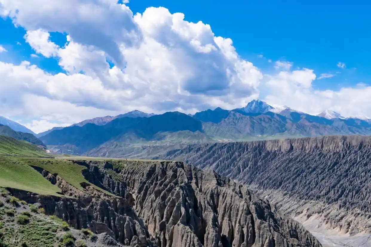
The Duku Highway is the spine that connects the north and south through the Tian Shan, and it cuts the Urumqi to Kashgar logic in half. Open only from roughly June to September, it runs about 560 km from Dushanzi down to Kuqa, turning a two-day desert detour into a single spectacular day. The road climbs past snow fields and red rock canyons, and at its high passes your ears pop.
I treat Duku as a must if my timing allows, because it replaces 900 km of flat desert with 560 km of the best scenery in the country. The full experience, including the side trips, is in our Duku Highway travel guide, which I leaned on heavily for the seasonal opening dates and the fuel strategy.
Kashgar and the Southern Loop
Kashgar is the anchor of the south and the most atmospheric city in Xinjiang, full of mud-brick lanes and Sunday livestock markets. From Urumqi it is 1,470 km, but from Aksu it is a manageable 460 km, and from Korla 1,070 km. Most southern travelers fly into Kashgar and drive from there, which is the smart play.
The southern loop circles the Taklimakan, the largest desert in China. The ring road around it is roughly 1,300 km if you go Kashgar to Aksu to Korla and back, and the middle is pure emptiness: straight highway, distant dunes, and a gas station every 100 km if you are lucky. I crossed it once and saw maybe ten other cars in three hours.
Tashkurgan sits 290 km southwest of Kashgar up the Karakoram, a four to five hour climb into the Pamir at altitudes above 3,000 meters. The road is paved but slow, winding past lakes and the border with Pakistan, and the police checkpoints add time. Our Kashgar to Tashkurgan day trip guide walks through the permit and checkpoint routine that eats an extra hour each way.
For the full southern circuit, including Kuqa’s canyon sites and the desert towns, our Southern Xinjiang loop guide lays out a ten-day route I followed with only minor changes. It is the loop that taught me to fuel at every town, because the gaps between them are longer than they look.

The City-to-City Numbers That Matter
Here are the distances I actually drove, with honest drive times including stops. Urumqi to Turpan is 190 km and about two and a half hours. Urumqi to Korla is 460 km and five hours on the G30. Korla to Aksu is 330 km and nearly four hours, and Aksu to Kashgar is another 460 km and five hours.
On the northern side, Urumqi to Yining is 690 km and around eight hours, a long but smooth run on good highway. Yining to Sayram Lake is only 90 km and under two hours, which makes the lake an easy day trip from the city. Kuqa to Kashgar via the southern route is 730 km and a full eight-hour day if you do not dawdle.
The standout is the Pamir leg, Kashgar to Tashkurgan at 290 km taking up to five hours because of altitude and checks. And the grand cross-region run, Urumqi to Kashgar the long way via the G30 and the south, is about 1,470 km and two solid days. Nobody should attempt it solo without a plan for where the next bed and fuel wait.
Altitude and Its Effect on Time
Distance lies worst in the mountains. The Duku climb and the Pamir road both add time that the odometer does not show, because you crawl at 30 km/h behind a truck on a pass. I budget an extra hour per 100 km of mountain road, and it has kept me from missing every hotel reservation I have made.
Altitude also tires you faster than a flat highway does. By Tashkurgan, at over 3,000 meters, I was stopping more often just to walk and breathe. The drive is short on paper and long in the body, and that counts as distance too in how you plan the day.
Fuel, Food and the Gaps Between
The single most useful distance fact is where fuel ends. On the G30 and the main loops, gas is frequent and cheap, around ¥7 to ¥8 a liter. On the desert ring and the Pamir, stations thin out, and I never pass one below half a tank. Running dry out here is not a tow-truck call; it is a long walk or a wait for a passing truck.
I also carry a physical map of the fuel gaps, because the navigation app shows stations that turn out to be closed or card-only when I arrive. The Pamir in particular has long stretches where the next open pump is 150 km away, and the border-region checks mean I cannot always detour to find one. Planning fuel is not paranoia here; it is the difference between a story and a stranded night.
Food follows the same map. The cities have endless halal restaurants where a plate of noodles runs ¥15 to ¥25 and a full mutton meal ¥50. The gaps have truck-stop cafes every 50 to 80 km, adequate and cheap, but the romantic idea of dining with a view only happens if you pack it. I keep a cooler with water and bread for the dead zones.
Timing your meals around the driving math is its own skill. A 460 km leg with a 1 p.m. start and two stops lands you at 7 p.m. with a hungry passenger and a dark highway behind. I eat early and drive late, or stop at the 250 km mark and push the rest after. The road rewards a plan and punishes a hope.
How I Plan a Realistic Day
My rule is 500 km as a hard ceiling for a relaxed day, 700 km if I share the wheel, and never more than that solo. Above those numbers the drive stops being a pleasure and becomes a task, and Xinjiang deserves better than a tired driver squinting at a white line.
I also build the loop, not the line. The northern loop guide from Urumqi is the route I used to close a circle through Kanas, Sayram and Yining rather than backtracking, which saved me roughly 600 km and a full day of redundant highway.
Finally, I pad every estimate by twenty percent. The map says five hours; I plan for six. The extra cushion absorbs a flat tire, a checkpoint, a photo stop at a canyon I did not know existed. Xinjiang is generous with those stops, and the distances only feel fair when you leave room to take them.
What the Miles Teach You
After three weeks and close to 4,000 km on my last trip, the distances stopped scaring me and started structuring the journey. I learned to love the long morning run because it is when the light is best and the road is mine. I learned that the far towns, Kashgar, Tashkurgan, Burqin, are worth every extra hundred kilometers because they are unlike anywhere else.
The big lesson is that Xinjiang cannot be rushed. The 1,470 km between its two great cities is not a problem to solve but a landscape to cross, and the shuttle buses and the scenic gates are just punctuation between the real driving. Plan the miles with respect, fuel with paranoia, and time with generosity, and the scale that overwhelms newcomers becomes the best part of the trip.