
Xinjiang’s Best Roadside Viewpoints and Scenic Overlooks
The Pull-Offs That Make the Drive
A Xinjiang road trip is measured in the overlooks you actually stop at. The highways cross country so empty and so large that the eye stops registering it after a while, and then a graded shoulder appears, a wooden platform juts over a gorge, and the whole scale snaps back into focus. I have driven past a hundred such spots and learned to slow for the right ones, because the best frames of my trips came from unmarked pull-offs, not the ticketed viewpoints.
This is a practical list of the overlooks worth building a day around, plus the habits that turn a random stop into a memory. The region rewards drivers who treat the road as the attraction rather than the cost of reaching it.
The Yizhao Highway Ledges
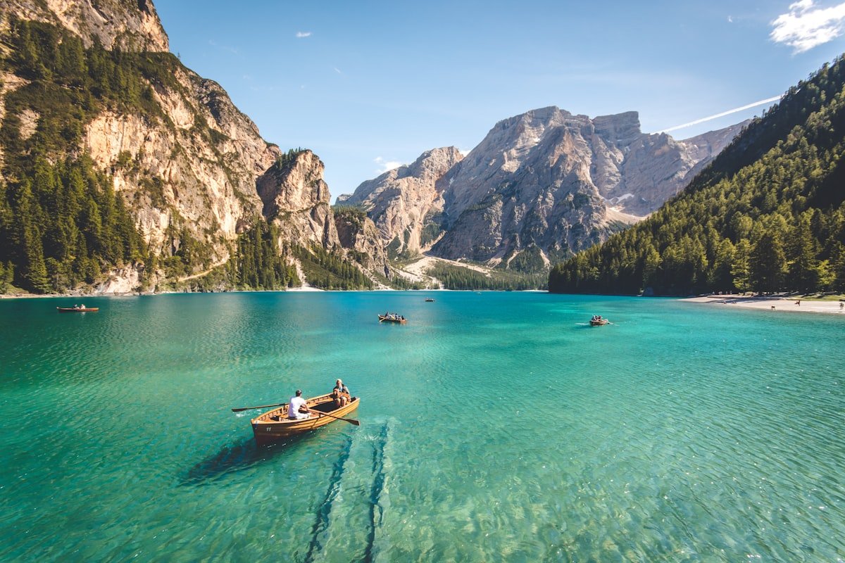
The Yizhao Highway is a short, spectacular link in the south that climbs through layered hills and opens onto a series of roadside ledges where you can park and look back down the valley. I drove it in late September and pulled over four times in twenty kilometers, each stop a different color of slope. The road is seasonal and weather-dependent, so check the pass closure calendar before committing; a closed gate turns the best overlook into a missed one.
Dushanzi Grand Canyon Rim
Near the north end of the Duku, the Dushanzi Grand Canyon has a developed rim walk with fenced platforms, but the better view is the unofficial pull-off a kilometer south where the red walls fall straight into shadow at dusk. I arrived an hour before sunset and had the place to myself; the light moved from gold to violet across the rock in the time it took to drink a thermos of tea. Paid entry covers the main rim, but the roadside stops are free and often quieter.
High Passes and the Big Reveal
The highest passes are where the landscape opens all at once. On the climb over the Tianshan spine you surface above the tree line and the valley behind you drops away in one long green sweep. I make a rule to stop at the first safe shoulder after a summit, never the busy one with the tour buses, because the second pull-off always has the cleaner angle. The seasonal closure guide lists which passes hold snow into June, so you can time a crossing for when the view is clear rather than whiteout.
Lakeside Pull-Offs
Alpine lakes reward the slow driver. Sayram Lake has a toll loop road that lets you stop anywhere along the shore, and I counted eleven pull-offs worth a photograph on a single lap. The east bay, where a stream enters, is the quiet one the buses skip. Up near Urumqi, Heavenly Lake is seen from a boardwalk, but the cable car mid-station offers a framed view of the water and Bogda Peak that the shore cannot match. Get there before the 10 a.m. tour arrival and you have it alone.
How to Spot a Good Stop
After a while you read the road for overlooks the way locals do. A graded shoulder wider than the lane means someone intended you to stop. A gap in the guardrail with tire marks means others already have. A small pile of prayer flags or a lone bench means a view worth the brake. I avoid any pull-off with no run-off room; the corrugated shoulders can grab a wheel, and a rental with a flat on a mountain pass is a long wait for help.
Carry a thermos, a windbreaker, and the patience to wait twenty minutes for the light. The difference between a snapshot and a photograph in this region is almost always the quarter hour you spend standing still after everyone else drives on.
Building a Day Around the Views
My favorite driving days are the ones with no destination, just a list of overlooks and a full tank. Last spring I ran the southern Tianshan from dawn to dusk, stopping at seven pull-offs and covering only 220 km. I saw more in that slow day than in the 600 km dash I made on a different trip. The region is not a place to get through; it is a place to pull over in, and the viewpoints are the invitation.
Overlooks on the Duku Highway
The Duku Highway runs 561 km from Dushanzi to Kuqa and crosses the Tianshan spine at a handful of points where the road simply stops being a road and becomes a ledge. I drove the whole thing over three days and kept a running tally of pull-offs: 34 marked, maybe 50 worth stopping at. The stretch between the Hashilegen Pass and the Bayinbuluke turnoff gave me the most in the shortest distance, about 90 km with eight overlooks that each faced a different wall of the range.
One stop at roughly the 370 km marker sits on a wide gravel shoulder above a U-shaped valley. I parked there at 3,000 meters and watched a single herd of horses move across the far slope for twenty minutes. No sign marks it. The tour buses stop at the fenced platform two kilometers north, so the gravel shoulder stays empty. If you only have one day on the Duku, spend it between kilometer 340 and kilometer 390; that band earns the drive.
The southern half changes character below the tree line. After the Tianshan Mystery Grand Canyon the road crests a low ridge and the red rock opens to the left in a way that no photograph prepared me for. I pulled over twice within three kilometers there. The second pull-off had a better angle because a small rock outcrop blocked the guardrail from the frame.
The northern gateway has its own quiet reward. A few kilometers past the Dushanzi zero marker the road runs along a reservoir on the right, and a dirt track drops to a flat shelf above the water. I rolled down there one morning and ate breakfast watching mist lift off the surface. No other car took the track all hour. It is an easy way to begin the Duku before the pass crowds build.
Desert Dune Vantage Points
Xinjiang is not only mountains. The desert edges hold their own overlooks, and they ask for a different kind of patience. Near the Kumtagh Desert at the edge of Turpan I found a paved turnout where the dunes roll right up to the road. I climbed the first ridge on foot, a ten-minute walk, and the whole town of Shanshan lay behind me with the sand running north to the horizon. Go at midday if you want clean shapes; the heat haze softens everything after 4 p.m.
The Flaming Mountains west of Turpan are best seen from the road shoulder near the 40 km post on the highway toward Dabancheng. The red slopes glow in a way the name promises, and a pull-off there fits three cars. I stopped once in July when the air measured 44 degrees and the rock face looked almost wet. Carry water and do not wander far from the car; the open ground offers no shade and no signal.
Out past Korla the Taklamakan’s edge gives a low, flat overlook where the poplar belts meet the sand. I pulled off there at dawn and the light was horizontal and thin. The view is quiet rather than dramatic, but it taught me that an overlook does not need a drop to be worth the stop.
South of Turpan the Aydingkol Lake basin sits 154 meters below sea level, and a road shoulder near the access road gives a strange, empty panorama of white salt flats. I stopped for ten minutes and the silence was the real attraction; no wind, no bird, just a flat white floor under a huge sky. Bring sunglasses because the glare bounces hard off the salt by late morning.
Best Time of Day for Each Stop
Light makes or breaks an overlook, and the same spot reads completely different at 7 a.m. versus 7 p.m. The Yizhao ledges face east, so morning sun lights the far slopes and the valley stays in soft shadow. I learned this the hard way after arriving at noon and finding the colors washed flat.
Dushanzi’s red rim wants the last hour of sun, as the existing notes say, but Sayram’s east bay is the opposite. The stream mouth catches early light and the tour loop does not reach that corner until mid-morning, so a 7:30 a.m. arrival bought me forty minutes of still water. Heavenly Lake’s boardwalk crowds by 10 a.m., so treat 8 a.m. as the hard cutoff.
The high Duku passes sit above the haze line, so midday gives the clearest air after the overnight frost burns off. I crossed Hashilegen around 1 p.m. and could see three valleys at once. Desert stops flip again and prefer the low sun. Match the hour to the wall you came to see.
Watch for cloud inversions after a cool night. On the southern Tianshan I woke to a valley full of cloud with only the peaks showing, and the overlook at kilometer 410 put me above the white floor with the ridgelines poking through. That kind of morning is rare and it does not wait; by 9 a.m. the sun ate the cloud and the view turned ordinary. When you see mist in the valleys at dawn, drive to the nearest high shoulder without finishing your coffee.
Safety Pulling Off the Road
Pulling over in Xinjiang looks easy and can turn serious fast. The first rule is run-off room: a shoulder with a ditch or a drop on the far side means you cannot ease back into traffic and a strong gust can push you over the edge. I scout the shoulder before I brake, not after. Corrugated gravel grabs a front wheel, so I keep the speed down for the last few meters.
Wind is the quiet hazard on the passes. At 3,000 meters a crosswind shoved my door open hard enough to bend the hinge, and I now crack the window first and lean into the wind when I step out. Never stop at a tunnel mouth or on a blind curve; the trucks run the passes in long, fast convoys and they cannot swing wide.
Altitude slows you. Above 2,800 meters I move slower getting in and out of the car and I drink water at every stop. A headache at a remote pull-off is a signal to drive down, not to linger for one more shot. Tell someone your route each morning; the cell signal dies for long stretches on the Duku and the southern Tianshan.
Fuel and bathrooms shape which stops are practical. I keep the tank above half because the gap between working stations on the Duku can run 200 km, and a scenic shoulder near empty is a stress I do not need. The paid sites have toilets; the roadside pull-offs do not, so I plan a real stop every two or three unmarked ones. A full thermos and an empty bottle routine keeps me off the guardrail and on the view.
My Favorite Underrated Viewpoint
Most travelers rush the stretch between Sayram Lake and the Guozigou Bridge, but a small unmarked pull-off about six kilometers before the bridge gave me the best frame of the whole trip. The valley drops to a green river and the bridge threads across it on a single high arc. I had no plan to stop; I just saw a gap in the guardrail and took it. Twenty minutes there beat the paid lakeside platform I had driven to the day before.
What I like is the scale. The bridge is huge, but from that shoulder it looks like a thin line, and the mountains close in around it. No ticket, no crowd, no sign pointing the way. That is the kind of stop this region hands you for free if you keep your eyes on the shoulder instead of the horizon.
A Stop I Regretted Skipping
On the run south from Urumqi I passed a signed overlook near the 60 km mark toward Tianchi and waved it off because the lot was full of coaches. I told myself the boardwalk at the top would be better. It was not. The roadside stop faced the full northern face of Bogda Peak with the tree line running diagonal across the frame, and the boardwalk gave a cropped, managed version of the same mountain.
I drove back the next morning and the coaches were gone at 8 a.m. The view took five minutes to appreciate and I wished I had spent the earlier hour there instead of in line for the cable car. The lesson stuck: a busy lot at the wrong hour is not the same as a bad view. Check it at the quiet time before you write it off.