
The Pamir Highway from Kashgar: A Self-Drive Guide
The Pamir Highway Changed How I Think About Road Trips
There is a stretch of road southwest of Kashgar that I rate as the finest drive in all of Xinjiang. The G314 climbs out of the Tarim basin, crosses the Pamir Plateau, and threads between peaks that dwarf anything in Europe. Foreign travellers call it the Pamir Highway (locals call the Chinese segment the Middle Karakoram or the Tashkurgan road). I have driven it twice, once in a rented 4WD and once with a local driver, and both times I ran out of superlatives before I ran out of mountain. This is the practical guide I wish I had before the first run.
The Route in Plain Numbers
From Kashgar to Tashkurgan (Taxkorgan) is about 300 km, but do not think of it as a three-hour cruise. The road climbs from 1,300 metres to over 3,700 at the Krezi (Qiaogeli) pass area, and the last 80 km to the Karakul Lake turnoff is where the drama concentrates. Plan a full day each way if you want to stop, which you will. The surface is paved and good; the challenge is altitude and weather, not roughness. I drove it in late September both times and had clear skies, but I have friends who hit an October snow closure, so the season is not a guarantee.
Stop 1: The Gate and the Permit
The highway begins at the edge of Kashgar, and the first real checkpoint is where the border permit gets enforced. Foreign visitors need the county border permit for Tashkurgan, and the booth about 60 km out is where it is checked. I sorted mine in Kashgar city the morning I left; the border permit full guide explains the exact office and documents. Without it, this is as far as you go. With it, the officer waves you toward the mountains.
Stop 2: Oytag and the Glacier View
About 100 km from Kashgar, the Oytag area opens to a glacier-backed valley and a small village. I stopped for the view and a walk along the stream; the air at 2,500 metres was thin but the light was clean. This is also where the landscape shifts from brown foothills to raw grey rock and snow. A good first leg-stretch and a chance to feel the altitude before the higher passes.
Stop 3: Karakul Lake and Muztagh Ata
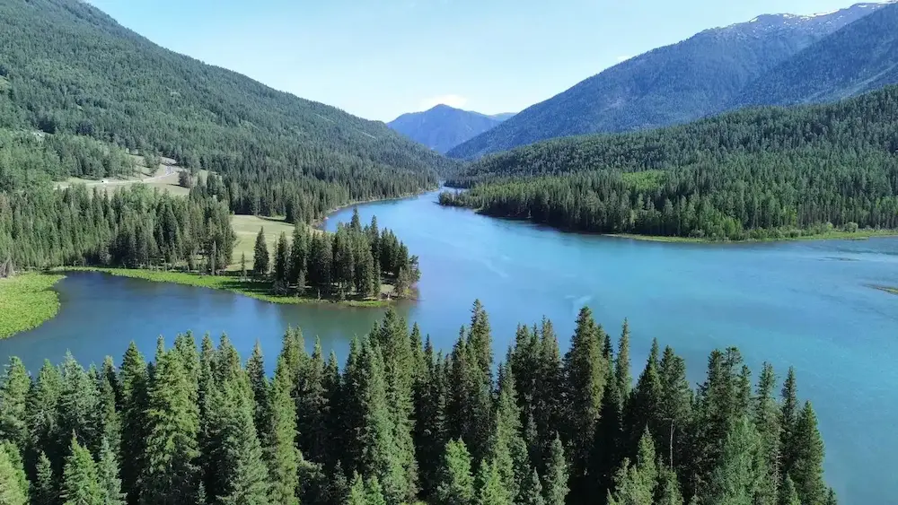
At around 3,600 metres, the Karakul Lake sits directly beneath Muztagh Ata, a 7,546-metre peak the locals call the “Father of Ice Mountains.” I have stood here in dead silence except for wind; the reflection of the snow cone in the lake is the image that sells the whole trip. There is a small herder camp where Kyrgyz families offer yak-curd tea and a felt tent visit for a few yuan. I spent two hours here and could have stayed longer. The lakeshore loop walk is flat and easy but take it slow; the altitude is real.

Stop 4: The High Passes
Beyond Karakul the road crosses the high plateau, with stretches above 4,000 metres on the approaches. I felt the thin air stepping out of the car at a viewpoint and needed a minute to settle. The colour of the land here is otherworldly: rust, grey, and the occasional frozen river. In late September the nights at Tashkurgan dropped to minus 3, so even on a “warm” autumn day, pack the jacket. Snow can appear on the passes any time from October, and the closures are real, not rumours.
Stop 5: Tashkurgan (Taxkorgan)
The town of Tashkurgan is the end of the line for most travellers, a small, tidy place at the crossroads of China, Pakistan, Afghanistan, and Tajikistan. The Tashkurgan travel guide covers the stone city ruins and the nearby Tajik villages, and the Sunday market is a genuine look at a frontier culture you will not see elsewhere in Xinjiang. I stayed one night; the altitude (about 3,100 m) meant a light sleep, but the clear mountain morning was worth it. Fuel and food are available but slimmer than in Kashgar, so I topped up the tank and bought fruit before leaving the city.
Driving Realities: Self-Drive Versus Driver
I self-drove the first time and hired a driver the second. Both work. Self-driving gives you the stops on your own clock, but you own the altitude fatigue, the permit run, and the navigation on a road with few signs in Latin script. The Kashgar-to-Pamir day trip guide is built around the common shuttle-and-driver version, which many travellers prefer because the driver handles the paperwork and the Pamir weather. If you self-drive, tell someone your plan, carry water and a blanket, and do not push past dusk.

When to Go
Late May to early October is the reliable window. June and September are my picks: green valleys at the start, clear passes, and comfortable Tashkurgan temperatures in the low 20s by day. July and August are warm but the city and the road get busier. Avoid November to April unless you are experienced in winter mountain driving and have confirmed the pass is open; even then, a sudden storm can strand you. I would not take the high sections in a regular sedan in any season, snow or not, the rental 4WD was the right call.
What to Pack for the Plateau
Altitude medication if your doctor approves, a day’s extra water and food, a warm layer even in summer, sunglasses (the glare off snow and rock is harsh), and sunscreen. The altitude prevention notes I rely on say to hydrate hard and ascend slowly; I spent a night in Kashgar first both times and felt fine. A power bank matters because the phone signal is patchy and you may want maps or a translation app at a booth.
The Common Errors
Three I saw or made: leaving Kashgar without the permit and having to turn back 60 km; starting the drive at noon and rushing the passes in failing light; and underestimating the cold at Karakul even in September. None are fatal, all are avoidable. The road rewards an early start and a calm pace far more than a fast one.
Fuel, Food, and Services on the Road
The last reliable fuel before the high plateau is in Kashgar and again at the small stations near the Oytag turnoff; I always leave Kashgar with a full tank and a jerry can of confidence rather than need. The villages along the way have basic food, the herder camps at Karakul sell tea and curd, but do not count on a hot meal up high. I carry a day’s water and snacks per person and ate a packed lunch at the lake both times. Mobile signal fades after Oytag and is patchy to absent on the plateau, so download the offline map and tell someone your plan in Kashgar before you leave. The distance guide gives the leg lengths so you can time the fuel stops.
Sleeping: Karakul Versus Tashkurgan
You have two sensible overnights. The Karakul lakeside guesthouses put you at the view for sunrise but are basic, cold at night even in September, and sit at 3,600 metres, so sleep is light. Tashkurgan has proper hotels, food, and is lower at 3,100 metres, an easier night. I did Karakul once for the dawn (worth it, but I slept in every layer I owned) and Tashkurgan the other time and slept well. For a first trip, I suggest Tashkurgan as the base and a dawn departure to Karakul; you get the view without the thin-air insomnia. Book Tashkurgan ahead in September, when the Pamir is busiest.
Photography Spots Mile-by-Mile
The road rewards stopping. The Oytag glacier viewpoint at 100 km is my first frame. The Karakul lakeshore at 180 km is the headline shot, best at sunrise when Muztagh Ata lights pink. The high plateau between 220 and 260 km has the starkest colour, rust rock against grey sky, around the 4,000-metre stretches. Approaching Tashkurgan, the stone city ruins on the right make a final composition. I shot all of these from pull-offs, never blocking the lane, and never near a booth. The light changes fast up high, so I kept the camera ready and the battery warm in an inside pocket; cold drains it quicker than the gauge suggests.
A Note on the Pakistan Border
The G314 technically continues toward the Khunjerab Pass and Pakistan, but that crossing is a separate, permit-heavy overland journey and not part of the standard tourist drive. I have not crossed it and would not attempt it without a dedicated visa and a guide; this article covers the Kashgar-to-Tashkurgan tourist segment, which is the part most foreigners actually drive. If the international crossing interests you, treat it as its own trip and start the paperwork months ahead. The border permit guide is the place to begin understanding what the region requires.
Comparing the Pamir to Other High Roads I Know
I have driven the Karakoram in Pakistan and the passes of the Andes, and the Pamir segment near Kashgar holds its own. It is better paved than the Pakistani side and far more serviced than the remote Andes, but it is higher and colder than either at the plateau stretches. The difference that matters for a foreign traveller is the permit and the booth discipline; once those are sorted, the drive is no more technical than a good alpine road. I rate it above the tourist highways of Europe for raw drama per kilometre, and below the empty Andes for solitude. For a first high-road, it is the right difficulty: impressive, but not reckless.
Packing the Car for the Plateau
Beyond the personal kit, the car needs its own. I carry a full-size spare (the plateau shreds tyres on loose rock), a tyre repair canister as backup, 5 litres of water for the radiator just in case, a warm blanket per person, and a small shovel. The rental 4WD I used had all of this except the blanket, which I added. At 4,000 metres a breakdown is colder and slower to resolve than at sea level, so the margin matters. I also keep the fuel above half the whole way; the next station can be 150 km and a closure can double that. None of this is exciting, but the Pamir rewards the prepared and punishes the casual, and the line between the two is exactly this list.
The Drive in Numbers, Personally
To make the scale concrete: Kashgar sits at about 1,300 metres, Karakul Lake at 3,600, and the high plateau stretches touch 4,000 before Tashkurgan eases back to 3,100. The 300 km took me about six hours each way with stops, not the three the map implies, because the views demand pulling over and the passes demand care. I burned roughly three-quarters of a tank from Kashgar and back with the refill near Oytag, and spent about ¥200 on food and the herder tea across two days. The cost of the trip was the rental and the permit time, not the road itself. Numbers like these are why I tell people to budget a full day, not a fast crossing; the Pamir is measured in stops, not kilometres.
My Verdict
The Pamir Highway is the one drive in Xinjiang I would repeat without hesitation, and the one I would not do carelessly. Sort the permit, respect the altitude, start early, and stop often. The peaks do not hurry, and neither should you. It is the closest I have come, on four wheels, to the top of the world.
I still think about the silence at Karakul, the kind you only get above four thousand metres with no engine running and no wind to speak of. That quiet is the real souvenir, and no photograph carries it. Go for the mountains, stay for the stillness, and leave the pass with more patience than you arrived with; the plateau has a way of slowing the traveller who lets it, and that slowness is the point of the road.