
Kuerdening Forest: Hidden Waterfalls & Alpine Meadows Guide
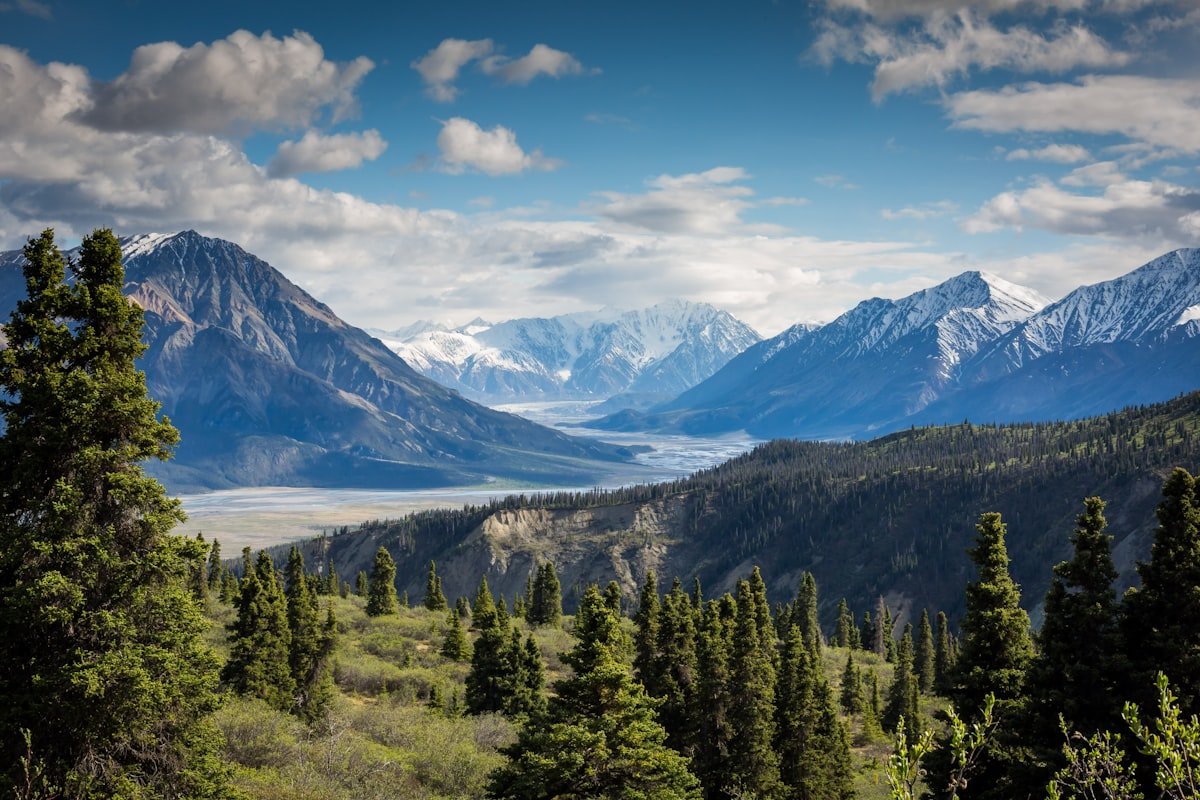
Nalati gets the buses. Kuerdening gets the people who’ve already been to Nalati and don’t want the second round. I drove the switchbacks south out of Gongliu town and within 40 minutes the tour coaches were gone and the only sound was a river and a ridiculous number of spruce trees. Kuerdening — the name means “horizontal valley” in Kazakh — is the same Ili mountain beauty as Nalati with maybe a tenth of the crowd and none of the canned folk shows. I camped one night by a waterfall and didn’t see another foreign face the whole time.
This is the uncrowded version: how it stacks up against Nalati, the waterfall trail, the meadow at 2,300m, when the flowers actually bloom, and how to reach it from Yining without a tour.

How Kuerdening Compares to Nalati
I’ve done both. Nalati’s ticket is ¥95 plus a ¥60-100 shuttle you can’t refuse, and in July the prairie boardwalk is a conveyor belt of selfie sticks. Kuerdening charged me ¥60 entry in 2024 and let me walk in on my own feet. The scenery is the same family — Tianshan spruce (雪岭云杉) marching up the slopes, green valleys, snow peaks if you look south — but Kuerdening hasn’t been bulldozed into a photo set.
The cost gap is real. A day at Nalati with shuttle and a meal ran me ¥280. Kuerdening with a packed lunch and the entry fee was ¥60, and the silence was free. Authenticity goes the same way: Nalati has staged yurts and a Kazakh song on a loop; Kuerdening has a herder who waved and kept moving his sheep. If you’ve only got one day, Nalati is easier. If you’ve got two, spend the second here.
Why the Spruce Valley Stays Cool
A practical note for summer visitors: the canyon floor along the river stays 5-8°C cooler than the open meadow above, because the spruce canopy blocks the sun and the water pulls the heat. I’d start hot at the trailhead and be in a jacket by the upper falls in June. That’s why the locals bring picnics down to the river rather than the plateau — the shade is the best seat in the valley when the Ili basin bakes at 32°C. Plan the waterfall walk for midday and save the open plateau for the cooler morning or evening light.
The Main Waterfall Trail — 4km, 7 Cascades
The valley road ends at a trailhead around 1,800m, and from there a 4km round-trip path follows the river up to a chain of seven waterfalls. None are tall — the biggest drops maybe 15 meters — but they’re stacked close, and in June the spray keeps the air cold even when the meadow bakes. I counted the cascades (seven, as promised) and sat at the top one for an hour eating bread and listening to nothing but water.
The path is dirt and roots, moderate grade, doable in 2.5 hours round trip if you’re not photographing everything. It gets slick after rain — I wore trail shoes with grip and was fine; a guy in city sneakers went down once and laughed it off. Carry water from the trailhead; the river looks drinkable and isn’t.
Next step: start the trail before 10am to have the upper falls alone, and turn back at the seventh cascade unless you’re with a guide — above it the route fades into goat paths and I lost it for twenty minutes.
The Alpine Meadow Plateau at 2,300m
Above the waterfall zone, a side trail climbs to an open plateau at roughly 2,300 meters. This is the “horizontal valley” the name points to — a long flat green bench wedged between spruce walls, with the Kunde (喀班巴依峰, 4,258m) peak standing at the valley head. I reached it on the second day and the view stopped me. No railings, no viewing platform, just grass to the edge and a drop you don’t test.
The air at 2,300m is thin enough that I felt it on the climb but it passed in minutes. Wildflowers carpet the plateau in season — yellow rape-like blooms, white anemones, and a purple I couldn’t identify. Bring a windbreaker; even in July the plateau wind cuts cold by afternoon.
Wildflower Season: May to July Peak
The bloom climbs the mountain as the snow pulls back. Lower meadows green in late April, the big carpet hits in mid-June, and the high plateau peaks in early July. I caught June 18 and it was the loudest display of my Xinjiang trip — whole hillsides yellow and purple with the spruce dark behind. By August it’s gone to seed and turned gold-brown, which is its own quiet beauty.
If you’re timing a wider Ili flower run, pair this with my spring blossom trail guide — the apricot and tulip stops are lower and earlier, so you can chain April apricots, June Kuerdening wildflowers, and July lavender without overlapping.
| Month | Bloom State |
|---|---|
| May | Lower meadow greens, few flowers |
| Jun | Peak carpet — yellow & purple |
| Jul | High plateau blooms, lavender below |
| Aug | Seed heads, gold-brown |
Camping Rules and Homestay Options
Camping inside the reserve is allowed at designated sites near the trailhead meadow, and I paid nothing beyond entry to pitch a tent there in June. No open fires — the ranger checked and told me to use the gas stove only. Pack out everything; there are no bins and the herders will glare. The site has a long-drop toilet that’s cleaner than expected and a stream for washing dishes (boil first).
If tenting isn’t your game, the villages below — around 莫合 and the Gongliu approach — have homestays at ¥100-150 a night with a Kazakh family, whose breakfast of cream (奶皮子) and flatbread beat any hotel. I stayed one night in a wood cabin near the gate for ¥140 and the host lent me a horse bridle to pose with, gratis.
Next step: tell the gate which site you’ll use so they log it, buy entry for two days if you’re camping, and reserve the homestay by phone a week ahead in June — the flower crowd fills them.
Access From Yining
Yining (Ghulja) is the hub, and from there Kuerdening is about 140km south via Gongliu County — roughly 2.5 to 3 hours of driving, not the 40km the older guides claim (that 40km is the last leg from Gongliu town to the gate). There’s a public bus Yining to Gongliu (¥35, 2hr), then a hired car or minivan the final 40km for ¥80-120 a seat. I hired a car direct from Yining for ¥450 with a driver who waited while I hiked — simpler if you’ve got the budget and want the early start.

The road from Gongliu is paved but narrow with switchbacks; I wouldn’t drive it after dark. Fuel up in Gongliu — the gate has no station. My Yining and Ili valley overview lays out the whole region if you’re building a multi-stop loop, and Kuerdening slots in cleanly between Yining and the southern Tianshan.
The Spruce Forest and Why It Matters
The spine of Kuerdening is the Tianshan spruce (雪岭云杉, Picea schrenkiana), a species found almost nowhere else on earth and the reason the area carries UNESCO World Heritage status as part of Xinjiang Tianshan. These trees grow slow and straight up to 60 meters, and standing under a wall of them on the lower trail is its own quiet experience — cool, dim, and smelling of resin. The forest holds the valley’s water and the herders’ winter fodder, so it’s fenced off from logging and you walk a marked edge.
I’m not a tree person and even I stopped for it. The contrast — dark spruce below, green meadow mid, white peak above — is the postcard the whole Ili region is built on, and Kuerdening serves it without the Nalati ticket line.
A Two-Day Sample Itinerary
| Day | Plan |
|---|---|
| 1 AM | Yining → Gongliu → gate, walk lower trail |
| 1 PM | Waterfall trail to 7th cascade, camp or homestay |
| 2 AM | Climb to 2,300m meadow plateau |
| 2 PM | Descend, drive back to Yining |
Three days lets you add the southern spruce road and a herder visit. Book the homestay or campsite the week before in June.
Safety Notes
The reserve is safe and well-patrolled near the gate, but the upper trails are real backcountry. I carried a whistle and a paper map because the phone map lies past the meadow. Tell the ranger your route. The river is cold and fast — don’t ford it; use the log bridges. Weather flips fast at 2,300m, so the windbreaker isn’t optional.
Wildlife You Might Actually See
The reserve is alive beyond the flowers. On the meadow I startled a marmot (旱獭) that bolted for its hole, and the spruce edge held songbirds I couldn’t name but enjoyed. Locals and the ranger mentioned red foxes (赤狐) at dusk and, rarely, goitered gazelle (鹅喉羚) on the high plateau — I didn’t see either, but the tracks in the morning mud near my tent were clearly not human. Bring the binoculars you’d use for birds; they work just as well on the mammals if you’re quiet and up before 7am. The key is stillness: the plateau rewards the person who sits, not the one who hikes through.
Costs and What to Pack
| Item | Cost |
|---|---|
| Entry | ¥60 |
| Homestay | ¥100–150 / night |
| Hired car Yining | ¥450 / day |
| Camping | Free (entry only) |
Pack trail shoes with grip, a windbreaker for the 2,300m plateau, two liters of water, a gas stove if camping (no fires), and a paper map past the meadow where phone maps lie. Tell the ranger your route. Fuel in Gongliu; the gate has no station and the last 40km has no card option.
Summary
Kuerdening is Nalati without the leash. Same spruce and meadow and snow peak, a fraction of the crowd, and a price that’s a third of the famous prairie. Walk the 4km waterfall trail to the seventh cascade, climb to the 2,300m plateau for the big view, camp at the trailhead meadow or bed down with a Kazakh family, and time it for mid-June when the flowers are a carpet. From Yining it’s a 140km hired-car run via Gongliu — fuel there, start early, log your route with the ranger. Skip the tour bus, bring the windbreaker, and you’ll have the valley mostly to yourself.