

Akto County Guide: Pamir & Karakoram Gateway
Why Akto Should Be on Your Pamir Driving Map
We broke the drive to Tashkurgan with a night in Akto, and it turned out to be one of the smartest calls of our Xinjiang road trip. Most travelers treat the stretch west of Kashgar as a blur: jump in the car, punch the Karakoram Highway, and push hard for the high plateau. That is a mistake. Akto County sits about 70 km southwest of Kashgar, a low, dry, orchard-dotted belt where the Pamir foothills start to rise and the road begins its long climb toward the roof of the world. It is the last easy, comfortable, well-provisioned place before the altitude and the hotels get serious.
Akto is not a destination in the postcard sense. You will not find a famous lake or a border fortress here. What you get is something more useful for a self-driver: fuel, food, real beds, and a gentle step-up in elevation that helps your body prepare for the 3,200 m-plus nights ahead. Think of it as the antechamber to the Kashgar to Pamir road trip that most people rush through.
Where Akto Sits, and the Numbers That Matter
Let me give you the skeleton first. Akto County (Aketao in older spelling) lies in Kizilsu Kyrgyz Autonomous Prefecture, southwest of Kashgar city. The county seat itself sits at roughly 1,300 m above sea level, which feels almost balmy after you have spent a day in the desert heat. From here the Karakoram Highway, the G314, runs west and south. Akto to Kashgar is about 70 km, a 70 to 90 minute drive depending on traffic and the endless roundabouts on the city edge. Akto to Tashkurgan is about 230 km, and that is a full day of driving with the climbs, the checkpoints, and the photo stops.
The reason this matters for a solo driver is rhythm. If you leave Kashgar at 9 am, you can reach Akto by late morning, spend a relaxed day, sleep low, and then start fresh the next day with the big climb ahead of you. Your first night on the Pamir Plateau travel guide route will be far easier on your head and lungs if the previous night was at 1,300 m rather than 3,600 m.
Distances from Akto in short:
- Akto to Kashgar: ~70 km
- Akto to Oytagh (Wucha) glacier area: ~80 km west
- Akto to Baisha Lake: ~150 km
- Akto to Karakul Lake: ~190 km
- Akto to Tashkurgan: ~230 km
- Akto to Khunjerab Pass: ~380 km
None of those are huge numbers on a map. On a mountain highway with checkpoints and weather, every 100 km can eat two hours.
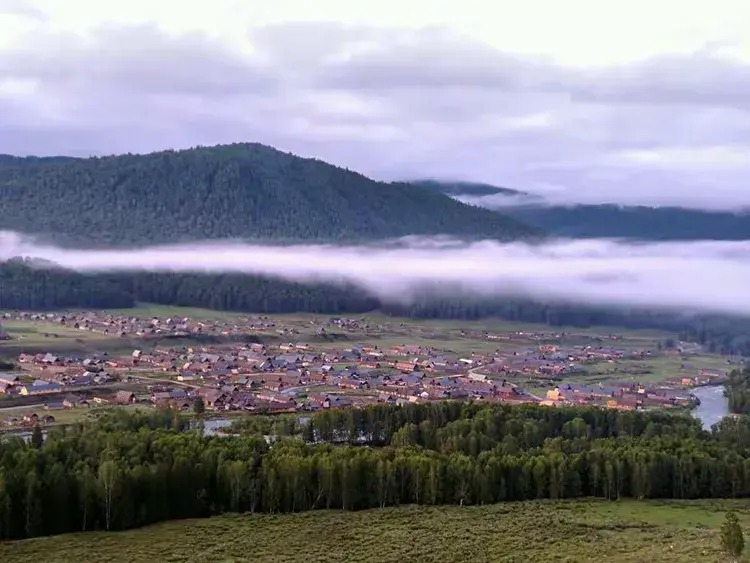
The town itself is plain and forgettable at first glance: low concrete blocks, a dusty ring road, poplars planted in straight lines against the wind. Give it an hour and it warms up. The side streets fill with bicycle traffic in the evening, kids kick footballs against compound walls, and the smell of roasting corn and mutton drifts from the night market. We liked Akto precisely because it was normal. After weeks of headline sights, a regular county town where people simply live was a relief, and a useful reminder of what the road was crossing.
The Oytagh Glacier Day Trip
The single best reason to linger in Akto is Oytagh, sometimes written Wucha or Oytag. It is a glacier and canyon area about 80 km west of the county seat, up a side valley that peels off the G314. We drove out there on a clear June morning and spent the better part of a day.
Getting to the Glacier
The turnoff is signed and easy to miss if you are not watching the km markers. You leave the main highway, cross a drying riverbed, and climb into a narrow canyon where the rock turns from tan to grey to black. The road is paved for the first stretch then becomes a rough track. A normal sedan will get you most of the way in dry season, but a high-clearance vehicle makes the last few kilometers far less stressful. In May and early June the meltwater crossings can be deeper, so ask at your hotel before you commit.
What You Actually See
At the end of the road the valley opens into a cold bowl backed by a hanging glacier. The ice is not the dramatic blue of higher Pamir glaciers, but the setting is raw: scree, a braided stream, and a wall of ice that drops from the mountain like a frozen waterfall. Bring layers. At 3,000 m the wind cuts hard even when Kashgar is 34°C. We carried windbreakers and were still cold standing still for photos.
Entrance is cheap, around ¥35 to ¥45 per person in the 2025 season, and there are a few yurts and a small canteen near the lower parking area selling instant noodles and sweet tea. Do not count on a hot meal. Pack water and snacks from Akto before you go.
Fuel, Food, and a Place to Sleep
Akto is a working county town, not a tourist bubble, which is exactly why it works for drivers.
Fuel
There are several gas stations on the G314 as you pass through, including PetroChina and Sinopec. Fill here. After Akto the stations thin out and the ones that exist near the lakes are sporadic and sometimes closed for lunch or prayer. We topped up to full in Akto even though the tank was half, and never regretted it. Diesel and 92/95 gasoline are all available. Keep your passport and the temporary driving permit ready at the pump; attendants often want to see documents.
Food
The food is the pleasant surprise. Akto sits in a fruit belt, and in summer the roadside stalls pile high with apricots, pears, grapes, and the small sweet melons that travel badly but taste like nothing you get at home. We ate at a hole-in-the-wall near the main crossroad: laghman noodles, a plate of kebabs, and a pile of freshly cut melon for under ¥40 for two people. There are a couple of small supermarkets for supplies and a morning market where Kyrgyz and Uyghur vendors sell cheese, dried fruit, and nan.
Sleep
Hotels are basic but clean. Expect ¥150 to ¥260 for a decent double with a real bed, hot water, and working heat or AC. Do not expect luxury. The win is altitude: sleeping at 1,300 m lets your body rest before the climb. We booked the night before through a Chinese app but you can usually walk in, especially outside July and August. In peak summer the town fills with domestic tour buses, so reserve ahead.
The Climb: How Altitude Creeps Up After Akto
This is the part most first-timers underestimate. Akto feels like nothing special because it is low. Then you drive west and the numbers start to move, quietly and then fast.
Altitude Checkpoints
After Akto the road climbs to the Baisha Lake area around 3,200 to 3,400 m. Karakul Lake sits at about 3,600 m. Tashkurgan is roughly 3,100 m but the passes around it go higher, and if you continue to Khunjerab you top out near 4,700 m at the pass. Going from 1,300 m to 3,600 m in a single day is the classic recipe for a rotten first night on the plateau: headache, no appetite, bad sleep.
By sleeping in Akto you halve the daily gain. The next day you still climb, but you do it awake and with a full tank and a full stomach. We felt the difference clearly. Our first plateau night, at Karakul, came after a low sleep and we slept badly. On the return, we repeated the Akto stop and felt human.
If your plan extends all the way to the border, read our Khunjerab Pass border crossing guide before you commit, because the altitude and the paperwork at 4,700 m are a different game.
Kyrgyz Yurt Life on the Pamir Edge
Akto is where the Kyrgyz presence becomes visible. Kizilsu is a Kyrgyz autonomous prefecture, and although the county seat is mixed Uyghur and Kyrgyz, the higher valleys and the plateau beyond are Kyrgyz heartland. Around the lakes west of town you will pass yurt camps where families offer tea, milk products, and a seat by the stove.
We stopped at a yurt near the Baisha area on the way back from the glacier. The host poured us black tea with salt and milk, set out a plate of dried curd, and waved off payment when we tried to hand over ¥20. That kind of encounter is why the slow route beats the fast one. If you want the lake context for that stop, our Baisha Lake white sand guide explains the wind-formed beaches and where the camps sit.
Etiquette and Small Payments
Bring small notes. ¥10 and ¥20 bills disappear fast when you want to thank someone for tea or buy a handful of dried apricots. Ask before photographing people. A simple gesture and a smile go further than any phrasebook line. Kyrgyz hosts are used to travelers but appreciate the courtesy.
A Suggested Two-Day Akto Stopover
Here is the rhythm we actually used, and I would run it again.
Day one: Leave Kashgar after breakfast, ~70 km to Akto, arrive before noon. Eat, fuel up, walk the market. In the afternoon drive the Oytagh glacier side trip if the weather is clear (~80 km each way, half a day). Sleep in Akto at 1,300 m.
Day two: Early start west on the G314. Baisha Lake around 150 km in, then Karakul at ~190 km. We spent the night at Karakul and used our Karakul Lake Pamir jewel guide to pick a yurt with a view of Muztagh Ata. From there Tashkurgan is a short hop the next morning.
That two-day shape turned a punishing one-day push into a relaxed exploration, and it cost us almost nothing in extra time.
Practical Notes Before You Go
Permits: Foreign travelers need the border area permit for the Pamir and Tashkurgan. Get it in Kashgar before you reach Akto. Akto itself does not issue it, and the checkpoints west of town will turn you back without it.
Best months: June through September is the safe window. July and August are warmest and busiest. May and early June can still have snow on the glacier road. October gets cold fast above 3,000 m.
Cash: Carry some. Card and phone pay work in the town but not always at stalls or yurts.
Driving: The G314 is paved and in good shape, but trucks are many and the passes have blind corners. Start early. The light is better and the police checkpoints move quicker before noon.
Water and fuel: Two rules. Fill the tank in Akto. Carry two liters of water per person per day on the plateau leg.
Why the Gateway Beats the Skip
I keep coming back to the same point because it is the one travelers ignore. The temptation is to blast from Kashgar to Tashkurgan in one go, sleep high, and call it efficient. It is not. Akto is the natural seam between the Tarim basin lowlands and the Pamir wall. Stopping there costs you one short, cheap, pleasant day and pays it back in altitude comfort, a full fuel tank, a stomach full of fruit, and a look at Kyrgyz life that the faster route misses entirely.
We left Akto the next morning with the mountains already in front of us and felt, for the first time on the trip, like we were driving into the range rather than being dragged up it. That shift in pace was worth more than any single viewpoint. Treat Akto as the front door to the Pamirs, and the rest of the highway opens up.