
Xinjiang Solo Travel Itinerary: 10 Days of Independent Adventure (2026 Guide)
 best time to visit Xinjiang – seasonal guide for solo travelers”>
Why Choose Xinjiang for Solo Travel?
Xinjiang solo travel has exploded in popularity among independent adventurers over the past decade — and for compelling reasons. This vast autonomous region in northwest China occupies one-sixth of the country’s total land area, offering a rare combination of epic landscapes that rival Patagonia or the Rockies, Silk Road history stretching back 2,000 years, and a cultural mix (Uyghur, Kazakh, Kyrgyz, Tajik, Han Chinese) that makes every town feel like a different country.
For the solo traveler, Xinjiang delivers what organized bus tours cannot: the freedom to linger at a Turpan grape arbor until the light turns gold, the flexibility to detour for an impromptu horse-ride in a Nalati meadow, and the unexpected conversations with a Kyrgyz herder over milk tea that no guidebook can script. If you’re planning your first independent trip to Xinjiang, this 10-day itinerary gives you the essential north-south spine without the rushed feeling of a 20-city tour. It’s designed for solo travelers who want a mix of natural wonders, cultural depth, and practical logistics that actually work.
The question isn’t whether Xinjiang is worth visiting — it’s how to structure a route that maximizes your limited time while avoiding the common pitfalls that frustrate independent travelers: misleading transport schedules, permit confusion, altitude miscalculations, and seasonal closures that catch the unprepared.
Before You Go: Essential Prep for Independent Travelers
Best time to visit Xinjiang: Late May through early October. June–August brings warm days (20–30°C in most valleys) but also domestic peak season crowds — expect Chinese tour groups at major sites. September is the golden window — fewer tour buses, crisp mornings, larch forests turning electric gold, and the parabolic glare of Sayram Lake at its most photogenic. Winter (Nov–Apr) is harsh, beautiful, and best left to experienced winter campers with proper gear and 4×4 capability.
Permits: Most of Xinjiang is open to foreigners without special permits. Exceptions: the border zones around Karakul Lake and Baihaba Village require a PSB border permit (边防证), arrangeable in Kashgar or Urumqi for free or a small service fee. The permit must explicitly list “Taxkorgan” or “Baihaba” — a generic Xinjiang permit isn’t sufficient for these specific border areas.
Transport: Xinjiang transportation has improved dramatically in the last decade. Urumqi has international flights from Istanbul, Moscow, and major Asian hubs; Kashgar, Yining, and Karamay have domestic airports with connections from Beijing, Shanghai, Xi’an, and Chengdu. The real magic, though, is the long-distance bus network (surprisingly comfortable, ~¥150–300 per 500 km leg) and — for the intrepid — private 4×4 charters (¥800–1,500/day including driver, fuel, and waiting time).
Money: Cash is king in rural areas and small towns. Alipay and WeChat Pay dominate cities but require a Chinese bank account linked to a mainland phone number — essentially impossible to set up as a short-term tourist. Bring sufficient CNY cash and exchange at the airport or Bank of China branches in major cities. ATMs are unreliable in remote areas; stock up in Urumqi or Kashgar.
Connectivity: China’s Great Firewall blocks Google, WhatsApp, Facebook, Instagram, and most Western news sites. Get a local SIM (China Mobile, China Telecom, or China Unicom — all have kiosks at Urumqi airport) and install a reputable VPN before you arrive in China. Google Maps is inaccurate in Xinjiang; use Baidu Maps (Chinese interface only, but workable with translation) or ask your hotel to mark destinations on your phone’s map app.
 Kashgar Old Town – starting point for Xinjiang solo travel“>
Day 1–2: Urumqi Arrival & Cultural Foundation
Base: Urumqi (乌鲁木齐) — the region’s capital and transport hub. Stay in the Hongshan or Renmin Road areas for easy access to transport and restaurants.
Day 1: Arrive, check into a centrally located hotel (YHA Urumqi or mid-range options like Mercure or Jinjiang Inn). Afternoon visit to the Xinjiang Regional Museum (free, passport required for entry). The Tarim Basin mummies gallery alone justifies the trip — 3,800-year-old burials with Caucasoid and East Asian features that rewrite the “who lived here first” narrative. The museum also contextualizes the Silk Road trade networks, the Uyghur migration narrative, and the region’s complex ethnic tapestry. Allocate 2–3 hours; hire the audio guide (¥70) for the mummy gallery if you want proper historical context rather than just staring at desiccated remains.
Day 2: Day trip to Heavenly Lake (Tianchi). It’s 110 km from Urumqi, doable as a private charter (¥600–900 round-trip including 2–3 hours waiting time) or via tour bus from the Nanyuan Passenger Station (¥100 one-way, departs when full). The glacial lake at 1,980 m framed by Bogda Peak (5,445 m) is the classic Xinjiang postcard. Walk the west shore plank trail (easy 3 km loop); skip the overpriced electric boat cruise (¥80–120) that blocks the reflection shots you came for. Bring a windbreaker even if it’s warm at the parking lot — afternoon winds pick up fast at lake level. Return to Urumqi by 18:00 for the famous night market on Hetan Road (手抓饭, 烤包子, 烤肉 — don’t eat the lamb skewers too fast if you can’t handle cumin).
Solo travel tip: Urumqi is safe, modern, and Mandarin-speaking. Download WeChat Translate and Didi (China’s Uber) before arriving. The city has a distinct Soviet-era layout — wide boulevards, monumental architecture, and a noticeable police presence that feels reassuring rather than oppressive for a solo foreigner.
Day 3–5: The Ili Valley — Grasslands, Lakes & Kazakh Culture
Transport: Fly Urumqi → Yining (Ili) (1.5 hrs, ~¥600–1,200) or take the overnight sleeper train (14 hrs, ¥260–400 for a soft sleeper berth). Flying saves time; the train is an experience — you’ll share a compartment with Kazakh students, elderly Han traders, and possibly a Uyghur family bringing melons to market. The train arrives in Yining around 08:00; grab breakfast at the station before heading to your guesthouse.
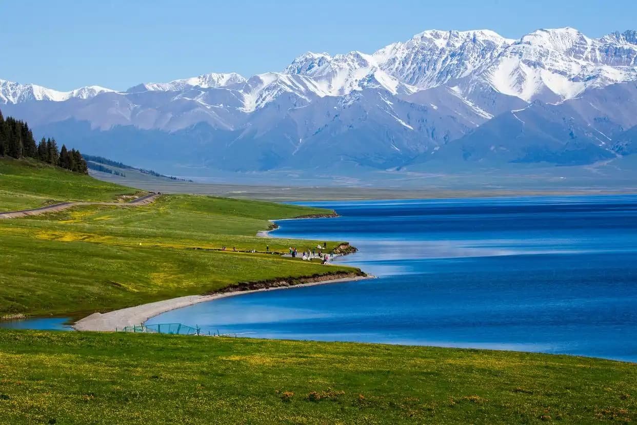
Day 3: Pick up a rental car in Yining if you have a Chinese driver’s license (mandatory for car rentals — international licenses aren’t accepted), or hire a local driver for the day (¥400–600 including fuel and waiting). Drive to Sayram Lake (~90 km, 1.5 hrs on decent paved road). This alpine lake at 2,073 m shifts from jade to electric blue to steel-gray depending on cloud cover and wind. Drive the entire 90 km ring road; stop at the west platform for the wide-angle shot and the southeast inlet for golden-hour reflections. Stay overnight in a yurt camp on the north shore (¥150–300 including dinner and breakfast) if you want the full experience — it’s rustic (no plumbing, solar lighting only), but waking up to glacier light from a felt tent is unforgettable. Bring a sleeping bag liner.
Day 4: Nalati Grassland (那拉提). The “Sky Prairie” zone delivers folded green ridges, grazing horses, and snow peaks behind. Entrance + shuttle is ~¥275/person for the full-zone access package. The key to Nalati is timing: arrive by 08:30 before the tour buses (which start rolling in around 10:00), walk the Sky Prairie boardwalk for 2 hours, then rent a horse (¥80–150/hour through Kazakh-family concessions — negotiate upfront, confirm the duration) for a ride deeper into the flowering meadows. Stay overnight in a yurt or lodge just outside the park gate — the sunrise over the prairie is worth the rustic accommodation. September nights drop below freezing; bring a properly rated sleeping bag if staying in a yurt.
Day 5: Drive the Duku Highway (独库公路) southbound toward Bayanbulak. This is one of Asia’s most scenic mountain roads — snow walls in early summer (plowed snow banks towering 3–4 meters on both sides), glacier views, and switchbacks that’ll make your stomach drop (in a good way). Note: Duku is only open June–early October, weather permitting, and foreign-plated cars may face restrictions — check current rules with your rental agency or use a local driver. The drive from Nalati to Bayanbulak (120 km) takes 3–4 hours with photo stops. The highest pass crests at ~3,400 m — if you’re altitude-sensitive, take it slow and hydrate.
Day 6–7: Bayanbulak Grassland & The Nine-Bend River
Day 6: Bayanbulak Grassland (巴音布鲁克). China’s second-largest alpine meadow, famous for the Nine-Bend (九曲十八弯) river formation. The ticket + mandatory shuttle is ~¥140/person. Arrive by mid-afternoon; the sunset viewing platform is the reason you stay until closing (the park officially closes at 18:30, but the platform area stays accessible until the sun dips below the Tianshan spine). On a clear evening, as the sun drops behind the mountains, the river’s multiple curves can reflect the sky in 7–8 separate ribbons of fire-gold — it’s the single most-posted sunset image in all of Xinjiang travel photography. Bring DEET 30%+ — the wetland breeds mosquitoes that can bite through light fabric. A bug net hood (¥20 from any outdoor store in Urumqi) is worth its weight in gold during June–July.
Altitude note: Bayanbulak sits at ~2,500 m. Most people are fine, but don’t sprint up stairs or chug alcohol at the guesthouse that evening. Mild headache is normal; persistent vomiting or confusion means descend immediately to the valley (1-hour drive to Hejing town at 1,100 m).
Day 7: Continue south on Duku toward Kuqa. The road crests at 3,400 m before dropping dramatically into the Tarim Basin’s heat — you can go from 12°C to 38°C in 90 minutes of driving. Afternoon in Kuqa: visit the Kizil Thousand-Buddha Caves (oldest cave-art complex in China, 3rd–8th century) — the murals show Indo-Hellenistic influences unlike anything in East Asian Buddhist art. Photography inside caves is strictly prohibited (flash destroys pigment); you can photograph the exterior cliff, canyon trail, and informational panels. Then hike the Tianshan Grand Canyon (red rock slot canyon, ~5 km walk, 2–3 hours round-trip). The rust-red sandstone walls narrow to 10 meters in places — bring a headlamp if you’re doing the full canyon walk, as some sections have minimal natural light.
Day 8–10: The Southern Silk Road — Kuqa to Kashgar
Day 8: Morning at Subash Ruins (massive mountaintop monastery complex, 3rd–8th century). The north precinct has a prominent stupa platform and clearer cell-block layouts; the south precinct sits closer to the river terrace and has prettier light for photography. Then bus or charter 700 km southwest to Kashgar (roughly 8–10 hours). This is a long travel day — break it up with a stop in Aksu if needed (simple noodle shops, clean-ish rest areas). The landscape transitions from Tianshan foothills to endless Tarim Basin scrub — bring entertainment and snacks.
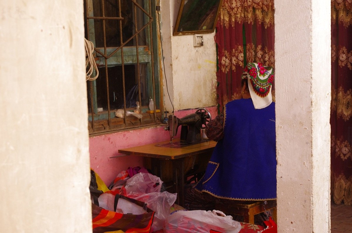
Day 9: Kashgar Old Town (喀什老城). A living UNESCO site of ~130,000 people. Get lost in the multilevel alleys — deliberately. Count how many doors have carved poplar lintels. The old town is laid out in a maze of dead-end lanes and hidden courtyards; the trick is to keep the sun’s position in mind and occasionally ask a shopkeeper “Bei men?” (North gate?) to reorient. Visit the Id Kah Mosque (¥45 entrance; dress modestly — shoulders and knees covered, women strongly encouraged to carry a headscarf even if not worn). Then the Sunday Livestock Market (星期天大巴扎 / Animal Market) ~5 km out on the Kashgar–Uzbek border road — starts by 07:00, peaks around 09:00–11:00. The smell, the noise, the donkey-cart traffic jams — it’s the most raw, unedited traditional market left in Central Asia. Negotiate a Didi or taxi for the round trip (~¥60 total).
Day 10: Day trip to Tashkurgan and Karakul Lake along the Karakoram Highway. The Pamir Plateau scenery is otherworldly — jagged snow peaks, high-altitude wetlands, and Kyrgyz yurt camps at 3,600 m. The classic shot is from the northeast shore track looking south at Muztagh Ata (7,546 m) mirrored in the lake. Best light: dawn (clear air) and 90 minutes before sunset. Stay overnight in Tashkurgan or return to Kashgar (5.5 hrs each way). If you stay in Tashkurgan, the Stone City (石头城) at sunrise is haunting — 2,000-year-old fortress ramparts against the snow line of the Kongur range.
Solo Travel Safety & Practicalities
- Altitude: Most of this itinerary stays under 2,500 m. Karakul Lake (3,600 m) and the Duku Highway passes (3,400 m) require acclimation. Spend a night in Kashgar (1,280 m) before ascending to the lake. Symptoms: headache, nausea, dizziness. Descend immediately if vomiting or confusion sets in — don’t “push through.”
- Food: Xinjiang cuisine is a highlight. Try Uyghur food — Laghman noodles (hand-pulled, chewy, topped with stir-fried lamb and peppers), dapanji (Big Plate Chicken — actually a whole free-range bird with potatoes and wide noodles, serves 3–4), naan (flatbread baked in a tonur oven), and chuanr (lamb kebabs with cumin). Solo diners are welcome; pointing at menu items and using translation apps works fine. A typical meal costs ¥25–50.
- Connectivity: As noted, get a VPN before arrival. WeChat is universal — install it, set up an account with your phone number, and add contacts as you travel. It’s how you’ll communicate with guesthouses, drivers, and that Kyrgyz family who invited you for milk tea.
- Safety: Xinjiang is one of the safest regions in China for solo travelers — consistent police presence, well-lit streets, and genuine local hospitality. The trade-off: checkpoints are frequent on highways; always carry your passport. Don’t photograph checkpoints, military vehicles, or train stations — it’s not worth the hassle.
- Water: Tap water is not potable. Buy bottled water (¥2–5) and carry 1L+ at all times in desert/plateau areas. The dry air hides sweat loss — you’ll dehydrate faster than you realize.
Sample Budget (Mid-Range, 10 Days, Solo Traveler)
| Item | Cost (CNY) | Notes |
|---|---|---|
| Accommodation (mid-range hotel/guesthouse) | ¥200–400/night | YHA hostels cheaper; book ahead for June–Aug |
| Transport (charter + flights + buses) | ¥3,500–5,500 total | Charter ¥800–1,500/day; flights ¥600–1,200 |
| Food (3 meals/day) | ¥80–150/day | Street food ¥10–25/meal; restaurants ¥40–80 |
| Entrance fees (all sites above) | ¥900–1,400 total | Shuttles often mandatory, add ~50% to listed price |
| Permits, tips, misc | ¥200–500 | Border permit free; tips ¥20–50 appreciated |
| Total (excluding intl. flights) | ¥6,000–11,000 | ~$830–$1,520 USD (2026 rates) |
Updated: June 2026. Prices are 2025–2026 reference; verify before travel. This itinerary assumes standard foreign tourist access — always check current regional regulations and border-zone policies before departure, as rules can shift with little notice.
Extending to 14–16 Days: What to Add
If you have two weeks (the ideal duration for a first Xinjiang trip), add these to the core 10-day route:
- Days 11–12: Tekes (Bagua City) and Zhaosu — the “Heavenly Horse” county with wild apple forests (ancestor of domestic apples) and July horse-racing festivals. The Bagua (Eight Trigrams) city layout is visually fun from a drone (restrictions permitting).
- Days 13–14: Yarkand (Shache) — historically rival to Kashgar, seat of the Yarkent Khanate, with Persinate tilework and rose-garden irrigation. Quieter and more relaxed for independent wandering than Kashgar.
- Day 15: Buffer day in Kashgar for the Sunday market (if you missed it) and last-minute Xinjiang food photography.
Final Word
Xinjiang solo travel isn’t just a trip — it’s a confrontation with scale. The landscapes are too big, the history too deep, and the hospitality too warm for a single visit. This 10-day route gives you the highlights without the bus-tour fatigue, and the 14-day extension lets you slow down and actually absorb the rhythm of the place. Pack layers, bring cash, charge your camera, and prepare for a region that will rewire your sense of what China looks like.
Written by a traveler who’s spent three summers exploring Xinjiang’s back roads. No tour groups, no shortcuts — just boots on the ground and a lot of chai-stained notebooks. Last updated June 2026.